
UPDATE 30th DECEMBER 2016 REPORT OF WALK ON THE 27TH DECEMBER-CARDININHAM WOODS Ona fine December morning a group of ten of us met at the car park inCardinham Woods to start our 4 mile walk on the Lidcutt Valley route.It was good to see some old faces, no I don't mean old in that waybut some we hadn't seen for a while. Wedecided to take the longer route which included the long climb up thehill, but as it says in the leaflet “we are rewarded by views overthe forest” and an opportunity to have a blow whilst pretending tolook at the view. Ourphotographer of the day Sue then had the opportunity to take our onlysnap of the walk and therefore does not appear in the photo but youdo have a mention in this report.  Afterthe decent and walk around Lady Vale Bridge and an increase in thenumber of walkers and dogs on this flat stage we head towards WoodsCafe and a stop in the tent for a welcome drink, scone or even soup. AHappy New Year to all the group and we hope to see you again in 2017with our first walk on 10th January. ********************** UPDATE 19th DECEMBER 2016 A WALK IN CARDINHAM WOODS - 27th December1) SHORT 3 MILE CIRCULAR ROUTE IN THE WOODS TO STRETCH OUR LEGS 2) POSSIBLE/PROBABLE VISIT TO WOODS CAFE IN CASE WE ARE STILL HUNGRY WE WILL MEET AT THE COMMUNITY CENTRE AT 10.00AM FOR A 10.15AM DEPARTURE PLEASE LET US KNOW BY SATURDAY 24TH IF YOU WANT TO COME ON WALK AND CAN PROVIDE TRANSPORT. A VERY HAPPY NEW YEAR TO ALL OUR WALKING GROUP REGARDS, CHRIS AND JANET **********************
REPORTOF WALK ON THE 13TH DECEMBER KELSEYHEAD AND CUBERT COMMON Ona day with a forecast of reasonable weather particularly on the Northcoast seventeen walkers set off from the National Trust car park atHolywell to walk the 5 mile circular walk taking in the coast pathand the in-land return route. Turningleft from the toilet block we headed towards the sand dunes and triedto navigate a path towards the coast path-we did get thereeventually! At low tide a shipwreck can be seen which is though bymany to be the SS Francia lost in 1917 as it sailed out of Newquay.There is however some confusion as some reports state that theFrancia, a 700 tonne steamer from Argentina, was sunk 4 miles offshore. Also visible off Penhale Point are Carter's or Gull Rocks asthe surf roles in on the beach at Holywell Bay This impressive viewcan be seen in the second series of the popular BBC programmePoldark. Walkingnorthwards to the end of the dunes we pass two tumuli and remains ofan old settlement on Kelsey Head with rocks known as the Chicks justoff shore. Round the headland we find the delightful cove calledPorth Joke where seals are quite often found-it says in most guidebooks. Well we saw about six enjoying the waves and floatinghorizontally as they acted like surfers on holiday. After roundingthis large finger like estuary we head towards Pentire Point Westbefore somebody remembered that we had not taken our usualphotograph.  (Click on image for larger view) Glynmanaged to capture the photo enclosed with the Goose rocks in thebackground before we turned off the coast path and towards our lunchstop at The Bowgie Inn. Another photo from our walk available here. Mostsat outside on the numerous picnic tables with hot drinks and watchedthe surfers in the waves whereas some ate inside with a roaring openfire-the food and drink provided was all very welcome. Afterthe break with the weather becoming a little cloudier we pressed onuphill and towards Cubert Common and across its western shoulder andover The Kelseys and past the Holywell Golf Club-the location for oneof our walkers golfing triumph-and past the sand dunes towards thevillage again and the car park. Duringthe drive back to Lostwithiel the rain started and the light startedto fail early in the afternoon making us feel that we had certainlythe best part of the day.  ChristmasGreetings to all our walkers and we hope for some great walks in 2017 ********************** NOTICE OF WALK ON THE 13TH DECEMBER KELSEY HEAD AND CUBERT COMMON Will try again to do this walk after the bad weather forecast last time and our reversion to Plan B
******************
REPORTOF WALK OF THE 29TH NOVEMBER TINTAGELAND TREBARWITH STRAND Whatan excellent day for walking with full sun most of the day and nowind even on the coast path. Twelve of us set off from the car parkin Tintagel to walk the planned 3.5 mile circular route. Just a notebefore we start that the walk was measured after at 3.53 miles-wemust be getting better as we used to be up to 2 miles out with ourstring gauge and a map. Fromthe car park we followed the path signposted “Parish Church andGlebe Cliff “ downthe hill passing the Chapel of Our Lady of Fontevrault on our leftbefore rising up again and over one of many stiles on the walk-mostbeing granite and quite tall for any with little legs. Passing somestables we walked alongside some fenced and well tended fields tocome out by Trevillick Farm and with three paths to follow, one ofwhich we tried on the recce only to find a blockage, we walked alongthe lane to the main B3263 and walked about 20 yds before turningright onto a track again and towards Trecknow. At the entrance tothis small hamlet we again turned right to head towards the coastpath and a view of Trebarwith Strand and our first photograph withGull Rock in the background. 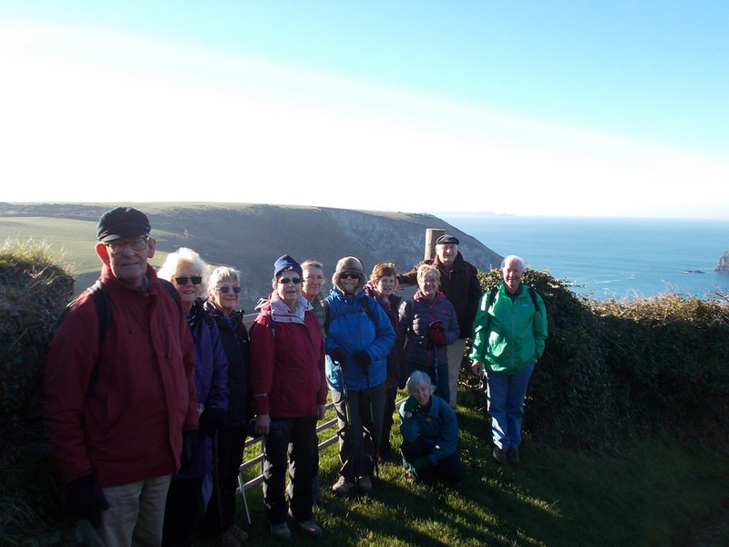 Headingdownhill we also see a sign on a gate “Bluff Centre” which wefind out is a modern guest house set on 9 acres of land with seaviews. Whenone comes down you also have to go up and we rejoined the South WestPath to go north and the Lanterdan Pinnacle, a tower of uncut rock24m high, can be seen. Thiswas left by the quarry workers because it contains inferior slatewhereas the trimmed and cut slate was lowered to cargo ships that layalongside the base of the cliffs. Walkingagain on the path overlooking the cliffs and past the Tintagel YouthHostel, once the offices of the nearby cliff quarry we followed thepath to the church of St Materiana. The existing church may have beencreated in the late 11th or 12th century whilstthe tower may be 13th or 15th century in date.We all had an interesting look around this impressive building beforefollowing again the coast path on the seaward side of the churchtowards the the great headland of The Island and the famous ruins of the monastery and castle and the centre of the tales of King Arthur. Afterlooking down on the site we walked up the steep hill and back toTintagel and our lunch stop. 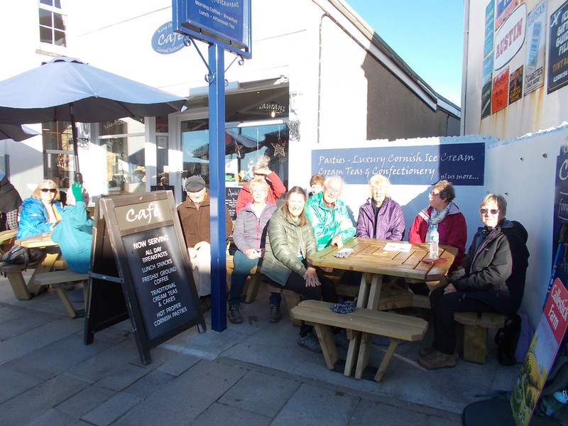 (Click on Image for larger view) Thephoto shows us sitting outside the café, still shielding our eyesfrom the sun as we decided to sit outside and enjoy the excellentfood before heading home with tired legs and full tummies.
UPDATE 21st NOVEMBER 2016 NOTICE OF WALK ON THE 29TH NOVEMBER TINTAGEL TO TREBARWITH STRAND 1) 3.5 MILE CIRCULAR WALK USING COAST PATH AND FIELDS 2) RELATIVELY EASY BUT MUDDY IN PLACES 3) WONDERFUL SEA VIEWS AND KING ARTHUR'S CASTLE 4) FACILITIES AVAILABLE IN TINTAGEL 5) WALK STARTS AT CAR PARK IN CENTRE OF TINTAGEL  NICE RANGE OF CAFES IN TOWN FOR THAT EARLY LUNCH OR PICNIC WE WILL MEET AT COMMUNITY CENTRE AT 9.45AM FOR 10.00AM DEPARTURE. PLEASE LET US KNOW BY FRIDAY 25th NOVEMBER IF YOU CAN JOIN US AND IF YOU CAN PROVIDE TRANSPORT. REGARDS, CHRIS AND JANET **************** UPDATE 9th NOVEMBER 2016 REPORT OF WALK ON THE 8TH NOVEMBER A QUICK CHANGE TO PLAN B With the weather forecast indicating that heavy rain was approaching Cornwall from the west and that it was expected to hit the north coast at around 1.00pm it was decided to switch the walk venue as the advertised Hollywell walk is very exposed. We decided to reduce our travel time and still give ourselves a National Trust car park, a sea view, somewhere to have a hot drink or something to eat but unfortunately no sand dunes-you can't please everyone! We parked at Coombe Farm just outside Fowey and walked under cloudy skies towards Polridmouth Bay and our photograph stop with a beach backdrop and showing our gang of 10 and one taking the photograph.  Turning eastwards above Lankelly Cliff and around Southground Point we walked on the South West coast path with the very calm sea below passing Southground Cliff and towards the remains of St Catherine's Castle and into Fowey and to the harbour side. At about 12.15 some stopped to eat picnics and the others squeezed into the Dwelling House to part take of some delicious food and beverages with an agreement to re-group again at 1.00pm. With some full(er) tummies we left the café with drizzle just starting and headed back towards Readymoney and the shorter route up the slippery path back to the car park arriving back in Lostwithiel at about 2.15pm with the heavy rain predicted now due to arrive at about 5.00pm. I'm not sure how many miles we walked but we all had a good time, some excellent food and good company. **************** NOTICE OF WALK ON THE 8TH NOVEMBER KELSEY HEAD AND CUBERT COMMON  1) 5 MILE CIRCULAR WALK ON SANDUNES, COAST PATH AND GOLF COURSE 2) MEDIUM TO EASY WALK WITH EXCELLENT SEA VIEWS 3) FACILITIES PART WAY AROUND AT THE BOWGIE INN, CRANTOCK FOR DRINKS ETC 4) FROM TIME VIEWPOINT BEST TO TAKE PACKED LUNCH OR FOOD AVAILABLE AT INN 5) START AT NATIONAL TRUST CAR PARK HOLYWELL (FREE TO MEMBERS £2.50 TO NON-MEMBERS-BRING YOUR CARDS) WE WILL MEET AT COMMUNITY CENTRE AT 10.00AM FOR 10.15AM DEPARTURE. PLEASE LET US KNOW BY FRIDAY 4TH NOVEMBER IF YOU CAN JOIN US AND IF YOU CAN PROVIDE TRANSPORT. **************** UPDATE 26 OCTOBER 2016
REPORT OF WALK ON THE 25TH NOVEMBER LUXULYAN VALLEYCIRCULAR
Eighteen of us set off fromthe Black hill car park on this walk and historic journey through this areawhich was designated part of a World Heritage Site in 2006 due to its majorconcentration of early 19th century remains, the majority of whichare the result of the work of Joseph Treffry. He was born in Plymouth as JosephThomas Austen to Joseph Austen, a former Mayor of Plymouth and Susanna neeTreffry. He changed his name by deed poll after the death of his mother'sbrother William Esco Treffry in 1808, when he inherited the family estate atPlace House Fowey. His name lives on as we headupwards, cross one of the many leats and towards the Treffry Viaduct. This wasconstructed between 1839 and 1842 from local granite and was the first stoneviaduct to be built in Cornwall and consists of 10 arches spanning 200 metreswhich rise 27 metres from the valley floor. The viaduct also doubled as anaquaduct -it has a water channel beneath the railway track which was preciselysloped to feed the upper most Carmears leat. Turning left before we crossthe viaduct we walk on the old tramway with the granite blocks and in someparts the old rails still present. We then pass an old ruined building withlarge stone fireplace still intact and head downhill till we come to the siteof a large wheel pit built in 1841and used to haul wagons up the incline untilthe 1870's. After this date it was re-purposed to grind quarried china stone amaterial used,mixed with china clay, to form porcelain after kilning. Againturning left and going uphill we pass a part of the 2 mile long watercourseconstructed by Treffry in the 1820's to supply water to his Fowey Consolscopper mines on Penpillick Hill.
 After a short break to admirethe view of the sea from this high point we head downhill past a fenced offmineshaft, the mineshaft being part of the Prideaux Wood mine one of the coppermines consolidated into the group of 5 known as the Fowey Consols. These werethe considered to be one of the deepest, richest and most important of theCornish copper mines and employed some 1680 people.
We then continued to reach aflight of steps departing to the left at a wooden post-the instructions thensay “at the post keep right to stay on the path”. However we did go down thesesteps to realise at the bottom that something was not quite right. With knowledge from somefellow walkers we pressed on and although we missed walking alongside the RiverPar and the clay dryers we were soon back at the car park. The dryers will I'msure feature in a further walk in this interesting location so those walkerswith extensive knowledge,you know who you are, should be ready to answer somedifficult questions. Updated on 16th October 2016 NOTICE OF SHORT WALK ON THE 25TH OCTOBER LUXULYAN VALLEY CIRCULAR-WOODLAND AND INDUSTRIAL Water Wheel, Luxulyan Valley
 We will meet at Community Centre at 10.00am for a 10.15am start. Could you let us know by FRIDAY 21ST if you are coming on walk and if are able to offer lift. Regards, Chris and Janet Updated on 15th October 2016 Reporton the walk of 11th October around Minions Fourteen walkers set off on this bright autumn day forour walk around Minions. For the morningpart of the walk, we did the 4 miles walk around Caradon Hill, starting justbeyond the Cheesewring Hotel where we turned left on a public footpath oppositeEdgemoor Cottage. It is on the wholean easy walk, much of it on old tramways. The only obstacles we had to negotiate were a wooden stile, a stone oneand a crossing over a very clear small stream. We were lucky that, so far, we have had a dry autumn. Having done this walk in January, the mainobstacles I had faced were the knee deep mud which meant several false startsand an impassable fast flowing stream! Choose your month carefully if you decide to do this walk again!
This area, which is of great natural beauty, was thecentre of a Victorian “copper boom”. Thefirst part of the walk is a fascinating mixed of ruined engine houses, spoiltips, devastation and a strange attraction. Because nothing grows on the spoil tips which contain arsenic, you havethe impression that the mines were abandoned yesterday. Very eerie indeed! After approximately one hour, we arrived atthe car park at Tokenbury Corner which is an alternative starting point andwhere we took in the beautiful views down the valley up to Kit Hill, EastDartmoor and also to the sea (Rame Head?). We then proceeded on the track which is parallel to the road and thenwalked on a former railway track which runs behind Caradon Hill.
We had lunch at the Hurlers’ Halt and at 2.00pm PatFitzsimmons of the Geology Group of the Saltash U3A joined us for what turnedout to be a very informative guided walk. The Saltash U3A led a recent community geo-archaeological project called“Reading the Hurlers” to survey the area around The Hurlers to identify the locationswhere the stones of The Hurlers were quarried from. Did you know that the name comes from thelegend that tells of local people being turned to stone for playing hurlers onthe Sabbath? The close grouping of threeLate Neolithic or early Bronze Age stone circles is extremely rare in Englandbut a grouping of three such regular circles is unique. Pat told us about the “Mapping the Sun”project which took place in 2014 and which revealed a “pavement”, a strip ofgranite paving between the northern circle and the central one. The “Reading the Hurlers” project also aimedto uncover a fourth stone circle. However,there is no fourth circle and all there is a standing stone, which is visible.
Pat took us to see Rillaton Barrow, a round cairn whichstands 500 metres north-northeast of The Hurlers stone circles ona rise of land known as Rillaton Moor in an area rich in round barrows,cairns, standing stones and natural rock features. It consists of a mound ofstone and earth that has a diameter of over 35 metres and stands over 2.5metres high despise a crater dug into its top by stone robbers. What is mostinteresting though is a slab lined cist onits eastern side and what it was found to contain. This cist which is alignednorth-south and is about 2 metres long by 1 metre in width and height wasopened by in 1837 by workmen looking for building material who found a skeletonalong with a bronzedagger, several faiencebeads and a decorated pot that contained a corrugated gold cup with a rivetedhandle. This spectacular find, now known as the Rillaton Cup and thought to date from 2000-1500BC, was handed overas treasure trove and found its way into King George V's dressing room where heis said to have used it for storing collar studs! It is currently in theBritish Museum and was thought to be unique in Britain until a similar butpartly crushed gold cup was found at Ringlemere in Kent in 2001. By the end of Pat’s guided walk, it was 3.00pm and as thewind had picked up we decided to call it a day. We will do the walk around the Cheesewring on another day. For more pictures of our walk, visit: https://www.flickr.com/photos/cornwallteashop/albums/72157645775972052/page2 ************* Updated on 6th October 2016 THE WALK WILL BE IN 3/4 (?) PARTS: 1. A WALK AROUND CARADON HILL: 4.5 MILES - 2 HOURS 2. BREAK - The Hurlers Halt have proved very helpful and will be able to cater for us. We can have whatever we want from hot drinks, to tea/coffee and cake to sandwiches/jacket potatoes. You can of course bring a packed lunch 3. A GUIDED WALK AROUND THE HURLERS WITH PAT FITZSIMMONS FROM THE SALTASH U3A (1 HOUR) 4. A WALK FROM THE HURLERS TO THE CHEESEWRING AND AROUND THE TOR. 3 MILES - 1.5 HRS HOWEVER, by the time the guided walk around the Hurlers is over it will be 3.00pm, so we might decide not to do the walk around the Cheesewring which we can do on another occasion OVERALL, THE WALK IS A MODERATE ONE (SOME OF YOU MAY CHOOSE TO CLIMB UP TO THE CHEESEWRING (AND BACK DOWN!). There are only 2 stiles (a wooden one and a stone one). WE WILL WALK ON A RANGE OF SURFACES: MINERAL LINES TRACKS, SQUIDGY MOOR, ACROSS ONE OR TWO STREAMS AND ON SOME MUDDY FOOTPATHS. I RECOMMEND THAT YOU WEAR STURDY BOOTS AND BRING YOUR STICKS. WE WILL MEET AT THE COMMUNITY CENTRE AT 10.00AM FOR 10.15AM START. WE WILL PARK IN THE HURLERS CAR PARK IN MINIONS (FIRST CAR PARK ON THE LEFT HAND SIDE BY THE VILLAGE SIGN)   Contact me by Sunday 9th if you would like to join this walk (you can do the morning walk only if you choose to) and if you are able to offer transport. Annie ************************* UPDATED ON 5TH OCTOBER 2016 REPORTOF WALK ON THE 27TH SEPTEMBER ACIRCULAR WALK TO ST. WINNOW Thirteenof us set off from the Community Centre car park at 11.00am; a littlelater than normal in order to arrive at St. Winnow in time for lunchat Angie's burger van. This3.5 mile walk uses minor roads, footpaths and across fields. Althoughwe were all prepared for showery weather and it was a bitdisappointing as we set off in a light drizzle- spirits andexpectations were high. Itwas a relatively easy walk to St. Winnow starting with a moderatehill past Lanwithan and towards Polmena. The trickiest part was theshort rocky pathway from the entrance to Newham and then a shortwaterlogged stretch where Annie found the dry route. We then turnright over the fields and through the woods to reach the boatyard atSt. Winnow and the churchyard. Although we had a few light touches ofdrizzle along the way by the time we reached St. Winnow we were ableto sit and enjoy our lunch in bright warm sunshine. Nearly all of ussuccumbed to Angie's food and in particular to the roast pork rollswhich proved the most popular. Very good it was too.   Aftera very enjoyable morning we arrived back in Lostwithiel at about2.30pm. **************** UPDATE 21 SEPTEMBER 2016 A SHORT WALK TO ST. WINNOW
1) 3.5 Mile circular walk from Lostwithiel to St Winnow using minor roads, tracks and footpaths ***************** UPDATE 16 SEPTEMBER 2016 REPORTOF WALK ON THE 13TH SEPTEMBER FROMPOLPERRO TO LOOE. Afterdelaying the start of the walk by 1 hour due to a bad weatherforecast for early in the day seventeen of us mustered outside theSawyers Guest House at Hannafore to catch the 11.43am bus to Polperroin the now hazy sunshine. The bus was about 8 minutes late and by thetime we reached the Crumplehorn stop in Polperro very full. Mostof us were able to use our bus passes but “Young David” as wewill call him had to spend about half his pocket money (£2.95) onthe single fair. Walkingdown into the old fishing village of Polperro towards the harbour andthe small cottages in narrow streets we pass many pasty shops and tearooms which we all resisted to join the South West Coast path for the4.5 mile walk to Looe. This is a very pleasant walk with many ups anddowns and steps which I had failed to mention in my introduction tothe walk(can I put it down to age?). We had good sight, as we leftthe harbour, of military manoeuvres in the bay with two helicoptersand a navy vessel involved. Ourfirst realisation after a short walk was that the foot path beforeTalland Bay had not been reinstated since the storms of 2014 whichmeant that we had to do a slight detour and walk down the long roadinto the bay and our lunch stop. For some it was the café and forothers a picnic on the beach. A pity we had not brought our swimmingstuff as by this point it was hot and humid with sun and little wind. 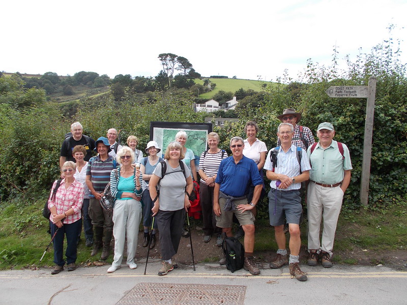 (Click on image for larger view) Startingagain, after use of facilities and a photograph-not at the same time,we continued on the coast path around Hore Stone and with PortnadlerBay on our right our first view of St George's or Looe Island. Theisland, the former home of the Atkins sisters who purchased the 22acre island in 1965, was left to the Cornish Wildlife Trust whopreserve the island as nature reserve. Twowardens live on the island and look after the day to day running andcare of the sheep and monitor the bird life which nests on theslopes. Aftera few more hills we arrive at Hannafore and a nice sea breeze withmany people sat on the chairs and enjoying what has turned out to bean excellent sunny day with none of the rain forecast. Withthe tennis court café closing early some of us walked into West Looeto have a final drink and scone/teacake before getting back at about5.00pm ***************** UPDATE 2 SEPTEMBER 2016 NOTICE OF WALK ON THE 13TH SEPTEMBER A 4.5 MILE WALK FROM POLPERRO TO LOOE ALONG THE COAST PATH 
This is a repeat of a walk we first did in April 2014 after the storms had taken away part of the coast path above Talland Bay and sixteen of us including many new members at the time had an enjoyable walk. 1) We will park at Hannafore near the Sawyers Guest House and catch the 10.43am No. 73 bus to Crumplehorn in Polperro 2) Conveniences and places to eat and drink at Looe, Talland and Polperro 3) We will lunch at Talland using cafe or picnic. Swimming a possibility? 4) Possibility for cream tea at Looe on return. We will meet at Community Centre at 9.40am for 9.45am depart to ensure we catch bus. If you could let us know by Friday 9th if you want to go on walk and if you are able to offer transport. Regards, Chris and Janet ***************** UPDATE 24 AUGUST 2016 SOUTH EAST CORNWALL WALKING FESTIVAL 10-18TH SEPTEMBER  Just to let you know this is taking place between 10-18th September organised by Looe Tourist Information Centre. A few of the walks we have done before, but for those who wanted longer walks there is one that's 11 miles and takes about 7 hours. More information about this and other walks on Looe Tourist Information website Regards, Chris and Janet (Walking Boots image credit: Lindsay Southgate ) ***************** UPDATE 18 AUGUST 2016 A WALK ON THE 29TH AUGUST - THE ST. WINNOW WAY  St Winnow Church Photo Credit: Robert Pitman Some rights reserved THIS IS NOT A U3A ORGANISED WALK BUT SEVERAL OF OUR MEMBERS TOOK PART LAST YEAR AND ENJOYED THE DAY. THE WALK LINKS FOUR MEDIEVAL CHURCHES AND THE WALK STARTS AT ST. MARY BRADOC TO BOCONNOC TO ST. NECTAN TO FINISH AT ST. WINNOW BRING YOUR OWN PICNIC TO BRADOC FOR 12.00 WHERE TEA/COFFEE WILL BE PROVIDED WALK STARTS AT 1.00 WITH TEA AT ST. NECTANS CHURCH FUNDS RAISED SHARED WITH CORNWALL HISTORIC CHURCHES TRUST LOOK FORWARD TO SEEING MANY OF YOU THERE. REGARDS, CHRIS AND JANET ***************** REPORT OF WALK ON THE 9THAUGUST - AROUND TREVOSE HEAD Cornwallat its best-as one of our group said as we looked out on ConstantineBay as eighteen of us set off at the start of our walk. The sky wasblue with hazy sunshine, the white surf breaking over the golden sandas we looked ahead to walk the half mile along Constantine Baytowards some steps which lead over a rocky ridge and above Booby'sBay. 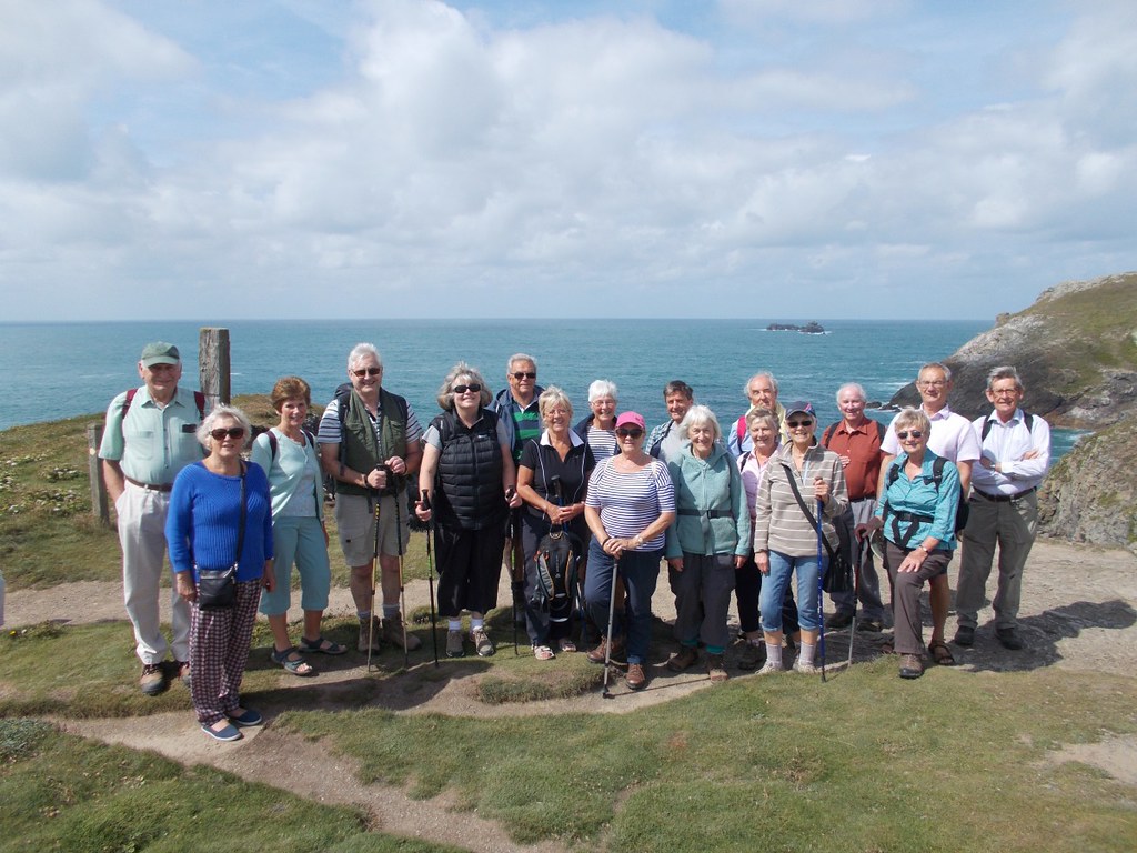 (Click on image for larger view) Atvery low tide the shipwreck of the SV Carl can be seen in this bay,the vessel was in Cardiff Docks in 1914 when war broke out and wasimpounded by the authorities. Three years later it was decided totow her to London and during the operation the vessel broke freeduring a storm and it grounded in the bay. Keepingleft along the clifftop path we see the giant Round Hole where youcan hear and with great care see the tide rushing into the deep hole.Not venturing onto Dinas Head we go onto Trevose Head; an arearecently in the news as it has been purchased by the National Trust.It is an area designated as a site of Special Scientific Interest forits geological and biological attributes. Passingthe car park near the impressive lighthouse which was first lit on1st December 1847 and more recently a new horn wasinstalled in 1963 and the lighthouse was fully automated and becameunmanned in 1995. Continuingeast along the cliffs and above Chairs Rock and Merope Rocks we cometo Trevose Head Lifeboat station the current home for the PadstowLifeboat. The station was re-sited to Mother Ivey's Bay in October1967 from Hawkers Cove due to the river silting. The boat can nowlaunch into deep water at any state of the tide. Thestation with its impressive shape roof makes an ideal backdrop foranother group photograph.  PassingMother Ivey's Cottage and the broad expanse of the bay we press on toCataclews Point and,with three good benches and a view over HarlynBay, an ideal lunch time stop for our various picnic treats andrevelations of some programme on Channel 4-looks like we will have towait until next Monday. Walkingalong the very busy Harlyn Bay a popular surfing venue with large carpark, which some of our group had already visited, we cross thebridge to make our return journey but not before comfort breaks forsome and ice creams for others. Wearingour reflective jackets we walk along the road before using footpathsto cut off some of the road and go through the grounds of HarlynHouse to aim for the golf course and club house to return to thecars. Themileage was assessed by our experts with gadgets as between 5.75 and8 miles(for those with short legs) so our initial indication of 6miles was considered a success worthy of applause. Wehope to see you all on September 13th for our next walk ***************** Update: 14th July 2016 REPORTOF WALK ON THE 12TH JULY-AROUND RAME HEAD Anexcellent day for walking with mottled sunshine and slight breeze as14 of us met in the car park on top of Wiggle Cliff after gettingthere by various routes. The cliff lives up to its name by providingfood plants for a range of caterpillars which can be seen asbutterflies in summer.  Descendingfrom the car park we walk on the coast path and past, you don't needmore than one guess , to Wiggle Hut; a building that is owned by theYMCA-an organisation set up in 1844 in London “to provide low-costhousing in a safe Christian environment for rural young menjourneying to the cities” Wecontinue on this path and into a field onto Rame Head an area ofOutanding Natural Beauty (AONB)- an area included in one of the 33regions in England with that designation. There is a single CornwallAONB which is itself subdivided into 12 sections. Ontothe path which leads to a rock outcrop from where you have greatviews across Whitesand Bay and on the opposite side Looe and LooeIsland was just visible on this clear day. We now head for the chapelon the headland and just as we try and decide who wants to walk tothe chapel on a short detour we meet a U3A Walking Group from Saltashwho have just come from Kingsand. Agroup photograph seemed a good idea. 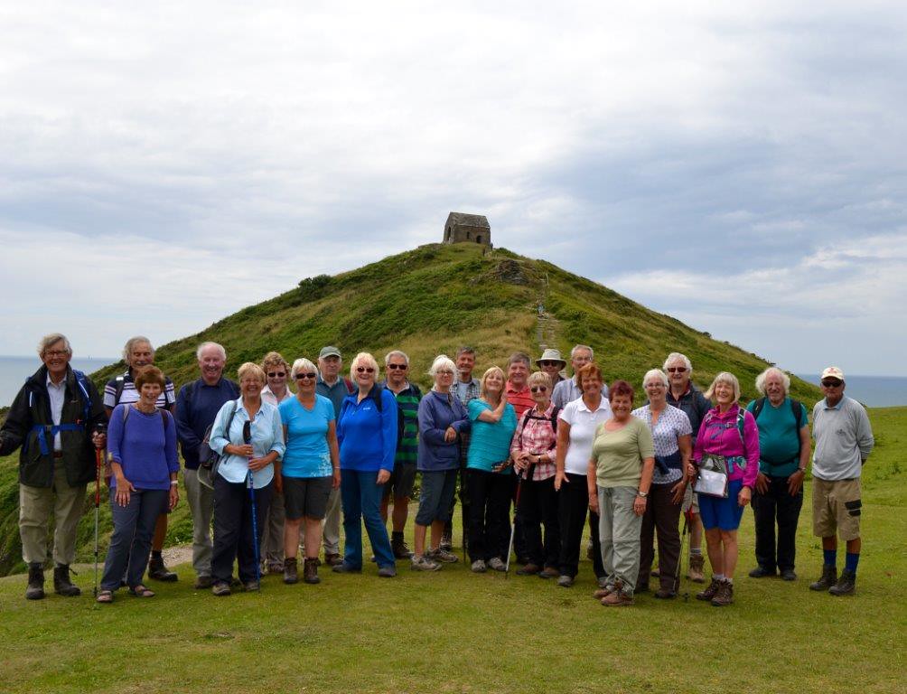 Click on image for larger view Thechapel is dedicated to St Michael and was first licensed for Mass in1397. Wethen travel east passing the path to the National CoastwatchStation-similar to that seen on our last walk from Charlestown. Thisis one of 50 stations around England and Wales which is run byvolunteers. Thenext major landmark is the wreck site of The Coronation a 90 gunman-o-war built towards the end of the Stuart period and whichcapsized in 1691. Much naval activity can be researched along thiscoast line and we saw two frigates and a helicopter taking off whilston our walk. Wewere soon into Cawsand a delightful coastal village just next to theequally delightful Kingsand. Until1844 the border between Celtic Cornwall and Saxon Devon lay betweenCawsand and Kingsand and the boundary line can still be seen on theside of the building. Wethen all had a good and very welcome lunch fish and chips, pasties,ice creams-some with flakes, scones-some with cream, toasted teacakes-some with extra butter, crab sandwiches----what a treat forall-all we have to do now is walk back to the car park. Pastthe gun emplacement and up the steps and then more steps to thefields above the towns and to the driveway to Wringford Farm. Fromhere we pass by an old bunker, the bottom of someone’s garden andalong the lane from the hamlet of Wiggle to the car park. Agreat walk which we all enjoyed and measured at 6.2 miles. Afurther treat was also in store for 5 lucky walkers who did not haveto return home immediately-a drink and home-made cake supplied by Sueand Rob and a tour of his garage and workshop. Ournext walk is on Tuesday 9th August-further details tofollow. ***************** Update: 6th July 2016 NOTICE OF WALK ON THE 12TH JULY- A CIRCULAR WALK AROUND RAME HEAD  Coastguard station and mast, Rame Head, Cornwall © Copyright Ruth Sharville and licensed for reuse under Creative Commons Licence. A) 6 MILE WALK AROUND RAME HEAD USING MAINLY COAST PATH WITH ITS NATURAL CONTOURS(UP AND DOWN) ***************** REPORT OF WALK OF THE 28THJUNE-FROM CHARLESTOWN TO CARLYON BAY
Weall managed to park in Charlestown, although some had to walk furtherthan others, and headed off to the harbour to find the coast pathgoing east. There were 2 square riggers in the harbour but no filmmakers on this occasion. It is hard to believe that as recently asthe 1950's you would have been walking through a thick coating ofwhite clay dust and that the house fronts would have also beencovered. Clay was carried down to the port along the wide road fromSt Austell, firstly in horse drawn carts and latterly in lorries tobe tipped down wooden chutes into the waiting ships. 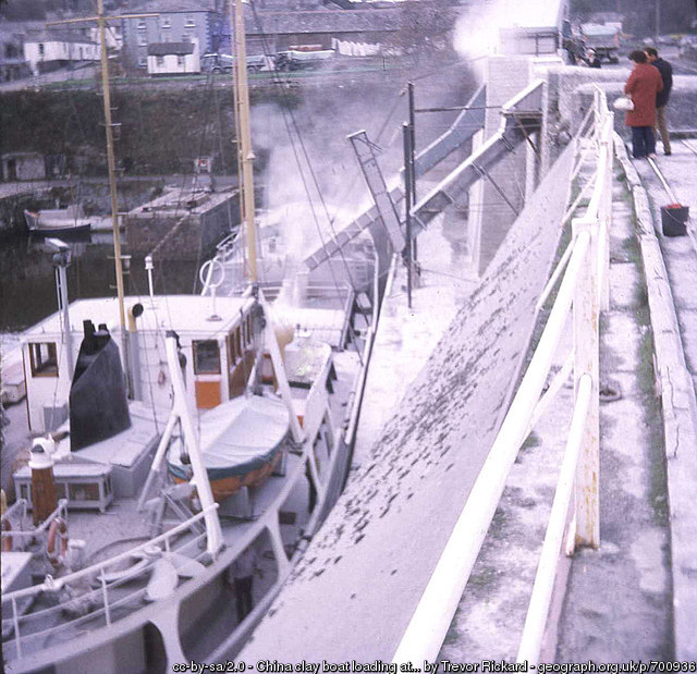 China clay boat loading at Charlestown 1973 - Click for larger view Weturn left where the public conveniences used to be and if we lookbehind towards the wooden knoll overlooking the port that once held adefensive battery and along the coastline towards Black Head, a 500year old Bronze Age cliff fort. Wefollowed the coast path until passing the rear of Carlyon Bay Hoteland continued along Sea Road admiring the many examples of 1930'sarchitecture. After passing the Porth Avalon Hotel we first missedthe sharp turn and then retraced our steps to go between two highhedges until we reached Beach Road. Lookingbehind us it is incredible to think that this area of manicuredsuburbia was up to the 1950's an area of mining spoil tips andriddled with shafts. We continued until we reached a grassy triangleand turned towards a house named Anneth Lawen (Cornishfor happy joyous place). Travelling on the old mining trackconstructed in the 1700's for exporting tin to South Wales forsmelting and by passing West Polmear Farm we exit onto Higher QuayRoad and back to the start. Eight of us manage to find somewherecomfortable for a drink and snack as the rain begins and we arepleased that we did not stop for a drink at the start. 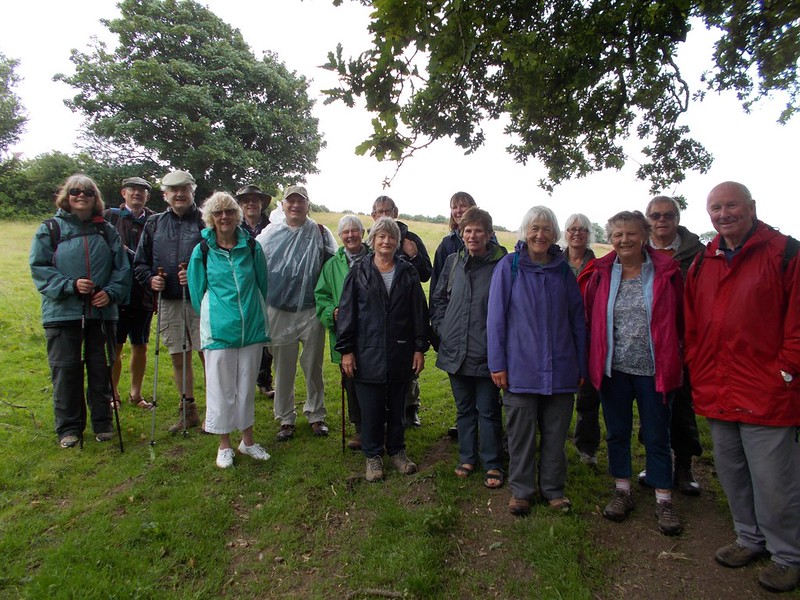 Click on image above for larger view Asusual this year there will only be one official walk in July andAugust and back to the normal short and long walks in September. ***************** Update: 20th June 2016NOTICE OF WALK ON THE 28TH JUNE - FROM CHARLESTOWN TO CARLYON BAY  A) EASY CIRCULAR WALK OF 3.5 MILES B) COASTAL HERITAGE, COAST PATH AND SUBURBIA C) PARKING AT PAY AND DISPLAY OR ROAD SIDE IN CHARLESTOWN D) WE WILL START IN CAFE IN CHARLESTOWN FOR TEA/COFFEE BEFORE WE WALK AND HOPE TO STOP AT COAST WATCH SITE ON ROUTE E) WE WILL MEET AT COMMUNITY CENTRE AT EARLIER TIME OF 9.45AM FOR 10.00AM START FOR THIS MORNING ONLY SHORT WALK COULD YOU LET US KNOW BY FRIDAY 24TH JUNE IF YOU WANT TO GO ON WALK AND IF YOU ARE ABLE TO OFFER TRANSPORT OR IF YOU WANT TO GO DIRECT TO START. REGARDS, CHRIS AND JANET ************************** Update: 16th June 2016 REPORT ON WALK OF 14TH JUNE A SEMI CIRCULAR WALK FOWEY TO GOLANT Seven walkers, optimistic that the weather would be kind to us (and it was), set off for this walk having driven from Lostwithiel to a spot with free parking in Hay Hill Close in Fowey. From Hay Hill Close, we took a footpath that runs from the Meadow Views flat complex down the road to the Bodinnick Ferry (B3269); we turned left onto that road and joined the Saint’s Way having turned right onto Penventinue Lane.  Click on above image for larger view The Saint's Way, or Forth an Syns, is a long-distance footpath that cuts right across Cornwall from Padstow on the north coast to Fowey on the south. Roughly 27 miles long, the route only came to light in 1984 when local ramblers investigating public paths found a series of forgotten granite stiles. The footpath features historic remains, ancient footbridges, old tracks and fascinating churches and passes through a rich and varied landscape of valleys, woodlands, pastures, moors and ancient field systems. You can reach Golant by walking on the upper or the lower footpath. We used the former on our way to Golant. The vegetation was very lush and when we reached the top of the ridge, we got stunning views over the River Fowey, Penpol Creek, Cliff and St Winnow Point. In the distance, we could see one of the ospreys nesting platforms erected in the land owned by Haye Farm on the bank of Penpol Creek thanks to a project led by the Friends of the Fowey Estuary (we actually saw them better on the way back).  We had a choice of venues for our lunch break: the Cormorant Hotel, the Fisherman’s Arms or the green. The sun was not out, so unfortunately we could not put to the test the Human Sundial at the south end of the green which was designed, crafted and built by villagers out of local slate in celebration of the millennium. Our return journey along the lower path took us past the creek where Sawmills, the recording studio is situated. We thought that the property had become a holiday cottage but in fact it is still operating as a studio. Here is the information that can be found on their website: “The Sawmills was established in 1974 as one of the first residential recording facilities in the U.K. Set in its own unspoilt tidal creek on the banks of the River Fowey in Cornwall, the Sawmills boasts one of the most picturesque and atmospheric locations for a recording studio anywhere in the world. The main building is a 17th century water mill; the site has a documented history stretching back to the 11th century. Over the past 3 decades the Sawmills has evolved into a unique balance between modern technology and the outstanding natural beauty of the Cornish countryside to produce a perfect environment for creative work. Recording artists from XTC to Robert Plant, The Stone Roses to Oasis, The Verve to Supergrass and Muse, have all remarked on and benefited from the special creative atmosphere that the Sawmills provides”.  As we approached the final stage of our walk, thanks to one of our fellow walkers John Smith, we were able to have a look inside Hunkin Boatyard and the staff talked about the two gigs they were working on: a new one commissioned by the Royal Marines based in Plymouth and an old Newquay gig that they are restoring. The new gig is made of elm which comes from Sweden.  In summary, here are some statistics on our walk provided by Tony Smith and Chris Short and their mobile phone Apps: duration including all stops 3hrs 24min; distance 4.8 miles; height gain 851ft; maximum altitude 306ft; minimum altitude 32ft; calories used: 570. And if I may add: stiles: 0! Chris and Janet will be back to lead the next walk scheduled for Tuesday 28th June. Annie Singer ****************************** WALK: FOWEY TO GOLANT AND BACK (part of the Saints' Way) TUESDAY 14TH JUNE 2016  The River Fowey Distance and timings: semi circular walk of 5 miles. 2 hours 45mns plus lunch break. Some uphill sections. Lunch and Comfort break: In Golant. Bring a packed lunch. However, food and drinks are available in the pub. PARKING: I will give drivers directions to free parking at a location where there is a footpath which joins the Saints Way. PLEASE let me know by Friday 10th June whether you will be join the walk and whether you are able to be one of the drivers. We will meet in the Lostwithiel Community Car Park at 10.15am for a 10.30am start Fingers crossed that the lovely weather continues. Kind regards |
Walking >


