Page listing - "Subpage Listing" Email: chris.dimond(at)btinternet(dot)com Main Walks (Normally 4-6 miles) 1 per month, on the second Tuesday of every month. Meeting point (for car sharing etc) at Lostwithiel Community Centre
Short Walks (Normally 3-4 miles) 1 per month, on the last Tuesday of every month. Meeting point at Lostwithiel Community Centre For both Long and Short Walks please meet at the Community Centre from 10.15a.m to leave at 10.30a.m. Looking forward to seeing you all, plus volunteers as Walk Coordinators and any suggestions/ideas for our programme. Future walk dates. Please let Chris or Janet ( 01208 871784) know if you would like to organise a walk. UPDATE 19th NOVEMBER 2019 NOTICE OF WALK ON 26TH NOVEMBER FROM WATERGATE BAY SOUTH TO NEWQUAY 1) 4 MILE EASY/MODERATE WALK ALONG SOUTH WEST COAST PATH-NO STILES 2) WE WILL BE BE CATCHING NO 56 BUS FROM GREAT WESTERN, CLIFF ROAD TO WATERGATE AND WE HAVE TO BE AT BUS STOP BY 10.30AM-BRING YOUR BUS PASSES. 3) WE WILL BE PARKING AT ALBANY ROAD CAR PARK TR72NQ AND WALKING TO BUS STOP-CAR PARK IS FREE AT THIS TIME OF YEAR. 4) WE WILL BE ABLE TO EAT PICNIC OR EAT IN NEWQUAY AT THE END OF THE WALK AND LEAVE NEWQUAY AT 3.00PM UNLESS YOU MAKE YOUR OWN ARRANGEMENTS. WE WILL MEET AT COMMUNITY CENTRE AT 9.10AM AND LEAVE AT 9.15AM IN ORDER TO CATCH THE BUS. PLEASE LET US KNOW BY FRIDAY 22ND IF YOU WANT TO COME AND IF YOU ARE PREPARED TO OFFER LIFT. REGARDS, CHRIS AND JANET ******************************** UPDATE 2nd NOVEMBER 2019 NOTICE OF WALK ON THE 12TH NOVEMBERCOASTAL LANDSCAPE AT BEDRUTHAN Bedruthan
1) 4.5 MILE SPECTACULAR COASTAL WALK WITH ONLY MINOR GRADIENTS 2) START FROM NATIONAL TRUST CAR PARK AT PARKHEAD-BRING MEMBERSHIP CARD IF YOU HAVE ONE 3) LUNCH AVAILABLE AT EXCELLENT CAFE AT CARNEWAS. PLEASE LET US KNOW IF YOU WISH TO PURCHASE YOUR LUNCH HERE AS WE HAVE TO LET CAFE KNOW NUMBERS. PICNIC CAN BE TAKEN AS AN ALTERNATIVE. 4) WE WILL MEET AT COMMUNITY CENTRE AT 9.45AM FOR A 09.50AM START. PLEASE LET US KNOW BY FRIDAY 8TH LATEST -IF YOU WANT TO GO ON THE WALK -IF YOU CAN OFFER TRANSPORT AND -IF YOU WANT TO USE THE CAFE FOR LUNCH SEE AT CARNEWAS-TEA-ROOMS.CO.UK REGARDS, CHRIS AND JANET *********************** UPDATE 30th OCTOBER 2019 REPORT OF WALK ON THE 29TH OCTOBER 2019 DEER WALL WALK AT LANHYDROCK On yet another day when the weather forecast was awful 25 walkers, including two new members, decided to brave the elements for the 4.3 mile walk along a well signed route around the National Trust estate. The walk is so called because it passes an historic deer wall used to surround the old estate built to discourage deer from leaving the park. Starting at the main car park we initially follow the cycle path trail to cross the Respryn Road and head down towards the path which goes to Bodmin Parkway train station in drizzle but on wide firm paths. Joining Station Drive flanked by tall conifers including giant redwoods we walk towards Respryn Bridge and cross the river to now walk along side the river to again cross at the footbridge and to then head up through one of the many red gates and with great views across the valley. A photograph was taken here which does not include the three walkers who had taken the easier/quicker route back to the house. Click on above image for larger view There are some 77 red gates across the estate and according to the walks leaflet they cost around £13,000 per year to replace and maintain. Up the path again and past the nursery we head towards the house and then up the main entrance back to the car park with rain falling a bit heavier and in time for a well earned stop and something to eat and drink in the now busy café. We are hoping that for our next walk on 12th November the weather will be kind. UPDATE 21st OCTOBER 2019 NOTICE OF WALK ON 29TH OCTOBERDEER WALL WALK AT LANHYDROCK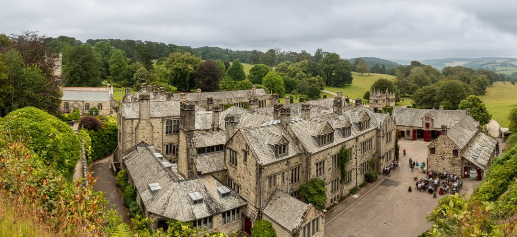 Image Credit: Lanhydrock House ©️ Lindsay Southgate 1. MANY OF YOU WOULD HAVE DONE PART OF THIS 4.3 MILE CIRCULAR WALK BUT I IMAGINE FEW HAVE DONE IT ALL. EASY PATH WITH ONLY 1 LONGISH HILL-WHICH CAN BE AVOIDED IF NECESSARY. 2.WILL BE WET IN PLACES BUT OTHERWISE GOOD SOLID PATH 3.WE WILL START IN MAIN CAR PARK SO BRING CARDS IF NATIONAL TRUST MEMBERS WE WILL MEET AT COMMUNITY CENTRE FOR SHORT TRIP TO START OF WALK AT 10.00AM FOR 10.05AM START. WE WILL FINISH WALK AT 1.00 ISH SO BRING PICNIC OR USE CAFE AT LANHYDROCK FOR LUNCH OR DEPART STRAIGHT AWAY. PLEASE INDICATE IF YOU WISH TO GO STRAIGHT BACK BEFORE LUNCH SO I CAN TRY AND PLAN TRANSPORT ACCORDINGLY. PLEASE LET US KNOW IF YOU WOULD LIKE TO GO ON WALK AND IF YOU CAN OFFER TRANSPORT AND YOUR CHOICE ON WHAT YOU DO AFTER THE WALK BY THE 26TH OCTOBER LATEST. REGARDS, CHRIS AND JANET UPDATE 11TH OCTOBER 2019 REPORTON WALK OF 8TH OCTOBER 2019 A 5.5 MILES CIRCULAR WALK FROM TRELISSICK GARDENS TO ROUNDWOODQUAY Fifteen members of the group armed with their NT membershipcards met up in the Trelissick gardens car park. Sharp showers had been forecast but this did notdeter us from starting the walk full of optimism. The setting for this walk reflects the themes echoed throughoutthe Parish of Feock: the house and the gardenswere built largely with the proceeds of mining from its heyday. The gardens were also a product of the age ofdiscovery when the Cornish plant hunters scoured the world for riches, as did theirmining cousins. All this is set within amaritime backdrop marrying industrial heritage with modern leisure activities. We walked across the cattle grid by the informationcentre and out into the pasture field to follow one of the routes down towardsthe estuary that we could see in the distance along with Pendennis Castle. We followeda path above the beach which borders the estuary – a huge amount of seaweed hadbeen blown into the path due to the strong winds and high tides of the previoustwo weeks. The path took us to the roadthat you drive down to take the King Harry Ferry to travel to the Roseland Peninsula. The King Harry Ferry was originallypowered by oars; however, its importance warranted a better system and in 1889steam was introduced. It is now a chainferry and we could clearly hear the clink clonk of the chain as the ferry was crossingthe estuary. We followed the well-maintained woodland track which bordersthe estuary and at one stage, we could see Roundwood Quay which was our destinationfor our picnic lunch. However, our walk leaderpointed out that it would be a while before we reached the quay as we had towalk to the end of Lamouth Creek, walk across a footbridge and then walk backtowards the estuary. Once we had crossedthe footbridge, the heavens opened but fortunately we were under the cover ofthe trees and we did not get too wet. One of our members had bought a new waterproof jacket and was even glad ofthe showers to put the new garment to the test! As we could see blue sky in thedistance, once the worse of the showers had passed, we decided to preserve and continuewalking. By the time we reached Roundwood Quay, the weather had brightenedup and we had just enough time to eat our lunch before the next downpour. The quays at Roundwood were probably built byThomas Daniell around 1760 and their principal purpose was to service the tinand copper mines of Kea and Gwennap with coal and exported ore. The quay area was also home to a copper smeltingoperation for a period in the 1770s. From Roundwood Quay, you have a good view of Tolverne and Smugglers’Cottage – it used to be a hostelry but is now a private residence. For the second half of the walk which took place in lovelysunshine, we walked through the Roundwood Quay National Trust car park, up a lanepast cottages and through fields from which we saw in the valley below the hamletsof Coombe and Cowlands with their many fruit orchards. This is the home of the famous Kea plum. The area was a hive of activity in the 19thand 20th century when, during harvest time in August and September, itwas a magnet for pickers which even came by steamer boat from Truro and otherFal ports to take a share of the bounty. We then crossed the main Roundwood track and re-joinedthe Trelissick fields. We walked thoughnewly planted orchards and gathered around an information board to take a photoin the sunshine but somehow managed to take a photo in Black and White! We were back on the woodland footpath and made our wayback to the footbridge. We then turned left and climbed up the hill back to Trelissick. Not far from the main road, there is a strategicallyplaced bench from which you have good views of the Tregothnan Estate and even thecorner of Roundwood Quay. Back in theTrelissick Gardens we made our way to the cafe for some refreshments. UPDATE 29th SEPTEMBER 2019 REPORT OF WALK ON THE 10TH SEPTEMBER 2019 THE CORNISH SHORES OF PLYMOUTH SOUND On a fantastic sunny day with just the hint of a breeze 17 very lucky people set off to walk either the 8 mile route or the 4 mile route around this wonderful area of south east Cornwall for our first walk of this new academic session and repeat what 11 walkers did in 2014.  Setting off on the southerly route through Mount Edgcumbe Country Park and around Picklecombe Point with a few climbs to negotiate in the woodland terrain but with glorious clear views across the breakwater and Plymouth sound we headed towards Kingsand and Cawsand. At an appropriate spot we stopped to celebrate Annie’s birthday with some lovely apple cake which she had baked at 6.00am that morning-that’s dedication for you! and news of the birthday soon spread to other walking groups. Click on above image for larger view Lunch time soon came and a relax by the waters at Kingsand and then passing the old county boundary sign we travelled to Cawsand to find a café.  Saying goodbye to those who wanted to catch the bus back to Cremyll we continued across the peninsular to the north side and views of Torpoint and the ferry and stopping off at Maker Church on the way to find the enchanting little harbour at Empacombe before travelling alongside maize fields and back to the car park. But for some our walk did not stop there as we made time to pop back to the Orangery at Mount Edgcumbe Park for that last drink or piece of cake before making our way home. It was confirmed that we had completed nearly 8 miles, had crossed about 6/7 stiles and had to negotiate a few climbs. ************************ UPDATE 25th SEPTEMBER 2019 Message from Chris, Walk planned for 24th September postponed because of bad weather. We will try again in October or November. UPDATE 23RD SEPTEMBER 2019 DETAILS OF WALK OFTUESDAY 8TH OCTOBER 2019 FROM TRELISSICKGARDENS TO ROUNDWOOD QUAY ALONG THE RIVER FAL
DETAILS OF WALK OFTUESDAY 8TH OCTOBER 2019 FROM TRELISSICKGARDENS TO ROUNDWOOD QUAY ALONG THE RIVER FAL
THE DETAILS ARE AS FOLLOWS:
I WOULD BE GRATEFUL IF YOU COULD LET ME KNOW BY FRIDAY 4THOCTOBER WHETHER:
I LOOK FORWARD TO YOUR COMPANY ANNIE UPDATE 17TH SEPTEMBER 2019 NOTICE OF WALK ON 24TH SEPTEMBERCOASTAL LANDSCAPE AT BEDRUTHAN Bedruthan
1) 4.5 MILE SPECTACULAR COASTAL WALK WITH ONLY MINOR GRADIENTS 2) START FROM NATIONAL TRUST CAR PARK AT PARKHEAD-BRING MEMBERSHIP CARD IF YOU HAVE ONE 3) LUNCH AVAILABLE AT EXCELLENT CAFE AT CARNEWAS. PLEASE LET US KNOW IF YOU WISH TO PURCHASE YOUR LUNCH HERE AS WE HAVE TO LET CAFE KNOW NUMBERS. PICNIC CAN BE TAKEN AS AN ALTERNATIVE. 4) WE WILL MEET AT COMMUNITY CENTRE AT 9.55AM FOR A 10.00AM START. PLEASE LET US KNOW BY FRIDAY 20TH LATEST -IF YOU WANT TO GO ON THE WALK -IF YOU CAN OFFER TRANSPORT AND -IF YOU WANT TO USE THE CAFE FOR LUNCH SEE AT CARNEWAS-TEA-ROOMS.CO.UK REGARDS, CHRIS AND JANET ******************** UPDATE 27TH AUGUST 2019 NOTICE OF WALK ON THE 10TH SEPTEMBERTHE CORNISH SHORES OF PLYMOUTH SOUND Kingsand Image Credit: Alison Day Creative Commons (CC BY-ND 2.0) THIS A REPEAT OF A WALK UNDERTAKEN BY 11 MEMBERS IN OCTOBER 2014 AND WE FEEL IS WORTHY OF ANOTHER GO. IT IS POSSIBLE TO DO HALF OF THE WALK AND THEN CATCH THE BUS 70/A/B BACK TO THE START AT CREMYLL BUT UNLESS SUFFICIENT DRIVERS CHOSE THAT OPTION THEN YOU MAY HAVE TO WAIT AT CREMYLL UNTIL YOUR DRIVER COMPLETES THE WALK TO RETURN HOME. YOU WILL REQUIRE A PICNIC OR THERE ARE SOME EATING PLACES AT KINGSAND/CAWSAND OR YOU CAN HAVE BOTH. WE WILL MEET AT COMMUNITY CENTRE AT 9.25AM FOR 9.30AM START OF DRIVE TO PAY CAR PARK AT CREMYLL. COULD YOU LET US KNOW BY FRIDAY 6TH SEPTEMBER:-
REGARDS, CHRIS AND JANET ******************** UPDATE 12TH JULY 2019 REPORT ON WALK OF TUESDAY 9TH JULY 2019 CIRCULAR WALK From ST JUST-IN-ROSELAND TO ST MAWES Twenty-one members of our walking group made their way to the church car park at St Just in Roseland for this walk which had been rescheduled from last year due to the strong wind and heavy rain. On Tuesday, the weather was glorious and we had to make sure that we put on plenty of sunscreen, wore our sun hats and carried plenty of water! The group has done many walks around the Carrick Roads and we had the opportunity to see where we had walked over the last two years: Mylor Harbour to Flushing, Mylor Bridge to The Pandora Inn, Feock to Devoran and opposite the Pandora Inn, Falmouth and finally the walk around Anthony’s Head. This easy to moderate 6.5-mile walk started in the semi-tropical gardens of St Just-in-Roseland church.
We followed the path along the Carrick Roads to St Mawes where we stopped for 45 minutes for lunch.
The crab sandwiches from the deli had been recommended and we were not disappointed. Some members could not resist eating an ice-cream. The walk continues along the Percuil river and up away from the river and you end up on the main road to St Mawes by the ugly water tower. The final part of the walk takes you across the fields of the NT Tregear Vean Farm where you have once again amazing viewS down to the Carrick Roads and across to the mining area around Wheal Jane and then down to St Just-in-Roseland. Unusually, the group was spared the normal cultural input but for those who read this report and have withdrawal symptoms, here are a few nuggets of information:
At the end of the walk, we gathered in the newly built café opposite the church for light refreshments. Guess who had a cream tea!
This was the last walk until Tuesday 10th September when Annie will bring cake to celebrate her birthday. UPDATE 28TH JUNE 2019
ST JUST IN ROSELAND TO ST MAWES AND BACK ALONG THE PERCUIL RIVER AND INLAND TUESDAY 9TH JULY Rescheduled from 11th June
GINA AND I DID THE RECCE FOR THIS WALK AND WE HOPE THAT YOU WILL ENJOY IT AS MUCH AS WE DID. HERE ARE THE DETAILS:
PLEASE LET ME KNOW BY SATURDAY 6TH JULY IF YOU LIKE TO COME ON THE WALK AND CAN OFFER TRANSPORT. I LOOK FORWARD TO YOUR COMPANY ANNIE UPDATE 26TH JUNE 2019 REPORT OF WALK ON THE 25TH JUNE 2019 FROM PENMERE STATION TO FALMOUTH This was a repeat of a walk we did in April 2017 when 9 took part. This time with only four of the original 9 another 7 joined us for the train journey and the 4.5 mile walk from Penmere Station around to Pendennis Point and Falmouth Town. The distance was verified by Dave and Roy; the two with those gadgets who try and prove me wrong. The first photograph, so that all avid readers can compare this group with the 2017 group, was taken in front of the delightful gardens before we headed off through a small housing development and took a path through woods to the top of Swanpool Nature Reserve and onto the South West Coast Path. Click on image above for larger view The route is exactly the same as in 2017 and we all stopped at the cafe at Gyllyngvase Beach in what was now hot sun with little breeze even next to the sea. After a drink and a piece of welcome birthday flapjack from Chris-a tradition that is hopefully taking off -don't be afraid we only want to know if its your birthday never your age!-we take off along the promenade and in front of the hotels and apartments towards Pendennis Point and a view out to St. Mawes -the destination for our next walk in July. Around the headland and into town to finish the official walk and make plans for the return journey from Falmouth Town Station. Many went to have fish and chips sat by the harbour and some even went shopping for clothes and ear rings or both! Where ever they went we nearly all met up at the station to catch the train to Truro and time for some to relax-yes the deck chairs are big and our walkers are normal size!- and for one to collect their boots which had enjoyed a trip to Penzance instead of going as planned to Falmouth. Back shortly after four after a good day out.  ******************** UPDATE 14TH JUNE 2019 NOTICE OF WALK ON THE 25TH JUNETO FALMOUTH BY TRAIN AND EXPLORING THE TOWN 1) 4.5 MILE MODERATE WALK FROM PENMERE STATION TO PENDENNIS CASTLE AND RETURNING FROM FALMOUTH TOWN.
9 OF US COMPLETED THIS WALK IN APRIL 2017 AND REALLY ENJOYED THE DAY OUT ALL DISTANCES HAVE BEEN CHECKED AND VERIFIED! REGARDS, CHRIS AND JANET UPDATE 31ST MAY 2019 DETAILS OF WALK OF 11th JUNE 2019
ST JUST IN ROSELAND TO ST MAWES AND BACK ALONG THE PERCUIL RIVER AND INLAND. Cancelled due to adverse weather forecast for strong wind and heavy rain
GINA AND I DID THE RECCE FOR THIS WALK AND WE HOPE THAT YOU WILL ENJOY IT AS MUCH AS WE DID. HERE ARE THE DETAILS:
PLEASE LET ME KNOW BY FRIDAY 7TH IF YOU WANT TO COME ON THE WALK AND CAN OFFER TRANSPORT. I LOOK FORWARD TO YOUR COMPANY ANNIE UPDATE 29TH MAY 2019 REPORT OF WALK ON THE 28TH MAY 2019 HELIGAN TO MEVAGISSEY TO PENTEWAN CIRCULAR
This advertised as a 4.5 mile circular moderately difficult walk with hills and steps was enjoyed by 20 people and was a repeat of a similar walk done on April 26th 2016. Well done to Jenny, Janet and Chris who managed to do both of the walks with the 2016 walk only having 9 participants as many of our regulars were away. Despite the light rain when we arrived at Heligan a drink and for some cake(not this time for the leaders) used enough time for the rain to disappear and for us to start our downhill walk past Heligan Mill to Mevagissey and the chance to take our customary photograph in front of the harbour. Click on image above for larger view As it was still early for lunch we had a short 15 minute break to buy some picnic food before setting off along the coast path towards Pentewan. This part of the South West coast path is a bit hilly with a long uphill stepped part but with some great views along to Black Head, Par and Polruan. The sun had now come out and with many walkers on the path we soon approached Pentewan, past a herd of cows who took no interest, and walked through the busy caravan and camping site to the village and the many seats overlooking the old harbour and lunch time. With two cafés we were also able to get drinks and any food we required. Uphill again now and following the footpath sign through several large fields of barley blowing in the wind and views on the right of the clay pits near St Austell and on the left out to sea. Through a small wooded area we were soon at Heligan camping site and our cars. Several walkers had electronic measurement devises and asserted that the walk had been over 6 miles! On the same walk in 2016 one of our walkers with a similar devise had measured 4.2 miles!. A local guide booked has the distance from Pentewan to Heligan to Mevagissey as 3.5 miles - we of course did the additional coast path to get from Mevagissey to Pentewan. What is the correct distance? Will we ever know? UPDATE 18TH MAY 2019 NOTICE OF WALK ON 28TH MAYFROM PENTEWAN TO MEVAGISSEYA LOVELY WALK THAT 9 OF US DID IN 2016 WHICH HAS THE OPPORTUNITY TO HAVE 11.00AM BREAK AT HELIGAN AND LUNCH OF YOUR CHOICE IN MEVAGISSEY. 1) 4.5 MILE CIRCULAR WALK USING FARMLAND, TRACKS AND COASTAL PATH 2) SOME HILLS AND STEPS ON MODERATE DIFFICULTY WALK 3) WE WILL BE PARKING IN FREE CAR PARK IN PENTEWAN 4) WE PLAN TO BE BACK IN LOSTWITHIEL BY 4.00PM LATEST COULD YOU PLEASE LET US KNOW BY FRIDAY 24TH MAY IF YOU WOULD LIKE TO COME ON WALK AND IF YOU CAN OFFER LIFT. WE WILL BE MEETING AT 9.40AM FOR 9.45AM DEPARTURE FROM COMMUNITY CENTRE REGARDS, CHRIS AND JANET UPDATE 15th MAY 2019 REPORT OF WALK ON THE 14th MAY WADEBRIDGE AND THE BANKS OF THE RIVER CAMEL Thirteen walkers set off from Wadebridge at the end of Guineaport Road on a bright, sunny and breezy morning. This 6.5 mile circular walk began with a steady uphill walk along a sheltered, tree line path past Treravon Farm. This eventually came to a quiet road with a left hand turn steeply downhill to the pretty hamlet of Burlawn. At Hustyn Mill we turned off into Bishop's Wood and followed the winding woodland track which lead to our lunch stop at the picnic tables just before Polbrock Bridge. After a solid 1.5 hours of walking everyone was ready for a lunch break in a sheltered glade with charming views of the River Camel and the Camel Trail beyond.   After lunch we set off over the bridge and the trek back to Wadebridge along the trail with lovely views of the river all the way, passing yellow irises and reed beds and avoiding several cyclists.  Once back at the cars 6 of us decided to head into Wadebridge for coffee and tea to round off a lovely day while the rest headed home. A special award must go to Dave B.-the only man on the walk for his long suffering resignation amidst the female banter. As I lead this walk without Chris today I'd like to thank everyone for being a very “easily-led” group. ******************** UPDATE 5th MAY 2019 NOTICE OF WALK ON THE 14TH MAY WADEBRIDGE AND THE BANKS OF THE RIVER CAMEL The Bridge at Wadebridge Credit: Derek Winterurn (CC BY-ND 2.0) 1) 6.5 MILE CIRCULAR WALK ON CAMEL TRAIL, MINOR ROADS, FIELDS, MUDDY LANES AND WOODLAND TRAILS. 2) PARKING EITHER IN CAR PARK IN WADEBRIDGE OR AT END OF GUINEAPORT ROAD. 3) REASONABLY EASY WALKING WITH SOME MINOR UPHILL AND DOWNHILL PARTS 4) NO FACILITIES ON THE WALK BUT PLENTY IN WADEBRIDGE 5) PICNIC LUNCH IN THE WOODS 6) POSSIBLE TO BE BACK IN LOSTWITHIEL BY 3.15PM WE WILL MEET IN COMMUNITY CENTRE AT 10.25AM FOR 10.30PM DEPARTURE PLEASE LET US KNOW BY FRIDAY 10TH IF YOU WANT TO COME ON THE WALK AND CAN OFFER TRANSPORT. REGARDS, CHRIS AND JANET UPDATE 1ST MAY 2019 Report on walk of 28th April 2019 A there and back walk from Pelynt to Polperro Eighteen members of the group made their way to a car park in Pelynt for the start of this walk which gave participants the choice between doing a 7 miles walk or walking 3.5 miles down to Polperro and then returning to Pelynt by bus. Eight members opted for the latter option. After all, the last Tuesday of the month is meant to be for short walks! (Click on above image for larger view) We started our morning with a visit to the church because of its connection to Bishop Trelawney. The name Pelynt comes from the Cornish Plunent which means the Parish of St Nunit. The Plu or Plou suffix is common in towns and villages in Brittany. The church is surrounded by roads which is where there would have been an enclosure ditch. Sir Jonathan Trelawney was born at Trelawne in the parish of Pelynt, Cornwall, the eldest surviving son of Sir Jonathan Trelawny, 2nd Baronet. He was educated at Westminster School and then went to Christ Church, Oxford at the start of the Michaelmas term of 1668 where he distinguished himself as a scholar. A staunch royalist, he was ordained in 1673 and became a beneficed clergyman. He was appointed rector of South Hill on 4 October and of St. Ives on 12 December 1677, becoming Bishop of Bristol in 1685. He was one of the Seven Bishops tried for seditious libel under James II. Trelawny and the other bishops petitioned against James II's Declaration of Indulgence in 1687 and 1688, (granting religious tolerance to Catholics) and as a result he was arrested and imprisoned in the Tower of London on charges of seditious libel. The bishops said that whilst they were loyal to King James II, their consciences would not agree to allowing freedom of worship to Catholics even if it were to be within the privacy of their own homes as the Declaration proposed; thus they could not sign. Trelawny was held for three weeks before trial, then tried and acquitted; this led to great celebrations, with bells being rung in his home parish of Pelynt. Trelawny was rewarded in 1689 by being appointed Bishop of Exeter (whilst still, until 1694, Archdeacon of Totnes) after the military defeat of James II and the accession of the Protestant William of Orange to the British throne. He was further rewarded by being appointed Bishop of Winchester in 1707, although his promotion was a matter of some controversy, as Queen Anne, who was determined to keep all important Church appointments within her own gift, overruled the advice of her ministers and of Thomas Tenison, the Archbishop of Canterbury in appointing him, thus provoking the so-called Bishoprics Crisis. He died in 1721, in Chelsea, Middlesex; his body was brought back for burial to Pelynt in Cornwall. In the church you can see his throne and crook. On the day of our visit, a workman was busy hanging Bishop Trelawney’s Coffin Plate. The plate had been stolen 3 years ago and found by a lady called Megan in a charity shop in Norfolk. The official unveiling of the coffin plate will take place in the church on Saturday 18th May 2019. In the Trelawney Chapel, there is also an embroidered piece with the words to the Cornish Anthem which immortalised Bishop Trelawney “The Song of the Western Men”, better known simply as Trelawny. It was written and composed by Parson Robert Stephen Hawker, vicar of Morwenstow in 1824. After the short history lesson, we walked down to Polperro. Well, this is what had been advertised. In fact, it turned out to be a walk down to Polperro with a few hills thrown in! We climbed 500 feet and descended 900 feet, we were reliably informed, curtesy of a mobile phone App. The walk leader promises to provide more accurate descriptions of her walk in the future! We walked on minor roads, footpaths and also along a green lane parallel to the river which eventually flows through Polperro. We went through wooded areas covered in bluebells – what a treat for the eyes! Once in Polperro, it was time to have our lunch. Some of us braved the slight breeze and had a picnic lunch by the harbour whilst the sensible ones retreated to hostelries. Many of us then made our way to the museum café for a hot drink. Guess who had a cream tea?  Although it was almost a “there and back walk”, we noticed different things on the way back which kept our interest going. This was a fairly local walk which nobody had done before and seemed to be enjoyed by all. NOTICE OF WALK OF 30th APRIL 2019 PELYNT TO POLPERRO Postponed from 12th March
HERE ARE THE DETAILS:
WE WILL MEET IN THE LOSTWITHIEL COMMUNITY CENTRE CAR PARK READY TO LEAVE AT 10.00 AM I WOULD BE GRATEFUL IF YOU COULD LET ME KNOW BY FRIDAY 26TH APRIL WHETHER: 1. YOU WILL BE JOINING ME ON THIS WALK 2. YOU HOPE TO WALK BACK OR WHETHER YOU WOULD RATHER TRAVEL BACK BY BUS (WE MIGHT ALL TAKE THE BUS BACK IF IT RAINS 3. YOU WILL BE DRIVING AND ARE ABLE TO OFFER LIFTS I LOOK FORWARD TO YOUR COMPANY ANNIE REPORT OF WALK ON THE 9TH APRIL DEADMAN'S COVE TO HELLS MOUTH TO TEHIDY WOODS AND BACK What a great day for a walk after a cloudy start but by the time we had driven to the National Trust Car Park on the North Cliffs above Deadman's Cove the sun was shining and fourteen of us were ready to start our 6 mile circular walk. Starting along the coast path we took a detour to have a tea/coffee and some of us something to eat at Hells Mouth café. Our formal photo was taken just off the coast path with the sea as the background. Click on above image for enlarged view Retracing our steps past three other smaller car parks we then returned to the car park to head south through fields to arrive in Coombe on the western side of Tehidy Country Park. The manor of Tehidy was owned by the Basset family until 1916 and shortly after the manor was sold it was converted to a hospital which was devastated by fire just two weeks after opening. The grounds were subsequently developed by Cornwall County Council and it now is the largest area of woodland in West Cornwall-so we were told by Sue!. In the centre there is now a private development of residential houses which we were to go past on our route finally to the North entrance. Time for lunch on the walk through the woodlands with a stream running alongside the path.  Our leaders also took the time to contemplate-probably which walk to do next or which café can we stop at!!!  In fact we did come across another café at the South entrance but rushed quickly by to head along a permissive path through the woodland and past an impressive beech tree with twisted roots to the North car park and access to the coast path again.  We all watched as a helicopter was, we assumed training, hovering low over the sea and then moving on before coming back again to redo the manoeuvre. Just another 30 minutes and we were back at the car park and the 50 minutes drive back home -still with good weather although rain did come at about 5.30pm as predicted. ****************************** UPDATE 6th APRIL 2019 NOTICE OF WALK ON THE 9TH APRIL TEHIDY WOODS AND NORTH CLIFFS WALK 1) 6 MILE CIRCULAR EASY/MODERATE WALK ON COAST PATH,WOODLAND AND FARMLAND 2) MOSTLY FLAT WITH A FEW GATES AND ONE MINOR UPHILL. WE WILL BE REPEATING ONE PART OF THE COAST PATH 3) YOU WILL NEED TO BRING PICNIC LUNCH BUT THERE WILL BE TWO OPPORTUNITIES FOR DRINKS AND TOILETS-ONE AT ABOUT 11.15AM. 4) WE WILL BE MEETING AT COMMUNITY CENTRE AT 9.25AM FOR 9.30AM DEPARTURE AND ABOUT 1 HOUR DRIVE TO START POINT AND RETURNING AT ABOUT 4.00PM. WE WILL BE STARTING THE WALK AT NATIONAL TRUST CAR PARK ON B3301 SOUTH WEST OF PORTREATH-POST CODE AND REFERENCES CAN BE GIVEN IF REQUIRED. COULD YOU PLEASE LET US KNOW BY SATURDAY 6TH APRIL IF YOU WANT TO GO ON THE WALK AND IF YOU CAN OFFER TRANSPORT. REGARDS, CHRIS AND JANET UPDATE 27th MARCH 2019 REPORT OF WALK OF THE 26TH MARCH 2019 TO KILMINORTH AND ALONG THE ESTUARY This was a 4.5 mile circular walk which was a repeat of a similar walk done in October 2015 when on that occasion 8 walkers completed the walk. On this very sunny and glorious March day 23 walkers gathered at Hannafore to start the walk past the bridge and through the large car park to reach the climb through the woods. A photograph was taken at this point whilst we were still in fine fettle.  After climbing first through the woods,over a stile and through a large agricultural field we reached our summit and another photograph showing the coast line behind us. Click on image above for larger view After a short walk following the footpath signs we reach the cottages rented by Hoseasons and then our downhill bit to sea level and the estuary with the tide fast going out leaving mud flats and wading birds. A levelish walk now along the estuary, a bit slippery in places, and towards West Looe and with the time about 12.45pm we reached our six picnic tables and time for a bite of lunch.  After a very pleasant break,particularly for those sitting in the sun, we headed towards the large car park and for some time to return to Lostwithiel whilst for others a visit into East Looe to sample some of the goodies before walking back to Hannafore and ,with the sun still shining, to return home. ******************************* UPDATE 16th MARCH 2019 NOTICE OF WALK ON THE 26TH MARCHTO KILMINORTH AND ALONG THE ESTUARY
 Kilminorth Woods 1) 4.5 MILE CIRCULAR WALK USING WOODLAND WALK, FOOTPATHS AND MINOR ROADS 2) ONE LONG HILL TO START AND COUPLE OF STILES-MAYBE WET IN PLACES DEPENDING ON TIDES 3) WE WILL BE HAVING PICNIC ALONG SIDE ESTUARY 4) ADDITIONAL REFRESHMENTS AND TOILETS AVAILABLE IN LOOE. WE WILL BE MEETING AT COMMUNITY CENTRE AT 10.10AM FOR 10.15AM DEPARTURE TO PARK AT HANNAFORE FOR 10.55AM DEPARTURE BY FOOT. COULD YOU LET US KNOW BY SATURDAY 23RD MARCH IF YOU WOULD LIKE TO COME AND CAN OFFER TRANSPORT. REGARDS, CHRIS AND JANET UPDATE 2ND MARCH 2019 NOTICE OF WALK OF 12TH MARCH 2019 PELYNT TO POLPERRO CANCELLED DUE TO BAD WEATHER
HERE ARE THE DETAILS: THIS IS A THERE AND BACK WALK (3.5 MILES EACH WAY)
WE WILL MEET IN THE LOSTWITHIEL COMMUNITY CENTRE CAR PARK READY TO LEAVE AT 10.00 AM I WOULD BE GRATEFUL IF YOU COULD LET ME KNOW BY FRIDAY 8TH MARCH WHETHER:
I LOOK FORWARD TO YOUR COMPANY ANNIE UPDATE 27th FEBRUARY 2019 REPORT OF THE WALK ON THE 26TH FEBRUARY AROUND SIBLYBACK AND A BIT MORE On a day when news broke that Siblyback Lake will no longer be the venue for sailing and other water sport events a near record of 24 members set off on a glorious February day with clear blue sky to walk the 4. something mile circular walk. The temperature was near to 16-17 degrees centigrade when we started the climb with one of our group showing off his bare legs and getting that first tan of the year. Click on image above for larger view Using the footpath we headed south east towards Crylla Farm and over many stiles and steps to then head downhill towards our surprise and promised eleven's destination of the village hall at Common Moor. Entering through the main door the group were met with comfortable chairs in a circle with two excellent cakes and home made sausage rolls laid out on a table in the middle and volunteers from the community ready to serve teas and coffees. What a treat which will take some beating. Click on image above for larger view Following the minor road and then a footpath along side a babbling stream we made for the road we drove in on and then to a footpath at South Trekeive where we crossed several fields, with magnificent views of the bright blue lake, to head towards the dam before circumnavigating the water in a clockwise direction to get back to our cars after another new walk in conditions that turned out to be better than the Caribbean. NOTICE OF WALK ON 26TH FEBRUARY AROUND SIBLYBACK PLUS A BIT  Siblyback Reservoir, Cornwall |

