
UPDATE 14 JUNE 2017 Report of Walk from Coombe Farm, Fowey to Polkerris and back First stop was at Polridmouth (pronounced Pridmuth) cove between Fowey and Gribbin Head. You can see Gribbin Head daymark in the background of the photo. Built by Trinity House in 1832 it was intended as a daylight navigation aid for shipping. Now owned by the National Trust it is open to visitors some Sundays in the summer. A flag is flown to show when it is open.  In the absence of our usual walk leaders, Chris and Janet, and Annie, we relied on the knowledge of some of our group to tell us that during the Second World War, the lakes at Polridmouth formed a decoy site for nearby Fowey harbour. Decoy sites were a diverse group of structures, which were built all over the country under the direction of Colonel John Turner. Borrowing heavily from techniques developed at Shepperton film studios, Colonel Turner supervised the creation of more than 1100 imitation airfields, ports, and towns, each a few miles from the real thing. The aim was to fool enemy bombers into attacking the dummy site, thus protecting the genuine site. The lakes had been built behind the beach in the late 1920s. Dams were built around the lakes, and lighting set up, to imitate, as far as possible, Fowey harbour. The decoy site was considered especially important in 1944, when 2000 US Navy personnel were stationed in Fowey, in preparation for D-day. At least one bomb is known to have been dropped near Polridmouth. From here we continued along the South West Coast Path to Polkerris, a tiny hamlet, west of Fowey. It is here that you find Kilmarth, the last home of Daphne du Maurier. It is also the next cove to Menabilly, the long time home of the author. We stopped here for lunch in the sun, partaking of various beverages, food and ice creams at the beach shop.  After lunch it was up the hill onto the road, taking in part of the Saints Way which runs for 27 miles from Padstow on the north coast to Fowey on the south. Through Lankelly Farm and back to our cars at Coombe Farm. ************************** UPDATE 4 JUNE 2017 NOTICE OF WALK ON THE 13TH JUNE FROM FOWEY TO POLKERRIS AND BACK
1) 5.5 MILE CIRCULAR WALK USING COAST PATH, SAINTS' WAY,FIELDS AND MINOR ROAD. 2) STRENUOUS COASTAL SECTIONS. 3) BRING PICNIC OR FOOD AVAILABLE AT POLKERRIS TOGETHER WITH PERSONAL FACILITIES 4) WE WILL START AND FINISH FROM NATIONAL TRUST CAR PARK AT COOMBE FARM WE WILL MEET AT THE COMMUNITY CENTRE AT 10.OOAM FOR 10.05AM DEPARTURE IF YOU COULD LET US KNOW BY FRIDAY 9TH JUNE IF YOU CAN COME AND IF YOU CAN OFFER TRANSPORT REGARDS, CHRIS AND JANET ******************************************** UPDATE 31 MAY 2017 REPORTOF WALK ON THE 30TH MAY GORRANHAVEN AND NORTH EAST Ona bright and calm day fourteen of us, including yet another newmember, set off from the Community Centre car park to drive the shortdistance to the large car park at Gorran Haven. Our first surprisewas that the car park fee was now at the summer rate of £4 anddespite aggressive negotiation no OAP discount was available whichleft us less to spend at the nearby café. This was our first stopafter walking about 100yds but it was 11.00am and we had a variety ofdrinks with cold and hot milk and buns from Chelsea buns, Ecclescakes(hot) and a mammoth doughnut which could have been used by theRNLI for rescue purposes. Soat 11.45am with the sun beginning to brighten we began our walk onthe coast path up the hill past the chapel and with views past Littleand Great Perhaver Points and with the Jobbles Rock just out to sea.The views are stunning here not only the coast but also the rollinghills inland with sheep enjoying the lush grass. PassingPabyer Point we see the white buildings on Chapel Point. Theprincipal house was designed by the renowned arts and craft architectin 1936 and featured in Daphne Du Maurier's The House on the Strandand is a Grade 11 listed building. Agreat location for lunch as we look over the bay and the activitiesin the water. 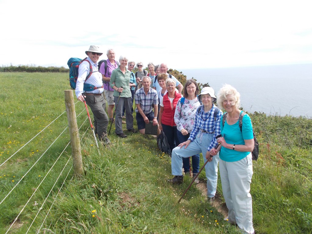 Click on image above for larger view Turninginland and along the valley westwards towards Old Walls a delightfulcottage with a pond in front and then up to Bodrugan Barton a familyhome and working farm with an assortment of self catering cottageconverted from stone farm buildings.  Withthe selected two dressed in reflective jackets we proceeded along theroad for about 0.5miles before we reach Trewollock and then footpathand across fields back to retrace our steps down into Gorran Havenand an ice cream for some. Anotherexcellent walk that most people had not done before and as alwaysgood company. ******************************************** UPDATE 17 MAY 2017 NOTICE OF WALK ON THE 30TH MAY GORRAN HAVEN AND NORTH EAST 
This was the first U3A walk we did when 5 of us set off in one car from Lostwithiel in 2013. 1) 4.5 MILE CIRCULAR WALK ON COAST PATH, FIELDS AND MINOR ROADS 2) REASONABLY STRENUOUS WITH UPS AND DOWNS AND STILES 3) FACILITIES IN GORRAN HAVEN INCLUDING TOILETS AND CAFES 4) WE INTEND TO HAVE PICNIC LUNCH OVERLOOKING THE SEA AND 11 O'CLOCK DRINK IN CAFE 5) £1 CAR PARK IN CENTRE OF GORRAN HAVEN WE WILL MEET AT COMMUNITY CENTRE AT 10.10AM FOR 10.15AM START PLEASE LET US KNOW BY FRIDAY 26TH MAY IF YOU WISH TO COME AND IF YOU CAN OFFER LIFT. REGARDS, CHRIS AND JANET UPDATE 11 MAY 2017 Report on Circular Walk aroundSt Anthony’s Head of 9 May 2017  Twelve walkers met in the National Trust’s Porth Farm car park for thiswalk on the Roseland Peninsula. A freshsouth easterly wind and an overcast sky was not what we had expected and this leftseveral of us wondering whether we had dressed warmly enough! Our walk was in 3 sections: Porth Farm to St Anthony’s Lighthouse: from this section of the coast path, we had great views of Towan beachand Porthbear beach and further on to the Manacles Rocks. As we drew closer to St Anthony’s head, wehad a great panoramic view of the Carrick Roads: the mouth of the Helford River, Falmouthbeaches, Pendennis Point, Falmouth Harbour and Town, Mylor Harbour and RestronguetCreek further on and of course closer to us St Mawes. We went into the birdhide from where you might see the Peregrine falcons that nest on the cliffopposite. No luck today though! Once upon a time, you could visit thelighthouse but no longer. We leant that St Anthony lighthouse was commissionedby Trinity House in 1835 to warn ships of the presence of the Manacles Rocks andof the dangers of Black Rock sat square in the middle of the channelinto the harbour. The fog warning for this stretch ofwater remained fairly basic until the 1950s, when a modern horn system replacedthe massive bell, and it was at the same time that the white tower's lampchanged to electricity. In 1987, the keeper was retired and the lighthousebecame fully automatic. St Anthonylighthouse's more modern claim to fame is that it featured in the openingcredits and many scenes of the 1980s children's TV programme 'Fraggle Rock'. Further along on the way to Place, youcan see a small white building which used to be the store for the paraffin usedby the lighthouse.  St Anthony’s Lighthouseto Place: wefound a sheltered spot just above lovely deserted sandy beaches to have ourpicnic.  The sun decided to break coverand from then on we had glorious weather for our walk. It was time to hear about St Mawes Castle andthis is when we all started having fun with word games, using the very learnedwords that could be found in the texts that Annie had found in her internetresearch. See whether you can spot themas you read this report! StMawes Castle is among the best-preserved of Henry VIII's coastal artilleryfortresses, and the most elaborately decorated of them all. One of the chain offorts built between 1539 and 1545 to counter an invasion threat from CatholicFrance and Spain, it guarded the important anchorage of Carrick Roads, sharingthe task with Pendennis Castle on the other side of the Fal estuary. St Mawes was designed to mount heavy'ship-sinking' guns. But particular care was also taken with its embellishment,and it is still bedecked with carved Latin inscriptions in praise of King'sHenry VIII and his son Edward VI. It owes its fine preservation tothe fact that unlike Pendennis Castle, it was little developed after itscompletion. Easily falling to alandward attack by Civil War Parliamentarian forces in 1646, it remainedneglected until partial re-arming during the 19th and early 20th centuries.Other coastal forts built by Henry VIII include Portland, Deal and Walmer Castles. We made our way to Place House(built in 1861 by Sir Thomas Spry in the style of a French Chateau) and wevisited its wonderful church which is maintained by the Churches ConservationTrust. A holy well and Medieval stonecoffin are located in the churchyard, the coffin having been discovered duringthe rebuilding of the chancel and restored by a local History Society. We walked towards the landingstage for the Place Ferry and we had good views of the front of PlaceHouse. The area in front of Place Housewas the pond of a tide mill until the 1860s when it was infilled to createlawns for the newly built house. In existence by 1540, the mill was originallyassociated with the priory and would have been used to mill grain. The slipway and boathouse to the north of theforeshore were built to provide for the twice daily steamer service fromFalmouth and also the rowing ferry to St Mawes. Several of the Sprys were closely connectedwith the Royal Navy and the family also depended on fishing and boat buildingfor its wealth. It maintained its own fishing fleet and owned a pilchard cellarbased on Cellars beach. During World War II the house was requisitioned by theWar Office and an anti-aircraft battery was placed to the South West to helpprotect Falmouth. The Place Ferry was run formany years as part of the Percuil and St Mawes Ferry, getting estate workers towork and children to school. As road use increased the ferries reduced andeventually went into abeyance. With the advent of the South West Coastal Paththe current service started with the support of the Countryside Agency in the1980s. Place to PorthFarm: this sectionof the walk takes you through wooded banks and fields along the PercuilRiver. The spring flowers includingbluebells were delightful. In 2008, the Percuil River was the site of thebiggest ever mass stranding of dolphins. Twenty-one animals died after enteringthe shallow waters of the river for unknown reasons. By the time we got back to Porth Farm, theconsensus was that we had walked more than 5 miles (as advertised in theleaflet)! Refreshments at the greycorrugated Citroën van, called Earl (see the pun?) run by the Thirsteacompanywere most welcome! ************************************************ UPDATE 29 APRIL 2017NOTICEOF WALK OF 9TH MAY A5 MILE CIRCULAR WALK AROUND ST ANTHONY’S HEAD 
Here are the details:
We will leave the Lostwithiel Community Centre Car Parkat 9.30am in order to start the walk by 11.00am at the latest. Let me know by Friday 5th May whether:
Please note that if the weather forecast is notfavourable for a coastal walk, I have a plan B! Annie UPDATE 29 APRIL 2017 REPORTOF THE WALK ON THE 25TH APRIL 2017 TOFALMOUTH BY TRAIN AND EXPLORING THE TOWN Thiswas a bit different than normal in that we all caught the train toFalmouth on what was a full day out with a 4.5 mile walk, a break fortea/coffee, lunch and views of the famous harbour, St Anthony Headand St Mawes Castle. Itfelt like a Sunday School outing as 9 of us gathered in the shelteron Lostwithiel station waiting for the 9.00am train to Truro. Withanother two picking up the train at Par we were soon in Truro andmaking our connection for the Falmouth train; excitement at thisstage was increasing and firm control was required. Alightingat Penmere Station a group photograph in the sunshine and beside aset of bogey wheels was called for as we headed out of the stationand towards our minor road and footpath towards Swanpool.  Onthe way we spoke with some allotment holders who told us of theirplots and help from the Lottery Funding to create the 120 units andthe 2 year waiting list that exists at present. Just a bit further onwe were spell bound as two young ladies carried out some strangefitness routines specifically designed for the bottom area!-no takersthis time from our female contingent but it may be the start of a newU3A group! Passingthe Swanpool Nature Reserve, the only home of in Britain of theTrembling Sea Mat, this brackish lagoon was cut off from the seaaround the time of the last ice age. 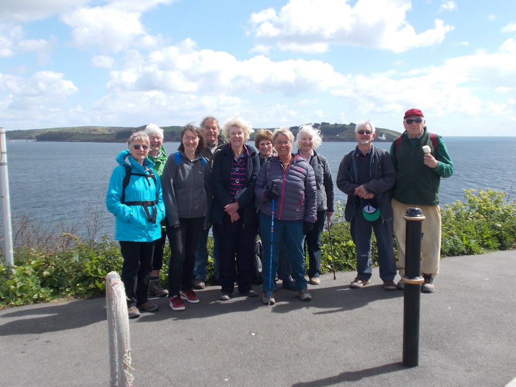 (Click on image above for larger view) Walkingalong the coast path with a very sharp shower but now full sun wecome to Gyllynvase Beach and our 11.00 o'clock, at exactly 11.00,coffee break at the excellent café on the beach. After an excellent30 minute break and some different cakes to go with our drink wecontinued along the sea front in front of the large Falmouth andRoyal Duchy Hotels. The former was built in 1865 by the FalmouthRailway and Falmouth Docks companies in preparation for an influx ofnew visitors on the railway. The latter was built in 1893 as thePendennis Hotel and was requisitioned as a hospital in the 1stWorld War. WithPendennis Castle in view we walk around the dry moat and with viewsof St Mawes Castle and the lighthouse on St Anthony's Head an icecream van poses too much of a temptation for one of us. FalmouthDocks now lay ahead, the world's third largest natural harbour, withthe large dry docks and navy vessels being refitted or serviced. PassingFalmouth Docks station and the small typical railway cottages we allgather to decide what we wanted to do with our free time before wecaught a train back. Mosthad lunch, fish and chips and bangers and mash, did some shopping andeven found time for a cream tea before all but one caught the trainwhich arrived back in Lostwithiel at 5.15. Afterthat brief visit it is no wonder that Falmouth is generally top ofany survey of towns in Cornwall as a great place to live forfamilies. Agreat response from the group and it was good not to have to worryabout cars and we will have to have a look for some similar days out. ************************************* UPDATE 17 APRIL 2017 NOTICE OF WALK ON THE 25TH APRIL - CIRCULAR WALK AROUND FALMOUTH AND A DAY OUT  1) 4.5 MILE MODERATE WALK FROM PENMERE STATION TO PENDENNIS CASTLE AND RETURNING FROM FALMOUTH TOWN. 2) WE WILL BE TRAVELLING BY TRAIN FROM LOSTWITHIEL TO PENMERE STATION THE TRAIN LEAVING AT 9.00AM VIA TRURO TO PENMERE STATION. NORMAL RETURN FARE £6.80, WITH RAILCARD £4.50 GROUP TRAVEL (3-9 PEOPLE) £4.50 (THIS GROUP MUST TRAVEL TOGETHER) TICKETS CAN BE PURCHASED ON THE TRAIN 3) THREE POSSIBLE RETURN TIMES ARE GIVEN AS IT DEPENDS ON WHAT THINGS PEOPLE MIGHT WANT TO DO AFTER THE WALK WHICH IS PLANNED TO TAKE 3-4 HOURS AND THE WEATHER ON THe DAY LEAVE FALMOUTH TOWN ARRIVE LOSTWITHIEL 14.53 15.58 15.53 17.13 16.53 17.55 4) WE WILL BE VISITING SWANPOOL -THE ONLY HOME IN THE UK OF THE TREMBLING SEA MAT, THE BEACHES OF GYLLYNGVASE AND CASTLE AND PENDENNIS POINT. 5) BRING A PICNIC OR EAT AT THE VARIOUS ESTABLISHMENTS IN FALMOUTH -A VISIT TO THE CAFE ON THE BEACH AT 11.00 MIGHT BE A GOOD START FOR OUR WALK ALONG THE COAST PATH. 6) AS NO CARS ARE INVOLVED IF YOU COULD LET US KNOW BY MONDAY 24TH SO WE HAVE AN INDICATION OF THE NUMBERS BUT PLEASE REMEMBER THAT WE CAN'T HOLD THE TRAIN UP! ************************************* UPDATE 12 APRIL 2017 REPORTOF WALK ON THE 11TH APRIL STNEOT TWO VALLEYS WALK Thiswas a repeat of a walk undertaken on May 12th2015 when 6 walkers managed the 5.5 mile reasonably strenuous walk.This time 16 walkers met at the car park at StNeot on a beautiful April morning with the sun shining and verylittle breeze to cool us off. Manyof the historical information given in that documented report willnot be repeated here but can be archived from the web site ifrequired. TheLondon Inn was passed as we left St Neot, a public house that is nowopen again. Upthe rickety stairs and gate and through two fields with about a dozenbullocks keeping an eye out for us we crossed onto a lane and pastTremaddock Farm onto the moors. We deviated slightly across the moorto see a stone hut circle, one of three in this area and close to aprehistoric enclosure known as Berry Castle containing the circularremains of a further 9 huts.  (Click on image above for larger view)  Overthe sound of the river and the birds could also be heard the sound ofthe group singing Happy Birthday to one of our members who had joinedus on her special day. Aftera bit more walking on the quiet lanes we reach Wenmouth Cross and astroll down past Higher Newton and back to the car park. Athank you to all the drivers who make sure we all get to ourdestinations and back again! ************************************* UPDATE 3 APRIL 2017 Notice of Walk on the 11th April ST NEOT TWO VALLEYS 1. 5.5 miles circular walk 2. Moderate to strenuous with some muddy parts and hills 3. Excellent personal facilities at start and end of walk 4. Free car parking at St Neot 5. Walking on minor roads, moorland,valley tracks and farmland 6. Please bring your own picnic or pasty for this walk COULD YOU PLEASE LET US KNOW IF YOU WOULD LIKE TO COME ON THIS WALK AND IF YOU CAN OFFER TRANSPORT BY FRIDAY 7TH APRIL. Regards, Chris and Janet ************************************* UPDATE 29 MARCH 2017 REPORTOF WALK OF THE 28TH MARCH - AROUND LADOCK WOODS Havingjust missed out on the really hot days prior to the 28ththe weather forecast was reasonable as we set off towards Ladock onthe A30. Sixteen of us were on the walk which was a good numberbearing in mind the predicted mud and the gate that had to beclimbed. Ladockwoods are owned by the Duchy of Cornwall and have seen their historygo from 19th century coppicing of oak and ash to 20thcentury conifer planting and from the mid 1980's the introduction ofbroadleaf species including cherry, chestnut, beech and lime. Aninteresting statistic mentioned in the walk information is that only13% of Duchy land is in Cornwall, the rest dotted over 23 othercounties with over half on Dartmoor. Encounteringthe first stretch of muddy paths, although not as bad as when we didthe preliminary walk, we proceeded through the woods until we cameout onto the narrow road to Mitchell and that gate which we allmanaged to get over, albeit with somewhat differing styles some moreflashy than others! Turningright we then walked on the north side of St Enoder Wood and towardsthe settlement of Trendeal which was first recorded in 1201 with thename Dintel. Trelassickthe other settlement passed was also recorded in mediaeval times ,spelt Treoysech in 1279. Turningsouth again and following the signs to Bessigga we again meet somemud and water on the path as can be seen on the photograph-is thatwhy the leader wore his shorts! 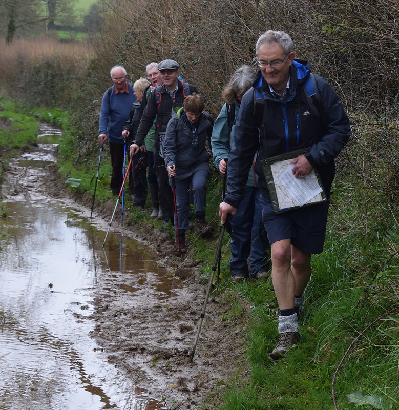 (Click on image for larger view) Througha field now -very quickly and quietly- with signs warning of the“Bull in the Field” into the woods again and along side fields ofspring cabbages we reach what is left of the old stone and cobcottage settlement of Bessigga which is reported to have beenabandoned in the 1960's and has since fallen into ruin. We now crossthe River Ladock and the B3275 to follow a footpath sign to LadockChurch. In 1802, the largest gold nugget at the time found inCornwall was discovered in the tin streamworks on the River Ladock.It was made into a gold necklace and is in Truro Museum. LadockChurch our next landmark was originally built in the 13thcentury and extended in the 15th and had a majorrefurbishment in Victorian times. Stoppingat the local shop/post office we had our lunch on the provided picnicbenches but not before the owner of the shop was quizzed about theirpost office and the running of it and made us envious when she namedthe other two post offices within 2 miles of Ladock.  (Click on image for larger view) Withsome food and drink inside of us we headed uphill and along side thewoodland again to reach the car park. An excellent 5 mile walk ingood walking conditions ************************************* UPDATE 22 MARCH 2017 NOTICE OF WALK ON THE 28TH MARCH - LADOCK WOODS  Ladock Wood Car Park 1) 5 MILE MODERATE CIRCULAR WALK AROUND AND THROUGH LADOCK WOODS. 2) WALK ON MINOR ROADS, FOREST TRACKS, FIELDS AND BRIDLEWAYS WITH SOME HILLS. 3) VERY MUDDY IN PLACES, 6 STILES, METAL GATE TO CLIMB OVER-STICKS WOULD BE USEFUL. 4) NO PERSONAL FACILITIES ON ROUTE. 5) WE WILL STOP IN LADOCK FOR LUNCH-EITHER BRING PICNIC OR PASTIES/SANDWICHES/CAKES AND TEAS/COFFEE AVAILABLE AT LOCAL SHOP. 6) CAR PARKING IN LADOCK WOODS. COULD YOU LET US KNOW BY FRIDAY 24TH MARCH IF YOU WOULD LIKE TO GO ON WALK AND IF YOU ARE ABLE TO OFFER TRANSPORT. WE WILL MEET AT 9.45AM AT COMMUNITY CENTRE FOR 9.50AM DEPARTURE TO LADOCK WOODS POST CODE TR24NQ REGARDS, CHRIS AND JANET ************************************* UPDATE 17 MARCH REPORT OF WALK OF 14THMARCH AROUND ST GERMANS Seventeen walkerstook part in the morning walk with fifteen taking up the offer ofthe afternoon guided tour of Port Eliot House. A leaflet produced by St Germans Rail User Group with financial assistance from Devon and Cornwall RailPartnership and First Great Western was used as our guide. The morning walk The village of St Germans grew on the bank of the river Tiddy. There appears to have been a church there fromthe 5th century and, for a short time, 926-1050, it wasthe seat of the Bishop of Cornwall. AnAugustinian priory was founded in the 12th century and in medieval times the area wasdivided in two manors, one leased to the Prior and Canons at St Germans andthe other, with lands along towards the present-day Polbathic, theManor of Cuddenbeake. Our walk took usthrough the village of St Germans and the buildings worthy of note include:
We walked alongNewport, which was the industrial part of the town in medievaldays when pots and tiles were made in the kilns. We saw the old tannery and forge and the Stable Yard, belonging to the Port Eliot Estateat the end of the Newport, is a fine example of the work of John Soane as partof his redesign of Port Eliot. We walked along a tiny lane calledWell Lane, then turned into Bag Lane. We then made our way steeply up under a railway and then into LongField. As the track rose towards the end of the field, we wereable to see fine views towards Dartmoorahead of us, Bodmin Moorand Kit Hill to our left and behind us. Wealso had great views of the estuary.  We followed the footpath down to the village and then turned rightinto Quay Lane. We walked along the quay and hadgreat views of the viaduct. The current viaduct was built in1908 to replace the old, largely wooden construction which had been a Brunel construction in 1859 and which the Earl had insisted should be paintedwhite in order to “harmonize with the scenery in its vicinity”. We walked along the old quay and saw the old cannons in thegardens of Battery Cottage.
It was then time to walk backtowards the Church where we spent about 15mns. An earlier building on the site was thecathedral for Cornwall between 926 and 1030, before the area was absorbed intothe Diocese of Exeter just before the Norman Conquest. The Normans then built aPriory on the site of the old cathedral, and the present church building datesto the 13th century. St Germanus ofAuxerre visited Britain in 429 AD. There is no evidence that he visited the village, but the church andvillage were associated with him by the 10th century. There are other churches dedicated to StGermanus in Brittany, Wales and the Isle of Man. Here are some statistics for today's walk: 2.96 miles, excluding time in Port Eliot gardens. Duration 1hour 40minutes. Average speed 1.8mph. Height gain 366ft. Max altitude 250ft. The afternoon visit Our afternoon visit to PortEliot started with lunch served in the dining room with Vivaldi’s “Four Seasons” as background music. The homemade pasties and scones were delicious (sorry you missed this treat, Chris!) We then had a guided tour for the house. The Houseis called Port Eliot because it was formally known as Port Priory. In theMiddle Ages it was a flourishing monastic port. For many centuries the housewas approached by water across what is now the park. The building is a multitudeof different ages. The foundations in places are 9th century, there are10th-century walls set with 13th-century lancet windows. The House received a major refit in the 18thcentury by Sir John Soane. The treasures in the house include a collectionof portraits and a rare landscape painting by Joshua Reynolds. We will all have many lovely memories of our visit including of some quirky features. The most striking one has to be Robert Oscar Lenkiewicz’ Riddle Mural in the RoundRoom. Lenkiewicz workedon his masterpiece on and off for nearly 30 years but died before itscompletion. Half of the mural, in the40-foot-diameter (12 m) room, shows death, destruction, insanity,unrequited love, and the apocalyptic end of the world. The other half reflectslove and affection, friendships, harmony, proportion and consensus. Hidden in the work are various references tofamily skeletons, art history and cabalistic mysteries, hence the name – theRiddle Mural. We finished our visit with a stroll in thePark and Gardens. What atreat on such a mild spring day! The walk beside the RiverLynher was very picturesque and we also enjoyed the “Camelia Walk”.  *************************************
UPDATE 3 MARCH 2017 NOTICE OF WALK ON THE 14TH MARCH A CIRCULAR WALK AROUND ST GERMANS WITH THE EXCLUSIVE OPTION FO A GUIDED TOUR OF PORT ELIOT HOUSE Chris and Janet are away and we have agreed that we would swap the short and long walks. So let us have another attempt at walking around St Germans – please note the later start and the optional afternoon visit: A) A 3 MILE WALK AROUND ST GERMANS USING MINOR ROADS AND MADE UP TRACKS. SOME MUD POSSIBLE ON ONE FOOTPATH ACROSS A FIELD AND ALONG THE QUAY B) AN EASY WALK IF IT WERE NOT FOR ONE SHORT STEEP HILL. ONLY ONE STILE! IT SHOULD LAST 2 HRS PLUS BREAKS (E.G TO VISIT THE CHURCH) C) PERSONAL FACILITIES ARE AVAILABLE IN ST GERMANS
Port Eliot House and Gardens will re-open on Sunday 12th March and I have negotiated the following optional deal for our group. Providing that there is a minimum of 10 people interested, for £15 they will provide:
PLEASE LET ME KNOW BY FRIDAY 10th MARCH AT THE LATEST AS I NEED TO INFORM PORT ELIOT OF THE CATERING REQUIREMENTS WHETHER:
WE WILL MEET AT THE COMMUNITY CENTRE AT 10.15AM FOR A 10.30 AM START Regards Annie UPDATE 1 MARCH 2017 REPORTOF WALK ON 28TH FEBRUARY CHARLESTOWNTO PORTHPEAN AND BACK On asunny day 15 walkers set off from Charlestown to walk south westerlyon the coast path towards Porthpean. The weather forecast had changedfrom the previous day to give us a window until 1.00pm when it wouldbe dry and bright-enough time to do this short 3 mile walk and maybetime for a drink at the end. Settingoff past the docks at Charlestown with Polmear Island just off thecoast and the area now known as Duporth inland. Duporth also know asDuporth Holiday Village was a holiday resort for over 50 years untilits closure in 2006. The site was then sold to private developers andnow contains new houses many in the traditional Cornish cottagestyle. The Holiday Village was built on the site of the old Duportestate and manor which was owned by Charles Rashleigh who developedCharlestown. After selling the site in 1933 to Seaside Holiday Campsit was requisitioned during the second world war for American andIndian forces before returning to a holiday camp after and then beingsold in 1972 to Butlins. PassingCarrickowel Point we walk down the many steps to Porthpean beachwhere we were able to take our first photo which shows the wonderfulblue sky and sandy beach with only a few other walkers and two metaldetectors for company. 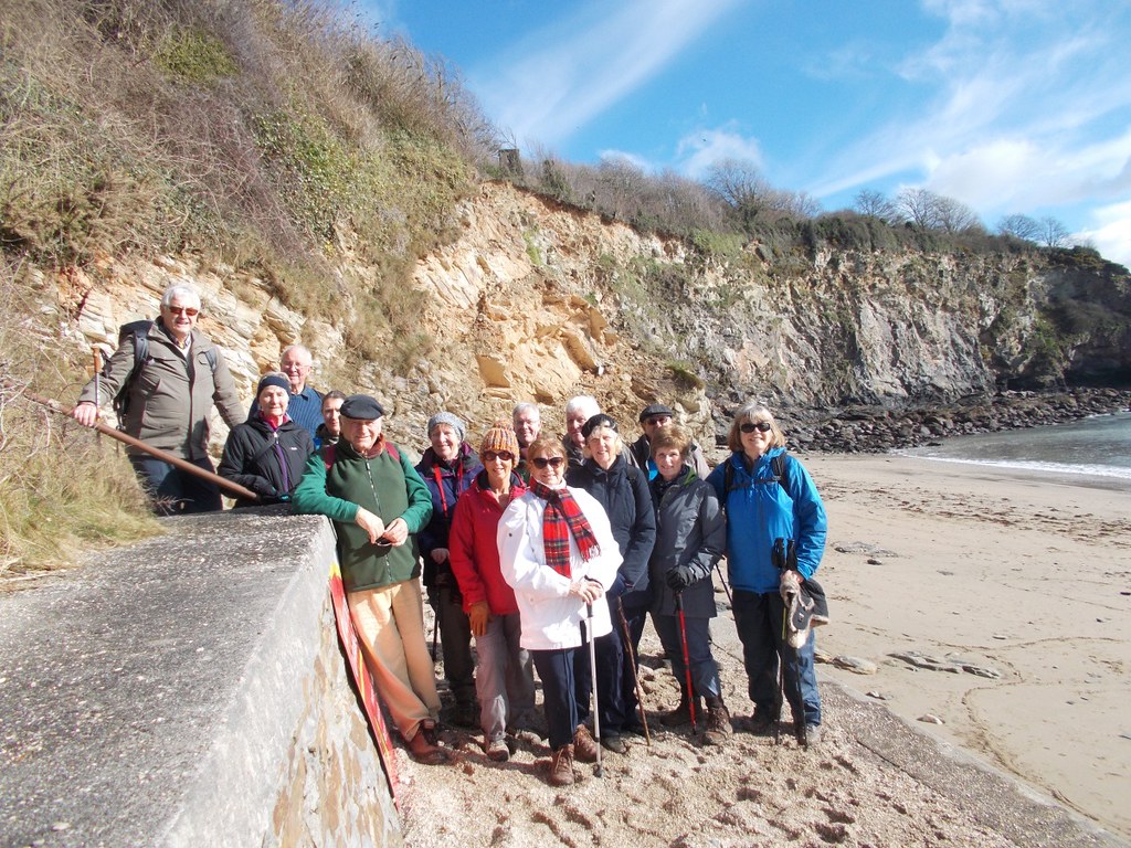 (Click on image for larger view) Withthe conveniences closed until Easter we pressed on uphill takinggreat care of the very muddy surface to turn right off the coast paththrough an equally muddy field to reach Higher Porthpean and somewelcome tarmac. We had one faller in the mud but many whose balancewas severely tested. After about 200yds we again face the muddy pathwhich runs along side but the other side of the hedge to thewonderful green fairways of the Porthpean golf club. After a goodclean up of our boots, after an assurance from the leaders that wewere past the mud, we turned left and the right to walk down thepavement with the hospital to our left to be able to then turn rightand back to Charlestown in time for that drink and for some a toastedtea cake and for one, who has missed the last few walks but who hasjust got his bus pass, a slice of pancake surprise-layers of pancakessandwiched together with all sorts of treats, see below. Well it was Shrove Tuesday. All that and the sun stillshone until on the way home that rain promised did come.  Wehave some excellent walks planned for the spring and Annie has verykindly offered to take the next walk, more information to come. ****************** UPDATE 23 FEBRUARY 2017 NOTICE OF WALK ON THE 28TH FEBRUARY - CHARLESTOWN TO PORTHPEAN AND BACK  Relatively easy 3 mile circular walk on coast path, pavements and inland track Muddy in places and a few minor hills. Parking on road or car parks at Charlestown This is a morning only walk and we intend to be back in Lostwithiel by 12.30 Various establishments in Charlestown for that drink and morning cake We will meet in Community Centre Car Park at 9.40am for 9.45am start to Charlestown. If you could let us know by Saturday 25th February if you can come and if you are able and willing to offer transport. Regards, Chris and Janet ******************* UPDATE 18 FEBRUARY 2017 REPORT ON CIRCULAR WALK AROUND GRAMPOUND OF TUESDAY 14FEBRUARY Twenty walkers put their faith into the weather forecast andset off for Grampound. Our optimism wasrewarded: it had stopped raining by the timewe reached the car park behind the school and the weather became sunnier andwarmer as the day progressed. Although fairly close, this walk was new to everybody and weenjoyed discovering a few little gems on the way. The walk was in 4 parts:
After our five mile walk, most of us decided to treat ourselvesto tea/coffee and cake in the community coffee shop run by volunteers. It was excellent value for money. UPDATE 3 FEBRUARY 2017 NOTICE OF WALK ON 14th FEBRUARY - A CIRCULAR WALK AROUND GRAMPOUND
A) A 5 MILE WALK STARTING FROM GRAMPOUND VILLAGE CAR PARK WHICH WILL TAKE US THROUGH CREED, GOLDEN AND TREVITHEN GARDENS. SOME OF THE WALKING WILL BE ON MINOR ROADS. B) AN EASY TO MODERATE WALK (ONE SHORT STEEP HILL). IT SHOULD LAST 3 HRS PLUS BREAKS (E.G TO VISIT CREED CHURCH) . I AM DOIND A SECOND "RECKIE" NEXT WEEK TO CHECK THE STATE OF ONE OR TWO PATHS BUT I CAN ALREADY WARN YOU THAT THE BRIDLEPATH FROM TREWITHEN GARDENS TO GRAMPOUND WILL BE MUDDY! C) PERSONAL FACILITIES AND A COFFEE SHOP ARE AVAILABLE IN GRAMPOUND D) WE WILL FIND SOMEWHERE TO PICNIC IN THE GROUNDS OF THE TREWITHEN ESTATE, WEATHER PERMITTING. IF NOT WE WILL HAVE TO WAIT UNTIL WE ARE BACK IN GRAMPOUND. PLEASE LET ME KNOW BY FRIDAY 10TH FEBRUARY IF YOU ARE ABLE TO COME AND/OR OFFER TRANSPORT. WE WILL MEET AT THE COMMUNITY CENTRE AT 9.45 AM FOR A 10.00AM START (NOTE SLIGHTLY EARLIER TIME). WE AIM TO BE BACK IN LOSTWITHIEL BY 3.00PM (ish..) UPDATE 31 JANUARY 2107 18 walkers had signed up for this walk but it was definitely a case of "rain stopped play". Reluctantly the walk was cancelled. We will do it another day! UPDATE 18 JANUARY 2017 NOTICE OF WALK ON THE 31ST JANUARY - A CIRCULAR WALK AROUND ST GERMANS  A) A 3 MILE WALK AROUND ST GERMANS USING MINOR ROADS AND MADE UP TRACKS. SOME MUD POSSIBLE ON ONE FOOTPATH ACROSS A FIELD AND ALONG THE QUAY B) AN EASY WALK IF IT WERE NOT FOR ONE SHORT STEEP HILL. ONLY ONE STILE! IT SHOULD LAST 2 HRS PLUS BREAKS (E.G TO VISIT THE CHURCH) C) PERSONAL FACILITIES ARE AVAILABLE IN ST GERMANS D) WE WILL TRAVEL BY CAR AS THE TRAIN TIMETABLE WILL NOT WORK OUT FOR US PLEASE LET ME KNOW BY FRIDAY 27TH JANUARY IF YOU ARE ABLE TO COME AND/OR OFFER TRANSPORT. WE WILL MEET AT THE COMMUNITY CENTRE AT 9.45 AM FOR A 10.00AM START (NOTE SLIGHTLY EARLIER TIME). WE AIM TO BE BACK IN LOSTWITHIEL BY 1.00PM (ish...) ************************************
REPORT OF WALK OF THE 10TH JANUARYPLAN B AGAINInview of the weather forecast for most of Cornwall with heavy rainpredicted from 11 till 3 and with heavy rain on Monday making LadockWoods even more muddy and wet we decided to repeat a walk we lastcompleted on November 26th 2013. Thiswas the first walk that Janet and I had the pleasure of leading afterour arrival in Lostwithiel in the August of that year. Itis interesting to compare the photographs as the number of walkers isthe same -ten but all the people in the photograph except one isdifferent-can you spot the person? can you believe that he or she isthree years older?  Walking Group 10th January 2017 ------  Walking Group November 2013 Thewalk takes you up Tanhouse Road to the footpath on your left up thehill and turn right at the top to walk to cross Tanhouse Road andBodmin Hill before joining the footpath down past Restormel Castleand onto Restormel Road. We would have normally walked back over theriver and railway bridge to the Duchy Nursery -and maybe even a drinkor cake-but with the bridge closed from 9th for repairs wewalked back along Restormel Road and to Lostwithiel where we alldecided to stop for drinks and two of us -can you name thosepeople?-had a fruit scone. Norain had fallen during our walk so we can consider ourselves lucky. Wewill do the Ladock walk, weather permitting, on March 14th. Annie Singer has very kindly agreed to organise the next two walks:-
She will contact regular walkers with the details in due course. ***************
 1) 5 MILE MODERATE CIRCULAR WALK AROUND AND THROUGH LADOCK WOODS. 2) WALK ON MINOR ROADS, FOREST TRACKS, FIELDS AND BRIDLEWAYS WITH SOME HILLS. 3) VERY MUDDY IN PLACES, 6 STILES, METAL GATE TO GET OVER-STICKS WOULD BE USEFUL. 4) NO PERSONAL FACILITIES ON ROUTE. 5) WE WILL STOP IN LADOCK FOR LUNCH-EITHER BRING PICNIC OR PASTIES/SANDWICHES/CAKES AND TEAS/COFFEE AVAILABLE AT LOCAL SHOP. 6) CAR PARKING IN LADOCK WOODS. COULD YOU LET US KNOW BY FRIDAY 6TH JANUARY IF YOU WOULD LIKE TO GO ON WALK AND IF YOU ARE ABLE TO OFFER TRANSPORT. WE WILL MEET AT 9.45AM AT COMMUNITY CENTRE FOR 9.50AM DEPARTURE TO LADOCK WOODS POST CODE TR24NQ REGARDS, CHRIS AND JANET **************** REPORTS FROM THE SECOND HALF OF 2016 AVAILABLE HERE *************** |
Walking >


