UPDATE 14 DECEMBER 2108
REPORT ON WALK OF 11THDECEMBER 2108
WADEBRIDGE TO PADSTOWAND BACK ON THE 11A BUS
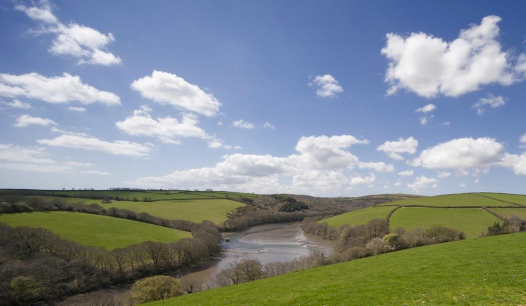
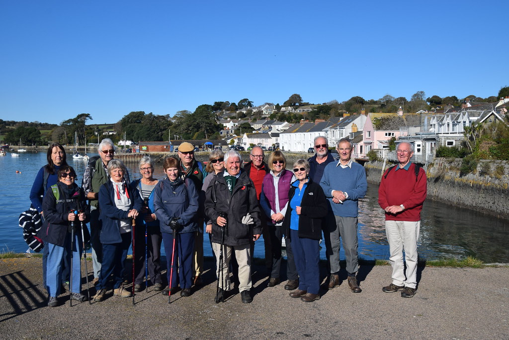
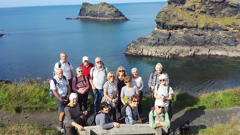
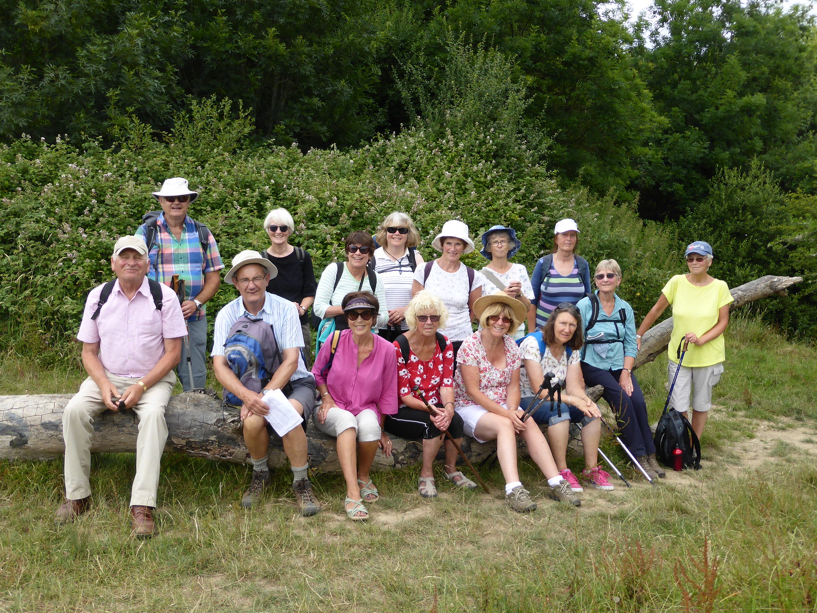
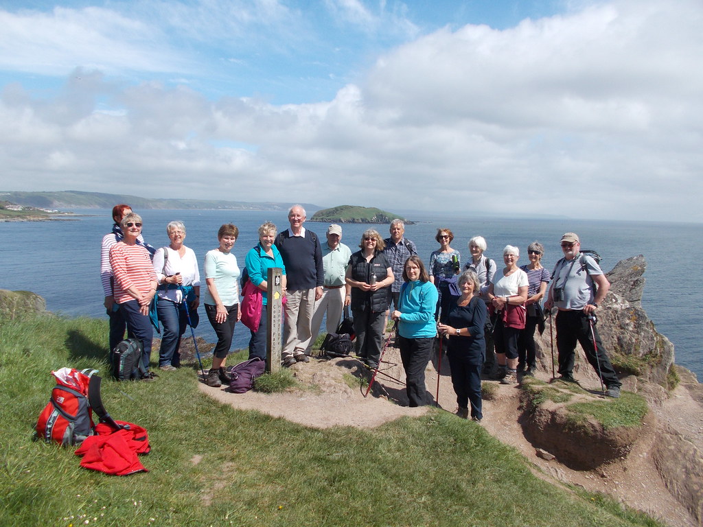
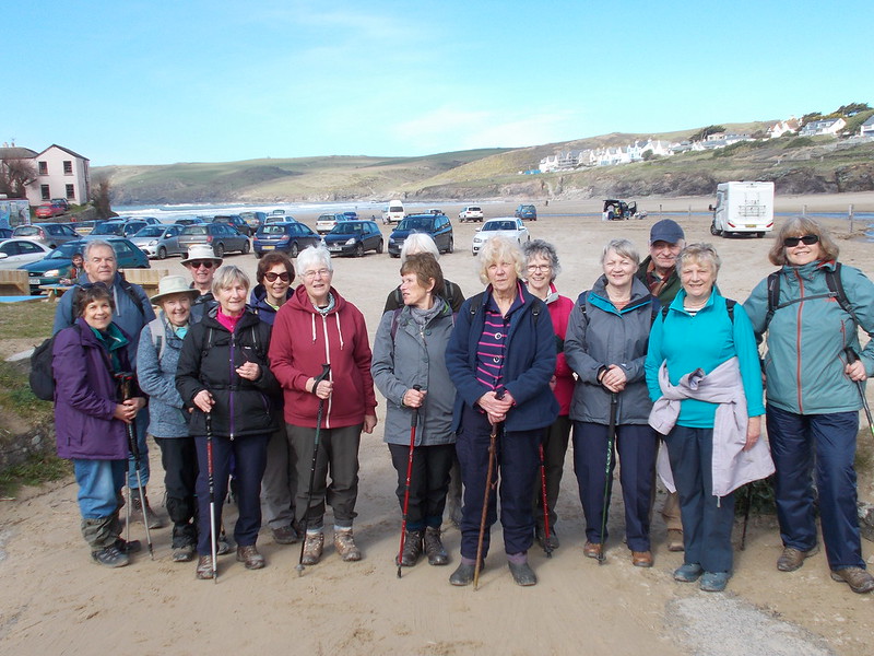
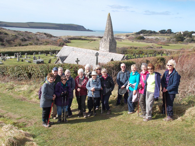
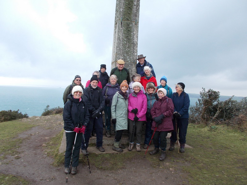
Twenty-fourof us met in the Camel Trail car park in Wadebridge for the start of a 5.5 milewalk to Padstow where lunch had been booked in the Harbour Inn for 1.00pm. By 10.15am, we were on our way for this easywalk which we were lucky to do on a dry day with a gentle breeze. The birdwatchers amongst the group hadbrought their binoculars and, as we spotted waders in the estuary, they gave ustheir names. Today, we saw curlews, oystercatchers, redshanks and a surprisingly high number of lapwings.
We canstart this walk from Padstow but doing it from Wadebridge to Padstow means thatyou see the estuary gradually open up in front of you and you get glimpses ofPadstow quite early on and then of Rock. The Camel Estuary lit up by a winter sun was a beautiful sight indeed.
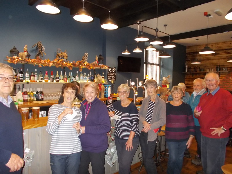
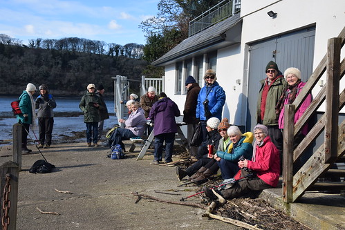
We stopped almosthalf way for a short coffee break and our usual group photo. Lunch was served very promptly in the pub whichmeant that we could travel back top Wadebridge earlier than expected on the 2.30pm bus. There was even time to pop into a few shops beforeand after lunch, including Rick Stein’s deli. What a treat for most members to be able to use their bus pass!
If you havemissed all the cultural notes, do not fret as normal service will resume in theNew Year!
Janet, Chrisand Annie thank you for your Christmas gifts and we wish you all a Merry Christmasand a Happy New Year! We look forward toyour company on the lovely walks that we have planned for you in 2019 and beyond.
UPDATE 24TH NOVEMBER 2018
NOTICE OF WALK OF TUESDAY 11TH DECEMBER 2018
WADEBRIDGE TO PADSTOW AND BACK ON THE BUS
WITH LUNCH AT THE HARBOUR INN
THIS IS A 5.5 LINEAR AND EASY WALK ALONG THE CAMEL TRAILWITH GREAT VIEWS OF THE CAMEL ESTUARY WITHOUT ANY STILE OR HILLS!
HERE IS THE PLAN FORTHE DAY:
1. LEAVE LOSTWITHIEL AT 9.30AM
2. PARK IN WADEBRIDGE IN THE CAR PARK BEHIND THEFIRE STATION/LIDL (£1.00 PER DAY)
3. TOILETS AVAILABLE AT THE START OF THE CAMELTRAIL (BRING 20p)
4. THE WALK ALONG THE CAMEL TRAIL WILL LASTAPPROXIMATELY 2.5 HOURS, INCLUDING A SHORT BREAK
5. THE INTENTION IS THAT WE HAVE LUNCH TOGETHER ATTHE HARBOUR INN
6. RETURN ON THE 11A FROM PADSTOW, CATCHING THE3.20PM OR 4.30PM BUS BACK TO WADEBRIDGE. THE RETURN JOURNEY IS 21 MINUTES LONG
7. BRING YOUR BINOCULARS AS THE ESTUARY WILL BEFULL OF WADING BIRDS (I SAW OYSTER CATCHERS, GREENSHANKS, CURLEWS, TURNSTONESTO NAME BUT A FEW WHEN I DID THE WALK EARLIER THIS WEEK
8. BRING YOUR BUS PASS, IF YOU HAVE ONE!
LUNCH AT THE HARBOURINN
1. I ATTACH THE MENU FOR US TO CHOOSE OUR MAINCOURSE. WE DO NOT HAVE TO CHOOSE OUR DESSERTAT THIS STAGE
2. THE FOOD ON OFFER IS GOOD QUALITY PUB FOOD.
3. WE NEED TO PAY A £5.00 DEPOSIT PER PERSON
4. I NEED TO CONFIRM NUMBERS AND CHOICES AS WELL ASPAY BY MONDAY 3RD DECEMBER AM.
I WOULD BE GRATEFULIF YOU COULD LET ME KNOW BY SUNDAY 2ND DECEMBER IN THE EVENING:
1. WHETHER YOU INTEND TO DO THIS WALK AND ARE ABLETO OFFER LIFTS
2. WHAT YOUR CHOICE OF FIRST COURSE IS
3. HOW YOU WOULD LIKE TO PAY YOUR DEPOSIT (CASH ORBANK TRANSFER)
THE PLAN B FOR THISWALK IN CASE OF BAD WEATHER IS THAT WE LEAVE LOSTWITHIEL AT 10.30AM, PARKIN THE FREE CAMEL TRAIL CAR PARK BEHIND THE BUROUGH ARMS IN DUNMERE AND TRAVELON THE 11A BUS WHICH LEAVES AT 11.07AM AND GETS TO PADSTOW AT 12.15PM. I WILL PHONE YOU THE NIGHT BEFORE IF I NEEDTO PUT PLAN B INTO ACTION.
I LOOK FORWARD TO Y0UR COMPANY
ANNIE
UPDATE 18TH NOVEMBER 2018
NOTICE OF WALK ON THE 27TH NOVEMBER
LOOE AND KILMINORTH WOODS
1) THIS A REPEAT OF WALK DONE IN OCTOBER 2015 BUT TO WHICH ONLY 8 TOOK PART OF WHICH 3 NO LONGER WALK WITH US-SO WORTH DOING AGAIN.
2) 4 MILE EASY/MODERATE CIRCULAR WALK IF PARKING AT HANNAFORE(FREE PARKING) OR 3 MILE IF PARKING IN LOOE(PAY AND DISPLAY)
3) TEA/COFFEE CAKES AND FACILITIES AVAILABLE IN LOOE BUT YOU MAY WANT TO BRING LIGHT PICNIC AS WE MAY WANT TO EAT WHEN ON WALK AND OUTSIDE TOWN.
4) ONE LONG HILL AT START OF WALK AND SLIPPERY ON ESTUARY BANKS.
5) WALKING ON ROAD,FIELDS AND AT SIDE OF RIVER.
WE WILL MEET AT COMMUNITY CENTRE AT 10.20AM FOR 10.30AM START.
PLEASE LET US KNOW BY SATURDAY 24TH IF YOU WOULD LIKE TO COME, IF YOU CAN OFFER LIFT AND WHETHER YOU WISH TO GO ON SHORT ROUTE OR LONGER ROUTE.
REGARDS,
CHRIS AND JANET
***********************
UPDATE 15TH NOVEMBER 2018
REPORTOF WALK OF 13th NOVEMBER - TODEER PARK AND HERODSFOOT
Arecord number of walkers numbering 28 all met up at Deer Park for the4 mile walk
justas a rain shower hit us-but after that the weather was fine.
Thiswalk based on the history of the site and of Herodsfoot was lead bylocal ranger Martin who gave us an inspirational talk as we wentalong showing us mine workings, areas of gun powder production aswell as information of the plants and trees.
Wewill not give up all the secrets here but advise that you get down tothe site, little known by local people, and see for yourself. Entranceis open to the general public and includes use of a very smart caféwhere we were provided with a bowl of soup and bread role after ourwalk and before we went to see the artefacts in the museum.
Mostof the articles on show were found in a dump near the gunpowder plantmanager's house and start from around 1906 and as you can see fromthe photograph everyone was taking a keen interest in the articlesfound.
Partway around the walk we passed the small village of Herodsfoot, theonly village of its kind in Cornwall as it is a “doubly thankfulvillage” in that all the locals who went to fight in both WorldWars all came back and the names on the cross in the village are ofsurvivors rather than those killed.
Backthen for lunch and as can be seen from the photographs not all thosepresent could be included in one shot but the café is excellent withwood burning stove, seating both inside and out and excellent staff.A big thank you to them and to Martin.
(Click on above image for larger view)
***********************
NOTICE OF WALK ON 13TH NOVEMBER
GUIDED WALK AROUND DEER PARK
1) RANGER LEAD 4.5 MILE THROUGH HISTORIC DEER PARK USING DIFFERENT ROUTE TO THAT USED IN 2015 AND INCLUDING VISIT TO MUSEUM
2) EASY/MODERATE WALK USING FOOTPATHS AND MINOR ROADS
3) SOUP AND ROLLS WILL BE PROVIDED BY THE HUB AT COST OF ABOUT £5 AND TEA,COFFEE CAKES CAN BE PURCHASED AT LUNCH TIME
4) COULD YOU LET US KNOW BY WEDNESDAY 7TH LATEST:-
IF YOU ARE COMING ON THE WALK
IF YOU REQUIRE LIFT OR CAN OFFER TRANSPORT
IF YOU REQUIRE SOUP/ROLL
5) I WOULD ENVIGAGE THAT WE SHOULD FINISH WALK/LUNCH/MUSEUM VISIT BY 3.00PM LATEST
6)WE WILL MEET AT COMMUNITY CENTRE AT 11.00AM FOR 11.10AM DEPARTURE TO DEER PARK RECEPTION PL14 4QY
REGARDS,
CHRIS AND JANET
************************
UPDATE 30TH OCTOBER 2018
REPORT ON WALK OF 30TH OCTOBER 2018
A 4 MILE CIRCULAR WALK ALONG THE FAL ESTUARY
MYLOR HARBOUR TO FLUSHING ANDBACK
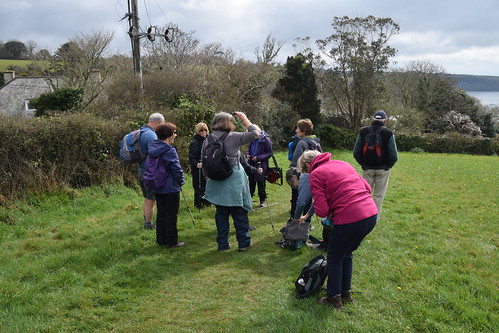
Sixteen members of the group drove to Mylor Harbour for thestart of this walk. In fact, the most challenging part of the walkwas finding a parking space as both car parks were full of boats who had beenlaid up for the winter.
The first part of the walk took us from Mylor Harbour toFlushing along the Fal estuary. Theestuary is known as the Carrick Roads and is reputedly the deepest naturalharbour in the world and every creek of the Fal is dense with leisure craft. The first place of interest we came across was the Restonguet Sailing Club where the Olympian Gold Medallist Ben Ainsley learnt many skills as a dinghy sailor. We recalled seeing the gold letterbox in the wall of the Pandora Inn on a previous walk from Mylor Bridge past the Pandora Inn. As we walked along the estuary, we had good views of St Justin Roseland, St Mawes, St Anthony’s and then Falmouth Docks. We even heard the siren which signalled thestart of the dock workers’ lunch break. We dropped into Flushing where we had our group photo taken on the quay by the sailing club. Form there we had good views of “Packet Quays”, a housing developing from the 80s. Part of the long heritage of the Fal belongs to the Post Office Packet Service which was responsible for communications throughout the British Empire. The service was based in the Fal from 1689 to 1850.
(Click on image above for larger view)
We spent over an hour in Flushing sitting outside thewaterside café and we could have stayed there all afternoon topping up oursuntan, had it not been for the fact that we had a walk to complete!
We made our way back to Mylor Harbour inland and onto an oldtrack which runs down through a wooded valley which took us back to the waters ofMylor Creek from where quiet lanes led us back to St Mylor Church. We first paid a visit to the Ganges Monumentwhich was erected in 1872, a commemoration of 53 youngsters who died, mainly ofdisease, on the famous Royal Navy training ship HMS Ganges which was based inMylor from 1866 to 1899. Some of usvisited the church which has a gnomic tower and a campanile (a separate tower)which houses the church bells. We all commented on the fact that this beautiful walk hadbeen made even more special by the glorious weather - the blue skies andsunshine had stayed with us throughout.
Click on image above to launch a slide show with more photos.
Note: Slide show may not work with all devices. Same photos available via this flickr page.
UPDATE 19TH OCTOBER 2018
NOTICE OF WALK OFTUESDAY 30TH OCTOBER 2018
A CIRCULAR WATERSIDEWALK ALONG THE FAL ESTUARY
MYLOR HARBOUR -FLUSHING – MYLOR HARBOUR

A RELATIVELY EASY 4 MILE WALK WITH A FEW STILES AND A SHORT MODERATE HILL IN FLUSHING
STUNNING VIEWS OF THE CARRICK ROADS ANDFALMOUTH
WE WILL WALK PAST THE SAILINGCLUB WHERE THE OLYMPIAN BEN AINSLEY LEARNED TO SAIL. THE HMS GANGES MEMORIAL IN MYLOR CHURCHYARD ISWORTH A VISIT
THE ROCKY PATH IN THE WOODLAND IS SLIPPERY ANDCAN BE MUDDY SO BRING STICKS IF THEY HELP YOU TO WALK DOWNHILL
PARKING IN ONE OF TWO CAR PARKS IN MYLOR HARBOURCOSTS £5.00 FOR THE DAY (UP TO £2.00 IS REFUNDED IF YOU USE THE CAFÉ OR THEWINE BAR - SOMETHING WE CAN DO AT THE END OF OUR WALK)
TOILETS IN MYLOR HARBOUR
A WATERSIDE CAFÉ AND 2 PUBS IN FLUSHING WHERE WEWILL STOP FOR LUNCH (BRING YOUR OWN PICNIC IF YOU WOULD PREFER)
WE WILL GATHER IN THE COMMUNITY CENTRE CAR PARKREADY TO LEAVE AT 10.00AM SHARP
MYLOR HARBOUR POSTCODE: TR115UF
I WOULD BE GRATEFUL IF YOU COULDLET ME KNOW BY FRIDAY 26TH OCTOBER WHETHER:
I LOOK FORWARD TO YOUR COMPANY
ANNIE
UPDATE 11TH OCTOBER 2018
REPORTOF WALK ON THE 9TH OCTOBER
CARDINHAMAND BURY CASTLE
Settingoff from Lostwithiel to travel the short distance to CardinhamVillage Hall, where we were given permission to park, we met withothers who had travelled separately before all 21 of us set off onthis pleasant 4.5 mile circular walk with the sun shining. Followingthe road past the 15th century church dedicated to StMeubred and which was damaged during World War 11 by German Bombs whowere targeting Bodmin we headed for a left turn through a gardenalong a wooded bridle path and up the far side of a field. To ourleft but on private land are the remains of Cardinham Castle. Thecastle founded by Richard fitz Turold dates from the 11thcentury and there is little left of the original structure remainingThe earthwork consists of a motte and bailey design.
Afterpassing farm buildings we then travelled along a minor road until wereach a footpath on the left and through a field with two horsesminding there own business.
Wewere expecting to see Highland Cattle after crossing a series ofcattle grids but on this occasion none were about to the relief ofsome as with their large horns they are magnificent but largecreatures.
Followingnow uphill-some might say again-we pass some converted farm buildingsbefore turning left and our picnic/snack spot on large rocks, theembankment of Bury Castle. Thank you to Kate who provided somedelightful buns to mark what will be John's birthday later thismonth.
BuryCastle has to be one of the best preserved and completely understatedhill forts in Cornwall. Large sections of the bank and ditch canstill be seen. As one of the highest points in Cornwall it offersspectacular views and a great place for a photograph. As you can seethe sky is still bright blue and short sleeves are in prominence asthe sun continues to shine.
(Click on image for larger view)
Walkingthen around the embankment over a rickety stile and through somewoods downhill first and then uphill turning left along a signedfootpath to reach again more ramparts rising in places to animpressive 14 feet with one of our Highland Cattle and calf withinthe enclosure.
Withviews of the church we then head through the gorse and downhill,withonly one slight mistake as there are many tracks across the heath, tofind some granite slabs across the remains of a ditch and towards yetanother old settlement called Penpoll.
Aftera few fields we are soon back to the village hall.
Anothergreat and recommended walk from the iwalkcornwall library.
NOTICE OF WALK ON THE 9TH OCTOBER
CARDINHAM AND BURY CASTLE
Image Credit: Gareth / Bury Castle / CC BY-SA 2.0
1) A 4.5 MILE MODERATE WALK ON FOOTPATHS,BRIDLEWAYS,MINOR ROADS AND TRACKS WITH SOME HILLS AND STILES.
2) BRING A PICNIC/SNACK AS NO FACILITIES ON THE ROUTE BUT POSSIBILITY OF STOPPING AT WOODS CAFE ON THE WAY BACK TO LOSTWITHIEL IF YOUR DRIVER WISHES
3) WE HAVE BEEN GIVEN PERMISSION TO PARK AT CARDINHAM PARISH HALL WHICH IS START OF WALK PL30 4BQ
PLEASE LET US KNOW BY SATURDAY 6TH IF YOU WISH TO COME ON THE WALK AND CAN OFFER LIFT. WE WILL MEET AT COMMUNITY CENTRE AT 10.25AM FOR A 10.30AM START.
REGARDS,
JANET AND CHRIS
UPDATE 1ST OCTOBER 2018
REPORTOF WALK ON THE 25TH SEPTEMBER
BOSCASTLEAND THE VALENCY VALLEY
Ona grand sunny day a good turnout of 16 members met at the large paycar park at 11.00am in Boscastle and began our walk inland on theflat along the valley and next to the River Valency and throughwoodland of Minster Wood. Across a wooden bridge which again is afavourite spot for a photograph of us and a local signpost.
Upa long hill we made our way to Minster Church and cake for all of usas it was one of our member's birthday in two days time. We thenchecked with all present to work out if we could expect cake on mostwalk days with over 60 signed up members.
MinsterChurch has its origins going back to the 6th century andis well worth a look as some of the more historic parts still remainincluding a Norman font, carved bench ends and a 13thcentury window to the left of the Alter.
Leavingthe church we walk along a minor road past Home Farm to a footpathsigned To Boscastle and along the Jordan Valley into and down OldBoscastle's main street.
Crossingthe B3266 we head up again onto Forrabury Common and towards theSouth West Coastal Path and glorious views of Boscastle Harbour andthe tortuous entrance with Meachard Rock at the entrance. With thebrave photographer crawling up a steep grass bank to take a greatphotograph of the rock and entrance,most now with sunglasses andshort sleeved tops.
(Click on image for larger view)
Mostof us now chose to eat a picnic by the harbour and to enjoy icecreams and teas and coffees from cafés in this ever popular coastalvillage which was devastated by the floods of 2004.
************************
UPDATE 19TH SEPTEMBER 2018
NOTICE OF WALK ON THE 25TH SEPTEMBER 2018
BOSCASTLE AND THE VALENCY VALLEY
1) MODERATE 4 MILE CIRCULAR WALK INCLUDING A FEW LONG CLIMBS AND ABOUT 5 STILES
2) WE WILL BE WALKING ON FIELDS(PLOUGHED AND MUDDY),WOODED VALLEY,MINOR ROADS AND COAST PATH. STICKS USEFUL IN PLACES.
3) WE WILL BE PARKING IN LARGE PAY CAR PARK IN BOSCASTLE
PLEASE LET US KNOW BY SATURDAY 22ND IF YOU WOULD LIKE TO COME AND IF YOU ARE ABLE TO OFFER TRANSPORT.
IT WOULD ALSO BE HELPFUL IN PLANNING LIFTS IF YOU COULD LET ME KNOW IF YOU WANT TO BE BACK EARLY THAT IS IMMEDIATELY AFTER WALK.
WE ARE PLANNING TO MEET AT COMMUNITY CENTRE AT 9.50AM AND START WALKING AT ABOUT 11.00AM. AFTER WALK LASTING ABOUT 2HRS 30MINS WE ARE THEN PLANNING TO HAVE LUNCH EITHER PICNIC OR USING FACILITIES IN BOSCASTLE. TIMES OF COURSE ARE APPROXIMATE AS THERE ARE THINGS TO LOOK AT ON THE WALK FOR EXAMPLE MINSTER CHURCH AND WITH HILLS WE CAN'T, AND I DON'T WISH TO, HURRY PEOPLE ALONG AS WE ARE A WALKING/SOCIAL GROUP AND NOT IN THE ARMY.
REGARDS,
CHRIS AND JANET
UPDATE 14TH SEPTEMBER 2108
REPORT ON WALK OF 11THSEPTEMBER 2018
WENDFORDBRIDGE TOBLISLAND AND BACK ON THE CAMEL TRAIL
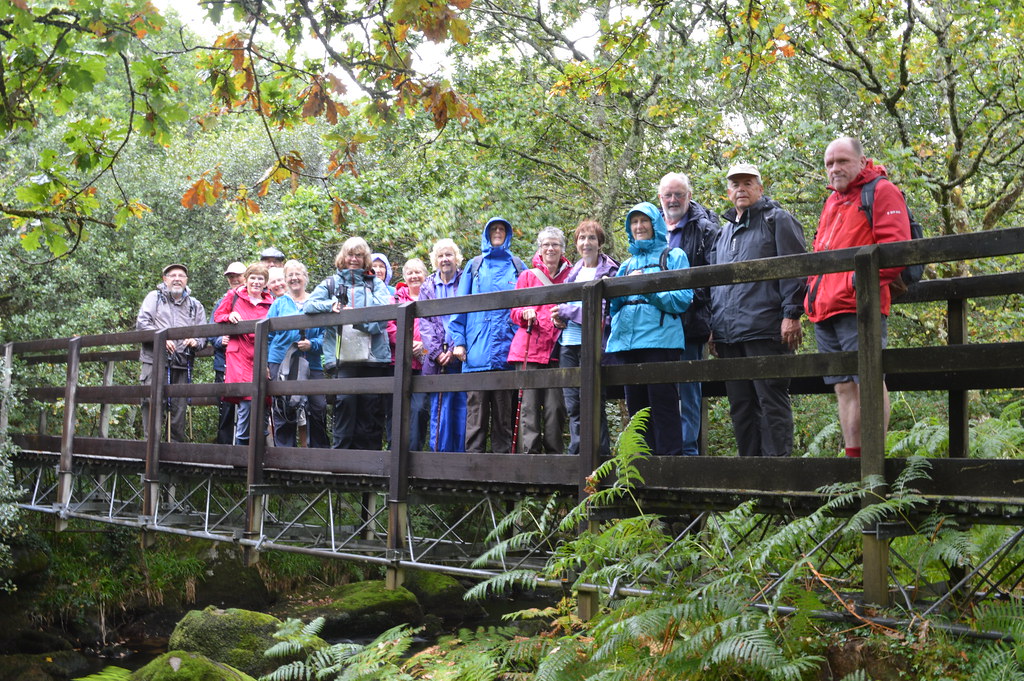
Eighteenhardy walkers met at Wendfordbridge and agreed unanimously that the drizzlewould not put them off doing this walk.
Thefirst section of the walk takes you from Wendfordbridge to the De Lank quarriesthrough fields and minor roads. Thequarries lie along the bed of the De Lank River which runs through a culvertbeneath the quarry workings. Buildingsand monuments which have incorporated its silver-grey granite include TowerBridge, The Royal Opera House and monuments to Churchill and Marx. At the Eden Project, “The Seed” in “The Core”was quarried from here. A short distanceto the northeast is the Hentergantick quarry: The London Stock Exchange and the Tate Gallery are built from BodminMoor granite extracted at Hentergantick quarry. We were interested to hear that Alan May’s great grandfather was Masterof Works in that quarry. We were alsoinformed that the black horse used by a famous bank in their recent adverts wasreared in a farm nearby.
Weproceeded to walk down to the De Lank River, a beautiful river with its bankcovered with huge granite boulders covered in green moss – we half expectedgoblins to emerge from behind these boulders!
The De Lank River springs from Rough Tor Marsh between the two highestpeaks on Bodmin Moor and joins the river Camel near Blisland. We could not ignore the photo opportunitythat the wooden bridge over the river afforded us! (Click on image for larger view)
Wethen made our way on the path and then steep hill through the bracken whichcovers a wide rocky valley to Pendrift Downs when our next stop was the JubileeRock.

Jubilee Rock is a largenatural granite boulder which originally supported another large balancing rock(known locally as a logan stone). It is now a Grade II listed monument as it iscovered with carvings of Britannia, royalty, and Coats of Arms. It wasoriginally carved in 1809-10 for George III's Golden Jubilee by Lieutenant JohnRogers. It was updated with new carvings in 1859 and 1887 for Queen Victoria'sGolden Jubilee and the carvings were restored for the 2012 Diamond Jubilee ofElizabeth II. A brass plate now in Bodmin Town Museum was originally fixed tothe rock containing lines of verse composed by John Rogers. In 2010, the platewas temporarily reattached to the rock for a 200 year celebration whichinvolved attempts at singing the verses John Rogers had composed. If you climb on top of the Jubilee Rock, you haveamazing views of Bodmin Moor right over to the Camel Estuary. NOT TODAY!

Ourwalk leader Annie announced that it was her birthday today and that she hadbaked a cake which we shared at the Jubilee Rock. Recipe for her Elderflower, raspberries andlemon drizzle is available on request!
Wemade our way down to Blisland. Unlikemost other Cornish villages, the houses of Blisland are grouped around avillage green indicating Saxon origins. On the corner of the green is Blisland Manor whichis much more recent, dating from the 16th Century. There are 7 wayside crosses in Blisland (outof 360 in Cornwall) including one near the village post office.
Thegroup split up for lunch, some eating in the pub whilst the others took refugein the church to have their packed lunch. After a 45-minute break, the weather had cleared up and we made our wayback to Wendfordbridge on a much flatter part of the walk on the Camel Trail whichwe re-joined at Tresarret. However, beforewe reached the Camel Trail, one of the obstacles we had faced was a clapperbridge which some members tried to cross very elegantly. Can you recognise who is trying to do a balancing act?

AtPooley Bridge, you walk alongside derelict clay driers - the building was thelongest in the UK when it was built. TheSnail Pace Café was too much of a temptation to resist at the end of the walkfor most members. We all agreed thatdespite the wet weather at the start, the walk had been enjoyable. Several members were at hand with theirmobile devices to give us the statistics for this walk: we had walked close to 6 miles; the number ofstiles was as advertised (even fewer maybe); however, there had been more than onesteep hill!
UPDATE 1ST SEPTEMBER 2018
REPORTOF WALK ON THE 28TH AUGUST
AGUIDED WALK AROUND LOSTWITHIEL
Ona reasonable August morning some twenty walkers gathered in theCommunity Centre car park to meet our three tour guides chosen tokeep our group in order and to be able to answer all the questions wehad spent time thinking up in preparation.
Wewere split into two groups led by Mary and John with Kitty keeping aneye out for any problems and making sure we had no escapees-in factwe rounded up one other who was nothing to do with the walking groupbut whose company we all enjoy-welcome Jill.
Thiswas the first walk we have organised in three years that we do nothave photographic evidence of who was on the walk-I forgot my cameraand even forgot to ask anyone else to take a photograph-such was theexcitement.
Thisis a regular walk given to tourists and residents alike and fromfeedback after the walk everyone really enjoyed learning about thehistory of the town but also learned something new despite how longthey have lived in the area. It can be recommended wholeheartedly toall and a big thank you to the guides.
Afterall the knowledge consumed it was time after the walk to consumesomething more decadent and seventeen of us used the café in theCommunity Centre for a relaxing lunch:-thanks go to Carol forco-ordinating with the Centre who shifted tables to fit us all intogether on two large tables. Again I heard only praise for the newcafé at the Centre, for the variety and quality and service at thecafé-the staff coping well in view of the large number arriving allat the same time.
Ournormal walks start again in September when the area is a littlequieter.
UPDATE 31ST AUGUST 2018
NOTICE OFWALK OF 11TH SEPTEMBER 2018
CIRCULAR WALK FROM WENFORDBRIDGE TO BLISLAND
AND BACK ON THE CAMEL TRAIL
HERE ARE THE DETAILS:
A MODERATECIRCULAR 5.5 MILES WALK. COULD BE MUDDYIN PLACES.
PARK IN THEFREE CAMEL TRAIL CAR PARK AT WENDFORDBRIDGE (PL30 3NP)
THE FIRSTPART WILL TAKE US FROM WENFORDBRIDGE TO BLISLAND VIA THE DE LANK QUARRY AND THEJUBILEE ROCK WHERE WE WILL HAVE OUR BREAK. A MODERATE SECTION WITH 5 STILES (I THINK) AND ONE STEEP HILL
PICNIC LUNCHON THE GREEN IN BLISLAND. FACILITIES AND REFRESHMENTS AVAILABLE IN THE BLISLANDINN.
THE SECONDPART OF THE WALK WILL TAKE US PAST THE BLISLAND CHURCH (WELL WORTH A VISIT FORITS AMAZING ROOD SCREEN) THROUGH FIELDS AND BACK TO WENDFORDBRIDGE ON THE CAMELTRAIL. TWO STILES (I THINK!)
THE SNAILSPACE CAFÉ IN THE CAR PARK WILL BE OPEN UNTIL 5.00PM
WE WILL MEET IN THE LOSTWITHIELCOMMUNITY CENTRE CAR PARK READY TO LEAVE AT 9.30AM
I WOULD BE GRATEFUL IF YOU COULD LETME KNOW BY SUNDAY 9TH SEPTEMBER WHETHER YOU WILL BE JOINING US FORTHIS WALK AND WHETHER YOU ARE ABLE TO DRIVE AND OFFER LIFTS.
I LOOK FORWARD TO YOUR COMPANY
ANNIE
UPDATE 3RD AUGUST 2018
REPORTOF WALK ON THE 31st JULY 2018
ST.NEWLYN EAST AND LAPPA VALLEY
Anotherexcellent turn out of 17 with a new member for this 4 milemoderate/easy walk along minor roads, footpaths, tracks and fieldsaround the lovely town of St. Newlyn East with its shop, post office,pub, church and butcher and double decker buses to Truro and Newquay.
Aftera ten minute walk by the side of allotments and through someresidential development we arrived ,as promised, to our tea,coffee,rum stop at the Pheasant Inn.
Thanksgo to Anne who provided a slice of Trench Cake for us all to enjoyand enjoy we all did.With some using the outdoor seating and othersinside it was not until nearly 12.00 noon that we set off andunfortunately went wrong according to our instructions, only to findout that we could have carried on as we were; good job that most didnot notice.
Someminor road walking before we reach a right hand turn and into woodswith a stream running by the side of the path. The stream's bed iscoloured red due to precipitated iron hydroxides colouring the waterand sticking to anything in the watercourse. As we walk along we canhear train whistles and children playing in the near by Lappa Valleywhich has 7.25 inch, 10.25 inch and 15 inch gauge railways runningaround the site; a treat for our train spotters.
Toour left we could also see the site of a large mine complex withengine house and chimney rising above the site; the remains of theEast Wheal Rose lead mine opened in 1835.
Crossinga road we now head along a public footpath, past a wetland area anduphill towards our picnic spot with extended views back to St NewlynEast and with four giant wind turbines behind us.
Theleader had forgotten his camera so got into a photo at last as Sueused her mobile phone as a back up.
(Click on image for enlarged view)
Headingnow down hill and through recently cut straw bales, worth aconsiderable sum today as the dry conditions have stunted growth andincreased the need for feed.
Wealso cross the old track way of the Newquay to Truro line closed in1963 and stopping at Perranporth and Mitchell and Newlyn East onroute.
Througha farm complex and along a track we are soon back onto a minor roadand past the St Newlyn East Learning Academy and public toilets andback to the car park
Permissionhad been granted to park in the large Village Hall car park.
Oneof us returned to the butchers to purchase two frozen pasties as partof his Pasty Project and also some traditional pork sausage-which atthe time of writing had just been eaten for lunch and very goodtoo-it may become a regular venue.
Thenext walk will be the Lostwithiel Town Trail on the morning of Tuesday 28th August. So far 20 havesigned up-we are also planning to have lunch locally for those whowant-more news on venue nearer the event.
NOTICE OF WALK ON 31ST JULY
ST NEWLYN EAST AND LAPPA VALLEY
- Lappa Valley
Image Credit: Some rights reserved by marksimpkins
1) 4 MILE EASY/MODERATE CIRCULAR WALK USING PATHS,FIELDS,MINOR ROADS AND TRACKS WITH SOME STILES
2) WE PLAN TO MEET AT COMMUNITY CENTRE AT 10.15AM FOR 10.20AM DEPARTURE
3) TEA,COFFEE,RUM ETC STOP AT ABOUT 11.10AM
4) PLEASE BRING PICNIC FOR LUNCH BREAK- RETURNING AT ABOUT 3.00/3.30PM
5) WE WILL PARK IN ST NEWLYN EAST-DETAILS TO BE CONFIRMED
6) A MUST FOR ANY TRAIN SPOTTER!
COULD YOU LET US KNOW BY SATURDAY 28TH JULY IF YOU WISH TO GO ON THE WALK AND IF YOU CAN OFFER TRANSPORT
OUR NEXT WALK,APART FROM HISTORIC LOSTWITHIEL ON 28TH AUGUST, WILL BE ON 11TH SEPTEMBER
REGARDS AND HAVE A GOOD AUGUST,
CHRIS AND JANET
PS SOME OF US ENJOY THE BRADOC WALK WHICH NORMALLY TAKES PLACE ON THE AUGUST BANK HOLIDAY WITH PLENTY OF CAKES AND SCONES.

UPDATE 20TH JULY 2018
WALK IN AUGUST
As most of you know we do not usually do a formal group walk in August but in 2018 we have decided to do an "Historic Walk around Lostwithiel" with one of the experienced guide in town.
This will take place on the morning of Tuesday 28th August and will probably finish with a light lunch somewhere for those who wish to participate. The walk will take about 1.5-2 hours at a cost each of £3.50.
In order to get a slot in the programme we need to have some idea of numbers.
Could you let me know by 31st July if you would be interested.
We will be holding our short July walk on 31st July and details will be available in due course.
Regards,
Chris and Janet
UPDATE 14TH JULY 2018
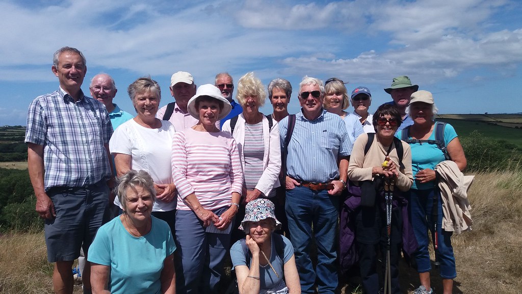
REPORT OF WALK ON THE 10TH JULY
CRANTOCK ANDTHE GANNEL
Sixteen of us met at the NTCar Park at Crantock Beach on a dry sunny day but with a slight cooling wind tohelp us over the next 5 miles. This circular walk takes us along the GannelEstuary and then back over fields to the start which meant that tide times hadto be considered when deciding the best time to start.
The tide was almost fully outwhen we started the walk along side the estuary with the large housesoverlooking the other bank. The name of this river is from the Cornish An Ganelmeaning “the channel”. Since the closure of the mines and with water quality greatlyimproved, the river now supports wildlife including salmon and the nowendangered European eel.
We followed the coast pathtowards Penpol-yet another one- a settlement which was recorded in 1216 and isCornish for “top of the creek”. After passing some rope swings-well some of usdidn't just pass we tried it out-we followed the field line until we reached aconcrete path and turned left to get onto the sand and the estuary. We weretold in our instructions that the mud deposits provide a habitat for marshsamphire and that is exactly what we found all along the estuary. Twocompletely unrelated plants both known as samphire grow in Cornwall the rocksamphire and the one we found the marsh samphire. As we were having Bream fortea it made a useful addition as a seasoning.
After just over an hour, wedecided to have a slight detour to have lunch in Trenance
Gardens and some indulged incake(s) and cream teas whilst we watched the ducks on the boating lake.
Resuming our walk to retraceour steps over the estuary and then up Penpole Path and through fields ofbarley suffering from the lack of rain and a settlement of Treyungy
to a footpath signed Crantockand a wonderful old tree to sit on for a rest and a photo opportunity.
Click on above image for larger view
Continuing across a woodenwalkway, we again crossed fields some with cattle and two kissing gates eitherside of a small lane and one with horses all covered up against the flies andback to Crantock village. Whilst some used the facilities and others had icecreams, Annie very kindly took two groups to see the high church of St Carantoc, a Norman church which boasts someof the finest wood carvings in the West Country and is a popular venue forwedding couples.
A short walk now down to thecar park and another walk which few had completed previously and one to berecommended.
*************************
WALK ON THE 10TH JULY
CRANTOCK AND THE GANNEL
1) 5 MILE MODERATE CIRCULAR WALK ON TRACKS, FOOTPATH, ESTUARY,FARMLAND AND MINOR ROADS
2) WE SHALL BE PARKING AT NATIONAL TRUST'S CRANTOCK BEACH CAR PARK -WILL MEMBERS PLEASE BRING THEIR CARDS
3) FACILITIES AVAILABLE AT CRANTOCK AND AT OUR PICNIC LUNCH SPOT WHERE DRINKS AND CAKES ALSO AVAILABLE.
4) PLEASE BRING DRINK AND SUN CREAM IF THIS HEAT WAVE CONTINUES INTO NEXT WEEK.
WE SHALL BE MEETING AT COMMUNITY CENTRE AT 9.55AM FOR 10.00AM DEPARTURE.
PLEASE LET US KNOW BY SATURDAY 7TH JULY IF YOU WANT TO COME AND IF YOU CAN OFFER TRANSPORT.
REGARDS,
CHRIS AND JANET
UPDATE JULY 2018
REPORTOF WALK ON THE 26TH JUNE
TOWHEAL MARTYN CLAY WORKS AND BACK
Ona very sunny day sixteen of us met on Tremena Road in St Austell towalk the 3.5 miles from there to see one of the sites of thefascinating china clay story and back with some drinks and food inbetween.
Thecycle and footpath was very well shaded and gave some protection fromthe sun as we walked on a good surface,none of the mud that we areused to, towards the mine at Wheal Martyn. The site is a must forlocals and holiday makers as it gives a great insight into one of themajor industries in Cornwall and explains some of the contours we seeas we drive and walk about the area.
Agood web site www.wheal-martyn.com explains all about theevents/history etc. but better still visit the real thing.
Ourfirst point of call was the café and we all had a drink before themajority visited the museum. We were very lucky that John and Sueused to work for the company who ran the site English China Clays,ECC, the company was acquired in 1999 by Imetal a French organisationwho subsequently changed their name to Imerys.
Soalong with all the explanation boards we had expert knowledge of theprocess and markets from John and a photograph of Sue and articleswritten by Sue to admire.
Wewere taken to the top of the mine to see the land now being worked bythe very large diggers and lorries taking the material to theprocessing site and an ideal place for our first photograph.
Walkingdown the trail again and past settling tanks and working waterwheels, old vehicles and blacksmiths areas we proceeded to our lunchin the café and met up with those who had a more leisurely morning.
(Click on above image for larger view)
Onemore photograph including some static white characters we met outsidethe entrance we made our way back along the the same path to our carsand the short trip home having learnt a lot about the clay industry,a pleasant short walk and as usual plenty of chat and some bad jokes.
UPDATE 14TH JUNE 2018
WALK ON THE 26TH JUNE
TO WHEAL MARTYN AND CLAY TRAIL
1) 3.5 mile easy walk along surfaced path
2) Opportunity to visit clay museum at discounted group rate
3) Road side parking at Tremena Road St Austell
4) Nice cafe at site for tea, cake, scones etc
We will be meeting at 10.00am for 10.05am departure for St Austell.
Please let us know by Saturday 23rd June if you would like to come, are able to offer transport and would like to visit museum. The museum trail will take about 1.5 hours and we hopefully will have a few in our group with experience of the industry.
Regards,
Chris and Janet
UPDATE 13TH JUNE 2018
REPORTON WALK OF 12TH JUNE 2018
SALTASH-FORDER-ANTHONY’SPASSAGE-TREHAN-TREMATON-FORDER-SALTASH
Fourteen of us made their way to St Stephen’s Church in Saltash for the start of a 5mile walk which was new to everybody except the walk leader of course! The Cecil Arms, next to the church, is partof a community toilet scheme during its opening hours and this proved to be a usefulfacility at the beginning and end of our walk.
We walked westward down St Stephen’s Hill, a hill that wewere not looking forward to climbing on our way back! We then crossed Forder Bridge and, at thehead of the creek, we gleaned much information about the area for aninformation board complete with map. Welooked forward to coming back to Forder Lake at the end of our walk for awelcome rest on the village green by this picturesque creek.
The walk has fine views of the Lynher and Tamar rivers assoon as you walk under the Forder Viaduct, a fine piece of Victorianengineering with granite piers supporting eight arches of engineeringbricks. It is one of fifty-one viaductsconstructed on the Plymouth to Penzance railway line. We gained even better views of the viaductacross the tidal pond by the tidal mill, now a private residence.
We reached Anthony’s Passage and walked past cottages andthe harbour. We took the footpath downto the beach and up some steps on a retaining wall. From there we had excellent views of InceCastle, a property that the U3A Garden Visit Group has visited in March2018. The harbour and beach are privateproperty and unfortunately we could not spend any time there. Stiles come in all shapes and sizes and furtheralong on this walk you have to cross a gate stile.
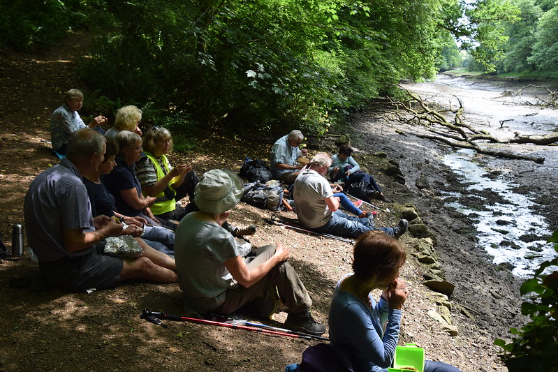
The path through woodland took us to a packhorse bridge atthe head of another estuary where we decided that it was time to have our lunchbreak in the shade of the trees.
(Click on image above for larger view)
The walk continues through a beautiful meadow, a farmestate drive and then minor roads to Trehan, where we noted the ancient granitecross and then Trematon Castle. Thefootpath past Trematon Castle back to Forder is full of wild garlic in May and althoughthe plants had died back, you could still smell the garlic. We had our second break on the village greenat Fodder Lake and we could see one or two people pottering on their boatsmoored up in the creek.

We made it back up St Stephen’s Hill to our cars in timeto avoid a few spots of rain. As itturned out, we had been very lucky as, in Plymouth, they had had heavy rain inthe afternoon. Just one thing toadd: the walk leader had very clearlystated that there would be no food outlet on this walk. One member of the groupfound it hard to cope with this and asked two unsuspecting ladies, one readingher book at the old tidal mill past Forder and the other working in her frontgarden in Trehan whether they would serve a cream tea! Can you guess who that was!?
UPDATE 2ND JUNE 2018
DETAILSOF WALK OF 12TH JUNE
SALTASH - FORDER LAKE- ST ANTHONY'S PASSAGE - TREMATON CASTLE - FORDER LAKE - SALTASH
- A MODERATE 5 MILE CIRCULAR WALK WITH 7 STILES (ONE OF THOSE IS A SET OF STEPS HANGING FROM A METAL GATE) AND WITH MODERATE ASCENTS AND DESCENTS EXCEPT THE HILL BACK TO THE CARS WHICH IS STEEP
- A MIX OF MINOR ROADS AND FOOTPATHS
- COULD STILL BE MUDDY IN ONE OR TWO PLACES
- MEET IN THE LOSTWITHIEL COMMUNITY CENTRE CAR PARK FOR A PROMPT 10.15AM DRIVE TO SALTASH
- WE WILL PARK OUTSIDE ST STEPHEN'S CHURCH, SALTASH. POSTCODE: PL12 4AP, GRID REF SX417584 (OS EXPLORER 108)
- NO PUBLIC TOILETS. HOWEVER, WE CAN USE THE CECIL ARMS’ FACILITIES AT THE START/END OF THE WALK AS THE PUB IS PART OF A COMMUNITY TOILET SCHEME (THIS IS WHY I AM NOT STARITNG THE WALK EARLIER AS WE NEED TO WAIT FOR THE PUB TO OPEN TO USE THEIR FACILITIES)
- NO FOOD OUTLET ON THE WAY BUT WE WILL STOP FOR A COFFEE AND CAKE BREAK (BRING YOUR OWN!)
- BRING YOUR FOOD FOR A LATE PICNIC LUNCH IN FORDER ON THE GREE
PLEASE LET ME KNOW BY SATURDAY 9TH JUNE WHETHER:
I LOOK FORWARD TO YOUR COMPANY
ANNIE
UPDATE 31ST MAY 2018
REPORT OF WALK ON THE 29TH MAY NEWQUAY EAST PENTIRE
Sixteenof us set off on the 9.00am train from Lostwithiel to catch theconnection at Par for the train journey to Newquay-a pleasant 50minute journey up through the Luxulyan Valley and through the claymine areas and past the Goss Moor Nature Reserve to Newquay-all for£3.95 return with the help of group travel.
Arrivingat the station we all piled out to find our first landmark-the oldtramway track leading between two hotels. It was along this routethat the minerals were carried after being transported by tramwayfrom the south coast. At the end of the tramway we turn right andthrough an open grassed area overlooking the sea called Killacourt.All routes through the open space lead to Towan Beach and we turnedleft to go past Newquay West End Bowling Club and the a short detourto see the harbour. Newquay was evidently originally called TowanBlystra up until the 16thcentury when Bishop Lacey gave money for the construction of a newquay to provide a harbour-from this the new name of Newquay evolved.Next our first stop at an Artisan Coffee House-and very nice coffeeit was too and although I didn't have anything to eat myself I wasinformed that that was good also.

Onwardnow we join the coast path and walk a little way before we see awhite painted building called a Huer's Hut where a huer would scanthe bay for shoals of pilchards approaching the shores duringAugust-October and on seeing the fish would shout out 'Heva Heva' forthe boats to take to sea. A good time for a group photograph.
Wethen kept to the coast path to pass the old lifeboat house and to theend of Towan Head where we see how many people can fit into thelookout shelter at the end of the head before returning with greatviews of Fistral Beach to the lifeboat house and the walk around thebeach and through the sand dunes to a road in front of hotels andflats and then to a path going onto East Pentire Head, a car park andthe opportunity to walk out on the headland and enjoy the views of Crantock Beach and The River Gannel.
Withthe full instructions past onto the walkers-”you must not be lateback as the next train back to Lostwithiel is at 7.00pm and if you docatch it you will have to pay again as the group travel will nolonger be valid”-we split into those who were having a picnic onthe headland and those who were going into town to find a café orjust stroll with the holiday makers enjoying a half term break.
3.00pmcame and we all made it back to the station for our trip back toLostwithiel:this turned out to be an adventure as we were told by theticket collector that the train serving the Truro to Falmouth linehad broken down so the next train from Penzance to Plymouth had beenused instead meaning that our connection from Par to Lostwithiel wascancelled. Several of us had to get back on time so plan A was putinto action with A and B ringing up their spouses so that C, D, E andF could get back to Lostwithiel and then E and F could collect theircars and go back for G,H,I,J,K,L,M etc. Thanks to all for thinking ofand operating the plan.
Thatand the stimulating conversation was just too much for one of us!
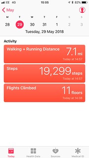
Ihope that we all got back in time for our other activities after ourwalk of 3.5-4 miles (taken from two local walk guides)-or was it?asthose with clever machines suggested it was up to 7.1 miles.
*****************
UPDATE 17th MAY 2018
NOTICE OF WALK ON THE 29TH MAY
TO NEWQUAY AND EAST PENTIRE HEAD
(AND A GOOD DAY OUT)
1) 4 MILE CIRCULAR ROUTE USING COAST PATH,SAND DUNES,BEACH AND ROADS
2) WE WILL BE TRAVELLING TO NEWQUAY BY TRAIN FROM LOSTWITHIEL VIA PAR
CATCHING THE 9.00AM TRAIN FROM LOSTWITHIEL*** AND RETURNING ON THE 15.01 FROM NEWQUAY ARRIVING AT LOSTWITHIEL AT 15.58
3) AFTER AN EARLY/MID MORNING DRINK WE EXPECT TO FINISH THE WALK AT AROUND 1.00/1.30- TIME FOR LUNCH OUT, A PICNIC OR JUST BROWSE OR ENJOY THE SUN AND BEACH BEFORE CATCHING THE TRAIN HOME
****IMPORTANT. FOR THOSE CATCHING THE TRAIN AND COMING FROM THE TOWN DIRECTION IN LOSTWITHIEL PLEASE NOTE THAT A TRAIN GOING IN THE PLYMOUTH DIRECTION CAUSES THE CROSSING TO GO DOWN AT ABOUT 8.50 AND DOESN'T THEN OPEN UNTIL AFTER THE PENZANCE TRAIN HAS LEFT. SO BE EARLY.
PLEASE LET US KNOW BY MONDAY 28TH IF YOU ARE COMING AND WHERE YOU ARE CATCHING THE TRAIN.
REGARDS,
CHRIS AND JANET

UPDATE 10th MAY 2018
REPORTOF WALK ON THE 8thMAY - FROMLOOE TO POLPERRO AND BACK
Withsome new members and others going to meet us at Looe we gathered atthe Community Centre at 9.45am and then to catch the 10.48am No 73bus from Looe to Polperro on a day with some drizzle expected earlyon but with the hope that it would clear so that we could see thosefantastic views promised.
Withbus passes in hand for most of us we caught the reasonably full busvia Pelynt to Polperro and followed the leader through the town andup a hill, a bit like Bodmin Hill, until he decided that it was notthe coast path and so we had to take another unknown path which zigzagged through a wood to that well known coast path-to the sound of“as his favourite walk he didn't know it very well”.
Withthe expected drizzle and sea mist we headed along the path withlimited views.
outto sea and around Downend Point with Downend Rock just out to sea andusing the diversion which has been in force ever since the storms toour dinner stop at Talland Bay. With the drizzle still coming downmost of us took shelter either under the umbrellas or in the sweetlittle beach huts that the café have provided for diners.
Thisprovided an ideal setting for one of our regular photos only torealise that two had gone shopping.
Withthe realisation by many of the group that we were only a third theway along the walk we set of again up the hill towards what is calledAesop's Bed off the coast comprising many rocks and around Hore Stoneand Bridge Rocks before we could see St. George's or Looe Island.The weather as predicted improved and raincoats and jumpers removedas it became hotter and hotter. Time for another photo with allpresent, except for the author, to show the sunshine and Looe Islandnow owned and managed by The Cornwall Wildlife Trust.
(Click on image above for larger view)
Withour destination in site we head along the coast path to our cars andfor four lucky people it was a chance to have a drink and a lightbite in the sunshine in the colourful café along side the tenniscourts before heading home.
UPDATE 1st MAY 2018
NOTICE OF WALK ON THE 8TH MAY
FROM POLPERRO TO LOOE
ONE OF MY FAVOURITE WALKS WHICH WE COMPLETED IN SEPTEMBER 2016-SEA VIEWS ALL THE WAY, DRINKS AND CAKES AT THREE POSSIBLE LOCATIONS AND A BUS TRIP. SOME UPS AND DOWNS AS WOULD BE EXPECTED FROM COAST PATH
1) WE WILL CATCH THE 10.48 BUS FROM LOOE FIRE STATION TO POLPERRO SO WILL LEAVE THE COMMUNITY CENTRE AT 10.00AM SHARP
2) 4.5 MILE WALK STOPPING AT TALLAND BAY FOR LUNCH-PICNIC OR PURCHASED FOOD AND DRINK
3) CONVENIENCES AT POLPERRO, TALLAND BAY AND LOOE
PLEASE LET US KNOW BY SATURDAY 5TH IF YOU WISH TO COME AND WHETHER YOU CAN OFFER TRANSPORT
REGARDS,
CHRIS AND JANET
UPDATE 25TH APRIL 2018
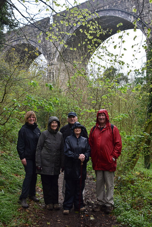
Report of a damp short circular walk from Lostwithiel to Milltown
Looking out of our window I wondered if anyone would turn up for a short walk to Milltown and back.
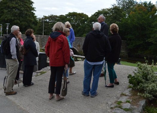
Arriving at the community centre we found 4 members of the walking group keen and raring to go. The route took us up Summer street past the new housing development to the cemetery. Here we had to make a decision if to walk further up the hill and pick up the Saints way or turn left along the road directly to Milltown. The latter course was taken due to the inclement weather.
The lane passes the private residence of Castle where it is rumoured Rudolf Hess was interrogated during WW 11.
Arriving at Milltown we bear left under the viaduct which was rebuilt in masonry around 1894 replacing a previous wooden structure which its support columns can still be seen.
From here we return to Lostwithiel across fields and Coulson Park.
On arriving back in Lostwithiel we found ourselves drawn into the Globe Inn for refreshments. A larger view of our intrepid walkers may be seen by clicking on the image.
UPDATE 18TH APRIL 2018 NOTICE OF WALK ON THE 24TH APRIL
FROM LOSTWITHIEL TO MILLTOWN
1) JANET AND I AND ANNIE ARE UNAVAILABLE TO LEAD A WALK SO DAVE AND CHRIS
HAVE VERY KINDLY AGREED TO STEP IN AND LEAD THIS SHORT 3.5 MILE WALK
2) AS USUAL WITH THE CURRENT WEATHER THERE IS SOME MUD AND A LONGISH HILL
TO START THE WALK ON MINOR ROADS AND FOOTPATHS INCLUDING THE SAINTS WAY.
3) COULD YOU MEET AT LOSTWITHIEL COMMUNITY CENTRE AT 10.25 FOR A 10.30 START
IF YOU COULD LET ME KNOW BY MONDAY 23RD IF YOU WISH TO GO ON THE WALK AND I WILL THEN PASS THE INFORMATION TO DAVE SO THAT HE KNOWS WHO TO EXPECT AND TRIES AND MAKE SURE EVERYONE ARRIVES BACK.
HOPE TO SEE YOU ALL FOR OUR NEXT WALK ON 8TH MAY
REGARDS,
CHRIS AND JANET
UPDATE 12TH APRIL 2018
Report on the walk of10th April 2018
A 7 miles circularwalk from Feock to Devoran
Thirteen walkers put their trust in the weather forecastwhich has promised that the weather would brighten up as the day went on. Well, this was a fairly accurate forecastalthough the “mizzle” made an appearance when we had our lunch break on the grassyquay in Devoran.
We had hoped to start our walk from Feock Church car park atabout 11.00am. It was important to haveaccess to facilities at the start of our walk. A phone call to the church warden led to a phone call to the lady incharge of the community centre bookings (as it so happens, she is a member ofthe Carrick U3A and their walking group!). We were kindly invited to use the centre facilities and join the Tuesdaycoffee morning. When we arrived, wenoted that they had set up extra tables and chairs and even warmed up a fewcups so we simply could not refuse! Weset off at 11.15am.
The walk is very accurately described in iwalkcornwall andnavigates you to a crisscross of footpaths. It takes you first from Feock to Devoran through Penpoll and then highabove the estuary through fields from which you have stunning views of theCarrick Roads as far as St Anthony’s Head.
The second half of the walk takes you from Devoran back toFeock along the road which hugs the estuary, through Chycoose, Point andPenpoll from where you then make your way to Harcourt. In Harcourt, you have great views of theother side of the estuary including of the Pandorra Inn. Some of the groupdecided to walk back to Feock whilst others did a one mile extension (there andback) to Restronguet Point. You havegreat views of the estuary back to Point, the Pandorra Inn and RestronguetPassage. It was interesting to lookacross at the footpath we had used during our November walk from Mylor Bridgeto the Pandora Inn.
So what do we know about Feock and Devoran?
The earliest known record of Feock is in a 12thCentury document where the settlement is referred to as Fioc. It is also recorded in 1264 as EcclesiaSancte Foece”. The name is taken from aceltic saint to which the parish is dedicated, but little is known about,although it is generally assumed to be female.
The settlement at Devoran dates back tomediaeval times and the first record of it is form 1278 when it was spelledDeffrion. However, until the end of the 18thcentury, Devoran consisted of a few farms and tin streaming works, Stemming from its location on the confluence oftwo rivers, the name is thought to be based on the Cornish for water - dowr
Heritage plaques in Devoran and Penpoll give you an insightinto the area’s industrial past.
During the 19th century Devoran wasengineered as an industrial settlement based around a port at the terminus of anew railway. A town was planned andbuilt which included the church built in 1855. A major part of the trade was the export of mineral from the Redruth andCamborne area and the import of coal and timber for use in the mines.
The Redruth and Chasewater Railway ran toDevoran and Point Quay. And this is why that road is called The Old Tram Road.
Until the port of Devoran was built, Point Quaywas the main docking point and the site of a Customs House and a smeltingworks.
There was a tidal mill in Penpoll
Well we might not remember any of the above but we willdefinitely remember the stunning views, the mud we had to wade through and thefact that the residents of Devoran care so much for their letterbox that theyhave knitted a blanket cover to protect it from the elements!
UPDATE 1 April 2018
NOTICE OF WALK OF 10TH APRIL 2018
A 6 MILE MODERATE CIRCULAR WALK FROM FEOCK TO DEVORAN
HERE ARE THE DETAILS:
- OUR STARTING POINT WILL BE FEOCK CHURCH
- STUNNING VIEWS OF THE CARRICK ROADS THROUGHOUT
- THE FIRST LOOP OF OUR WALK WILL TAKE US FROM FEOCK CHURCH TO DEVORAN VIA PENPOLL USING MINOR ROADS AND FOOTPATHS, SOME MUDDY. THERE WILL BE 12 STILES!
- WE WILL HAVE OUR PICNIC LUNCH IN DEVORAN. REFRESHMENTS AND TOILETS AVAILABLE IN THE LOCAL PUB ” THE OLD QUAY INN”
- THE SECOND LOOP OF THE WALK BACK TO FEOCK VIA POINT, PENPOLL AND HARCOURT IS LESS STRENEOUS WITH NO STILES AND WE WILL WALK ON MINOR ROADS ALONG THE ESTUARY
- OPTIONAL EXTENSION TOWARDS THE END OF THE WALK FROM HARCOURT TO RESTRONGUET POINT FROM WHICH YOU STAND OPPOSITE THE PANDORA INN (1 MILE THERE AND BACK)
WE WILL LEAVE THE LOSTWITHIEL COMMUNITY CENTRE CAR PARK AT 9.45AM IN ORDER TO START THE WALK BY 11.00AM
I WOULD BE GRATEFUL IF YOU COULD LET ME KNOW BY SATURDAY 7TH APRIL WHETHER:
- YOU WOULD LIKE TO DO THIS WALK
- YOU ARE HAPPY TO DRIVE AND PROVIDE A LIFT
Annie
UPDATE 28 MARCH 2018
REPORTOF WALK ON THE 27TH MARCH
“TOHELLAND AND BACK”
Thisis a walk and title taken from a little book called “The Best ofBodmin Moor” Volume 2 one of the many walks we take from excellentpublished literature.
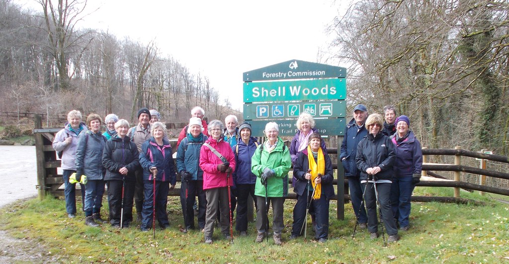
Ona reasonable day with a bit of drizzle forecast but not enough to putthis hardy bunch off the walk, particularly with the promise of a publunch after the walk. A great turnout of 20 walkers set off from theCamel Trail car park at Hellandbridge to walk the 4 mile circularroute. Passing the old Wesley Methodist Church we headed up theslight hill towards Helland and its parish church of St Helena withJanet,at the front and Carol at the back, proudly wearing ourLostwithiel U3A reflective jackets.
Infront of the church we find a war memorial and our walkers were askedto find a name of historical significance on the granite stone. Suewon picking out the name Bligh, of the same family that brought usCaptain Bligh of Bounty fame, although it was thought he was born inthe nearby St Tudy parish.
Mostof us visited the church with its chequerboard slate floor at theentrance and also were told of the historical significant and itspart in the Prayer Book Rebellion of 1549. With some good views ofBrown Willy and Roughtor we now headed eastward toLower Kernick and continuing on the road in view of the muddy fieldsto a crossroads with a choice of route. As the author says we caneither have no sense of adventure and continue on the road north ormaybe battle through undergrowth and brambles but finding a lovelyancient lane. Some might have regretted it but we all chose thelatter and had to battle over or under some fallen trees and also astream flowing down the lane to get to the bottom of what looked likean old drovers lane.
Tomake it even more exciting we were also joined by a young heifer whowas being rounded up by three farmers after going missing for 3weeks. An action photo was obviously called for to mark the occasion.
Makingit to the road and downhill to Shell Wood and the Camel Trail with amore normal formal photograph to capture all the participants.
Click on image above for larger view
Thistakes us back the 1.5 miles to Hellandbridge and a short car journeyback to the Borough Arms for our pub lunch.
****************
UPDATE 21 MARCH 2018
NOTICE OF WALK ON THE 27TH MARCH
TO HELLAND AND BACK
1) 4 MILE RELATIVELY EASY CIRCULAR WALK USING CAMEL TRAIL, FIELDS AND MINOR ROADS WITH A FEW STILES
2) NO SERVICES/FACILITIES ON ROUTE
3) PLEASE BRING DRINK IF YOU WANT AS WE WILL PASS A PICNIC SPOT ON ROUTE
WE WILL MEET AT COMMUNITY CENTRE AT 10.05AM FOR 10.10AM DEPARTURE HEADING FOR CAR PARK AT HELLANBRIDGE. PLEASE LET US KNOW BY SATURDAY 24TH IF YOU WOULD LIKE TO COME AND IF YOU CAN OFFER TRANSPORT.
PS WE WILL BE STOPPING FOR LUNCH AT BOROUGH ARMS-PLEASE LET US KNOW IF YOU WOULD ALSO LIKE TO STOP SO I CAN TRY AND ARRANGE LIFTS TO SUIT
REGARDS,
CHRIS AND JANET
****************
UPDATE 14 MARCH 2018
REPORTOF WALK ON THE 13TH MARCH
FROMROCK TO POLZEATH AND BACK
Youwould not believe as I sit typing this report with the rain lashingdown and the wind blowing that 16 walkers set off yesterday in brilliant sunshine with hardly a
breathof wind to walk along the coast from Rock to Polzeath and to returninland.
Afterparking at the Council car park we headed along the coast with thetide almost fully out through the sand dunes following the waymarksto reach Daymer Bay with only one slight mistake. The views acrossthe Camel estuary were magnificent with the ferry doing greatbusiness travelling over to Padstow on the opposite shore.
Continuingalong the path we have great views of Stepper Point, affectionatelyknow as “The Pepper Pot” the 40ft high stone tower daymark builtin 1830 and which we all saw at close quarters on our recent walkaround the point.
Wewere soon in Polzeath which comes from the Cornish words for “dry”and “pool/harbour” and time for picnic and drinks at the café onthe beach and our regular photograph.
Click on image above for larger view
Nowfed and watered we turn inland past a site with mobile homes and ontothe golf course at Roserrow and following the white markers andavoiding any golf balls as we cross the fairways to make our wayacross a stream and the start of the “muddy and wet” partpromised in the notification of the walk with electric fencesguarding the fields-but no sign of cattle in the wet conditions.Crossing a minor road we head across a ploughed field, with the towerof St Enodoc church as the guide, to reach the entrance and past thegrave of St John Betjeman. The church dates from the 12thcentury and is said to lie on the site of a cave where St Enodoclived as a hermit.
Withsuch views of the church and the coast another photograph was taken.
Click on image above for larger view
Ourroute now took us through another golf club that of St Enodoc GolfClub which was initially build in 1889 and improved in 1907 to thebasis of what the course is today. Following the white marker stonesand again avoiding any golf balls we make our way around the courseand onto the path in the sand dunes, above the one we had used on theoutward leg, and back to the car park with the sun still shining.
****************
NOTICE OF WALK ON 13TH MARCH
FROM ROCK TO POLZEATH AND BACK
1) 5.8 MILE CIRCULAR, RELATIVELY EASY,WALK STARTING AT PAY CAR PARK IN ROCK
2) FACILITIES IN ROCK AND POLZEATH
3) SANDY COAST PATH ON OUTWARD JOURNEY BUT MUDDY AND WET ON THE WAY BACK
4) PACKED LUNCH CAN BE TAKEN OR PURCHASED ON ROUTE
PLEASE LET US KNOW BY SATURDAY 10TH IF YOU CAN COME AND IF YOU CAN OFFER LIFT
WE WILL BE MEETING AT COMMUNITY CENTRE AT 10.00AM FOR 10.05AM START
REGARDS,
CHRIS AND JANET
UPDATE 27 FEBRUARY 2018
REPORT ON THE CIRCULAR WALK OF 27THFEBRUARY 2018
St Veep Church to Cliff via St Cadixand Haye Farm and back through Manely and Pennant
Eighteen walkersdressed in many warm layers braved the “Beast from the East” to do this verylocal short circular walk, a walk which we did in glorious sunshine andsheltered from the wind most of the way.
We started atSt Veep Church and made our way across the field opposite the church where the MaidenBells of St Veep were cast in the 18th century. They are called maiden or virgin bells becausethey did not need any tuning whatsoever, a rare thing. The mud had dried up nicely and we were ableto make our way down two more fields to the minor road that leads to Haye Farm. Onthe left through the bare trees, we had a very good view of St Cyric’s creekand the property known as St Cadix, a Grade II listed building from 1710, whichstands on the site of an ancient Cluniac priory dissolved in 1536. Little of the original building remainsalthough some early carved stones have been excavated by one of the recentowners.
Past HayeFarm, we followed the footpath to our left. We walked through two fields and climbed overa wall on our right. There, we took timeto stop and admire the views. Ahead ofus, we could see a group of buildings. This hamlet is called Manely, one of the largest manors in Cornwall atthe time of Doomsday. On our far left,on the opposite bank of the river Fowey, we could see the village ofGolant. Still on the opposite bank ofthe river but moving our gaze towards the right, on the foreshore at the bendof the river, is a small building constructed as a plunge pool andboat-house. It was built around the turnof the 20th century and reputedly visited by Edward VII when he wasPrince of Wales. You can see the riverLerryn as it flows into the river Fowey beneath St. Winnow point. Upstream you see St. Winnow Church and theTudor Barton House tucked into the hillside near the water’s edge. Daphne du Maurier in her book “VanishingCornwall” makes the suggestion that this landscape may be the setting for thelegend of Tristan and Iseult. Her theoryis based on the supposition that Castle Dore, the ancient hill fort on theridge above Golant, was the palace of King Mark and that other place names alsofit the legend.

Going over a stileand down some steps, we walked through a gateway and followed the track down toCliff. Cliff, at one time, was wellknown for its plum orchards and market gardens. At the bottom of the track, we turnright into the narrow lane. King CharlesI was here in August 1644. During thecivil war, the parliamentary troops held the opposite shore and the King camehere from Boconnoc to encourage his own troops. They were stationed at Cliff to guard the ancient ford which crossed theRiver Fowey. The owner of Cliff Cottagewas out in his garden and showed us the two cannon balls embedded in the frontwall of his house above the two windows. These had been found in the area, a reminder of the battles that hadtaken place during the civil war.
We stopped inCliff to have our morning break on a private terrace by the foreshore by kindpermission of the neighbour! We weresheltered from the wind and had superb views of Golant. We could have stayed there all day but after20 minutes, it was time to do the second loop of our walk.
We walked upthe lane for about 100 yards and on the left, in front of Penfoye House, wetook a footpath which took us down to the foreshore. This footpath is probably the original trackleading to the ford. From the foreshore, we had an excellent viewof the boathouse, St Winnow Church and St Winnow Point where the river Lerrynflows into the Fowey River. We retraced oursteps and turn left into the lane to make our way back to St Veep Churchthrough Manely and Pennant. From thefields after Pennant we had great views towards Polruan and the sea.
This moderatewalk is approximately 3 miles long and lasted 2 hours 45mns including ourbreak.
UPDATE 17TH FEBRUARY 2018
NOTICEOF WALK OF 27TH FEBRUARY
A3.5 MILE CIRCULAR WALK FROM ST.VEEP CHURCH
HERE ARE THE DETAILS:
OUR STARTING POINT WILL BE ST.VEEP CHURCH
THE ITINERARY IS: ST.VEEP CHURCH, HIGHER PENPOLL, ST CADIX, HAYE FARM,CLIFF, MANELLY AND BACK TO ST VEEP CHURCH
STUNNINGVIEWS OVER GOLANT, ST WINNOW POINT AND ST WINNOW CHURCH.
INSTEAD OF FOLLOWING THE FOOTPATH AT THEBEGINNING AND END OF THE WALK, WE WILL USE THE MINOR ROADS AS THE FIELDS AREEXTREMELY MUDDY
A MODERATE WALK : ONLY ONE STILE OVER AWALL BUT ONE STEEP FIELD ON THE WAY DOWN TO CLIFF AND TWO MODERATELY STEEPHILLS UP TO HAYE FARM AND BACK THROUGH MANELLY
TOILETS AT THE CHURCH AT THE BEGINNING ANDEND OF THE WALK
NO COFFEE SHOP (SORRY!). PLEASE BRING A HOTDRINK AND SNACK TO HAVE DURING A BREAK ON A QUAY BY THE RIVER FOWEY
NO QUIZ! BUT NO MINI EASTER EGGS!
WE WILL LEAVE THE LOSTWITHIEL COMMUNITY CENTRE CAR PARKAT 10.15AM IN ORDER TO START THE WALK BY 10.30AM AT THE LATEST.
I WOULD BE GRATEFUL IF YOU COULD LET ME KNOW BYSATURDAY 24TH FEBRUARY WHETHER:
I LOOK FORWARD TO YOUR COMPANY.
ANNIE
UPDATE 14TH FEBRUARY 2108
REPORT ON WALK OF 13THFEBRUARY 2018
A 6 MILE CIRCULAR WALKFROM DUNMERE HALT TO GROGLEY HALT
Onething is for certain: when you have beentasked with leading a walk, you become an avid, and concerned, watcher of the weatherforecast! The weather forecast hadpromised that the wintry showers would clear after 1.00pm with a reduced chanceof precipitations. So, it was agreed to postpone the start of our walk from10.30am to 12.00pm, a gamble which paid off since we walked in dry and sunny weathermost of the time save for a sharp but short hail shower. Twenty two walkers met up in the Camel Trailcar park in Dunmere, had lunch in their respective cars and set off at 12.45pm.
Thiswalk, curtesy of “iwalkcornwall.co.uk”, follows the opposite side of the riverfrom the Camel Trail. This was the most challengingpart of the walk as the path is at first very narrow, close to the edge of thebank and it was vital that nobody fell in the cold and extremely fast flowingriver Camel. We all commented that wehad never seen the river so swollen. Theother challenge on this short stretch was the mud.
AtBoscarne (a number of Roman artefacts were found near Boscarne), we turnedright and made our way towards Nanstallon where in the late 1960s, a first centuryRoman fort was excavated. Little remains now apart from some earth banks which areremnants of the ramparts. Once inNanstallon, we made our way to Ruthernbridge where we stopped for a groupphoto. The bridge over the river Rutherndates back to around 1450 and it is recorded in 1494 as Rothyn Brygge. A branch line was added from Ruthernbridge to jointhe Bodmin-Wadebridge railway at Grogley Halt and was opened in 1834. The railway lasted exactly 100 years, closingin 1933. The track was lifted in thefollowing year.
Wefollowed the track to Grogley Halt to an entry point onto the Camel Trail. At Grogley Halt, we had our second stop, not justfor another group photo but also for a quiz on the Camel Trail. The only reason the group humoured theirgroup leader is because they knew that if they gave a correct answer, they wouldget a mini Easter egg! So what did welearn?
TheCamel Trail starts at Padstow and ends at Wenford Bridge
Itis 17.3 miles long
Itis managed by Cornwall Council
400,000+visitors use it every year
TheBodmin and Wadebridge railway was built by Sir William Molesworth of Pencarrow
Itcost £35,000 to build in the 1930s
Theoriginal use was to carry sand from the Camel estuary to inland farms to use asfertiliser
Laterit was used to carry fish from Padstow to London and slate and china clay frominland quarries to ships in Padstow
Thelast passenger train to Padstow was in 1967
Thelast freight train was in 1983
TheCornish for River Camel “Dowr Camel” means Crooked River

Wemade our way back to Dunmere Halt walking past the Camel Valley vineyard which startedin 1989 and continues to win many national and international awards. We also walked past Boscarne Station which isat one end of the Bodmin and Wendford Steam Railway.
Wehad walked at a brisk pace and we were back at Dunmere Halt at 3.45pm.
UPDATE 3RD FEBRUARY 2018
NOTICEOF WALK OF 13TH FEBRUARY
A6 MILE CIRCULAR WALK FROM DUNMERE TO GROGLEY HALT
HERE ARE THE DETAILS:
OUR STARTING POINT WILL BE ONCE AGAIN THECAMEL TRAIL CAR PARK AT THE BUROUGH ARMS (PL31 2RA)
APART FROM SOME MUD AT THE BEGINNING OF THEWALK, THE REST OF THE WALK WILL BE DRY AS WE WILL WALK ON MINOR ROADS AND THECAMEL TRAIL
THE ITINERARY IS: DUNMERE HALT, NANSTALLON, RUTHERNBRIDGE,GROGLEY HALT AND BACK TO DUNMERE HALT
A MODERATE WALK : NO STILES BUT TWO MODERATELYSTEEP HILLS IN THE FIRST HALF OF THE WALK
TOILETS IN THE PUB AT BEGINNING AND END OFTHE WALK
NO COFFEE SHOP (SORRY!). PLEASE BRING APICNIC LUNCH TO EAT DURING THE WALK. YOUMIGHT CHOOSE TO HAVE A HOT OR COLD RINK IN THE PUB AT THE END OF THE WALK
THERE WILL BE A SHORT QUIZ TO TEST YOUR KNOWLEDGEOF THE CAMEL TRAIL!
WE WILL LEAVE THE LOSTWITHIEL COMMUNITY CENTRE CAR PARKAT 10.30AM IN ORDER TO START THE WALK BY 11.00AM AT THE LATEST.
I WOULD BE GRATEFUL IF YOU COULD LET ME KNOW BY SATURDAY 10TH FEBRUARYWHETHER:
I LOOK FORWARD TO YOUR COMPANY.
ANNIE
****************************
UPDATE 31 JANUARY 2018
REPORTOF WALK ON THE 30TH JANUARY
BODMINAND THE CAMEL TRAIL AND OUR NEW YEAR LUNCH
Twentyof us keen walkers set off from the car park adjacent to the CamelTrail at Dunmere in weather which was dry but with various forecastsof rain to come;the main question was when and would we be back bythe time it did?
Thewalk is a circular walk of about 3.8 miles and is in three parts, theCamel Trail, a short length of minor road and an area of woodland andriver side.
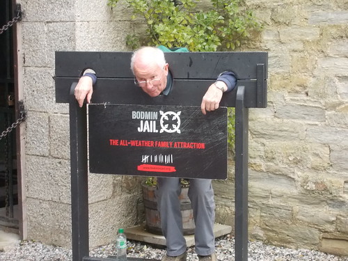
Afterabout 30 minutes of level walking we arrived at our drinks venuewhich was not spelled out in the notice of the walk but a clue givenas somewhere were we “hoped we would not be detained too long”.Yes you've got it Bodmin Gaol.
Allthe activities and history are very well described on their web site:www.bodminjail.org. Many ofus were not aware of the scope of the activities from the café andrestaurant , the quiz and curry nights, the ghost nights and muchmore.
BodminGaol was designed by Sir John Call and built in 1779 by prisoners ofwar and was operational for 150 years in which it saw over 50 publichangings. It was reputed to be the first British prison to holdprisoners in individual cells. The gaol closed in 1927 and since thatdate there has been no prison within the county of Cornwall. As mostlocals will know plans are in hand to give the prison new life as ahotel with scheduled completion in 2019.
Wewere all impressed with the café and I'm sure many of us willrevisit the site again.
Bothour photographs were taken at the jail, one showing us all gatheredafter our drink and the other showing one of our group making use ofthe facilities!.
(Click on image above for larger view)
Ouronly up hill followed on a minor road before we turned off the tarmacand past row on row of solar panels before heading down hill throughmixed woodland with many newly planted specimens in evidence. Notlong after the decent the River Camel and weir comes into sightwhich we follow on down past a new holiday cottage complex and thenthe main road and our finish and venue for our lunch.
TheBorough Arms provided us with a private room all laid up for our now17 strong group for an excellent lunch from an extensive menu. Byabout 2.15pm we were all finished and ready to go with the rain nowcoming down as predicted.
**************************
UPDATE 18 JANUARY 2018
NOTICE OF WALK AND "CHRISTMAS/NEW YEAR LUNCH
ON 30TH JANUARY THE CAMEL TRAIL AT BODMIN
1) 3.8 MILE CIRCULAR WALK ON CAMEL TRAIL, MINOR ROADS AND WOODLAND PATHS
2) RELATIVELY EASY WALK WITH ONE LONGISH STEEP HILL AND SOME MUD
3) WE WILL BE STOPPING FOR TEA/COFFEE AT 11.00ISH BUT HOPE THAT WE WILL NOT BE DETAINED TOO LONG!
4) A CHOICE OF LUNCH SUCH AS SOUP, FISH PLATTER, PIES AND MUCH MORE WILL BE AVAILABLE AT THE END OF WALK FOR THOSE WHO WISH TO STAY. IN ORDER TO ENSURE SUFFICIENT SPACES I NEED TO KNOW BY FRIDAY 26TH LATEST IF YOU WANT TO TAKE PART.
IF YOU DON'T THEN I WILL TRY AND ARRANGE TRANSPORT BACK HOME FOR YOU BUT IT WILL DEPEND ON DRIVERS CHOICES.
5) WE WILL MEET AT COMMUNITY CENTRE AT 10.05 FOR 10.10 DEPARTURE
6) PLEASE LET US KNOW IF YOU WOULD BE ABLE TO OFFER TRANSPORT
REGARDS,
CHRIS AND JANET
PS WE WILL STILL BE HAVING LUNCH EVEN IF THE WEATHER IS TOO BAD FOR WALKING
****************************
UPDATE 10 JANUARY 2018
REPORTOF WALK ON THE 9TH JANUARY
AROUNDTHE ANCIENT AND LONELY DODMAN POINT
Eighteenof us braved the impending rain, which was forecast to start at2.00pm, to walk the delightful 5.4 mile circular route usingfootpaths and the South West Coast Path around the Dodman with a stopoff in Gorran Haven. This was a similar route taken on a walk inDecember 2014 but adding a bit more distance to avoid some muddyareas and to take in more of the coast path. Unfortunately a fewmembers had to call off due to illness-we hope to see them againsoon.
Parkingat the National Trust car park at Penare we headed due west to meetto coast path just above Hemmick Beach at the far east of Veryan Baywith Nare Head visible at the far west with Gull Rock (again) justoff shore. Walking now on the coast path we pass the western end ofthe Bulwark -a 600m long Iron Age earthwork 6m high in places whichencloses Dodman Point creating a fortified area that would havecontained iron age dwellings. Onto the Dodman-it was recorded on oldlocal maps
as“Deadman”,hence the dark and brooding promontory connotation, andviews of the granite cross come into view. This huge cross was placedthere in 1896 as a navigational aid to seafarers and a good point totake our customary photograph-this can be compared to the one takenin 2014-spot the similar faces.

(Click on above image for larger view)
Oppositethe path can be seen the watch tower a 1795 survivor of a series ofAdmiralty signal stations used to alert the Navy at Plymouth of anyforeign shipping.
Withmany Dartmoor ponies also sharing the route we continue above thelarge sweep of Bow or Vault Beach with Cadythew Rock at its easternend to find a sheltered nook for our well earned lunch stop-as someof the crew were feeling a little peckish. Continuing on the coastpath with some muddy areas and some climbing to round Maenease Pointwe see views of Gorran Haven harbour and our next stop for hot drinksand chelsea buns, eccles cakes and doughnuts from the local shop satoutside under canvas with the sound of a slight drop of rain.
Fortunatelyby the time we were ready the rain had stopped and we proceeded outof town and turned left up another muddy areas to reach TreveagueFarm and the then short walk back to Penare to arrive at about 2.30pm
Onthe drive back home it was evident that it had rained quite heavilyfurther east and we considered ourselves very lucky to have had anexcellent walk in the dry with magnificent views.
UPDATE 1 JANUARY 2018
NOTICE OF WALK ON THE 9TH JANUARY
AROUND THE LONELY DODMAN
Veryan Bay
Photo Credit: Creative Commons (CC BY-NC 2.0) by James Stringer
1) 5 mile circular walk of moderate difficulty taking in the ups and downs of part of the South West Coast Path.
2) Parking at the National Trust car park at Penare.
3) Cafe and toilet facilities at Gorran Haven.
4) Wonderful views, on a clear day, across Veryan Bay from this dark and brooding promontary.
5) Walk takes in coast path and inland paths which will be muddy-sticks advisable
6) Bring packed lunch and/or use cafe at Gorran Haven for our lunch stop.
We will meet at 10.15am at Community Centre for 10.20am start. Please let us know by Saturday 6th January if you wish to go on walk and if you are able to offer transport.
Regards and Happy New Year
Chris and Janet
****************************
***************


